Cape Eleuthera Marina
Latitude: 24.83691 & Longitude: -76.34308
Click the link below to see our location.
http://fms.ws/7nZkk/24.83691N/76.34308W
If the above link does not work, try this link:
Bahamas Day 119 – BD119 (5/4/12) – We travelled approximately 30 miles northwest of Highbourne Cay to arrive at Cape Eleuthera Marina (aka Cape E). While we had done our homework, checking wind and wave height, we had an unexpectedly rough ride across the Exuma Sound arriving at our destination around 12:15 p.m. There was no answer from the resort to our hail on the radio and no help provided to tie us up at the dock either. We spent the rest of the day cleaning both the inside and the outside of the boat.
From north to south the island of Eleuthera is approximately 90 miles in length and, in most places, little more than 2 or 3 miles wide except at the extreme northern and southern ends. Eleuthera means “freedom” in ancient Greek. This island was fist settled in 1649 when a band of 100 persons and 2 clergymen arrived from England and Bermuda. The party was known as the “Eleutheran Adventurers” and set up what was probably the first true democracy which the western world had known. Eleuthera once had a large pineapple growing industry and I look forward to getting some fresh pineapple on our road trip tomorrow.
BD120 (5/5/12) – We rented an SUV and took off around 9 am headed north. Not long after leaving the resort, we both noticed an odd sound coming from the car. We continued north on the Queens Highway but the noises got so bad (creeks, squeeks, clunks, rattles and thumps) that Rick pulled over on the side of the road and lifted the hood to see if he could determine the problem. He said that all of the rubber was coming off of one of the tie rods. We had been gone for an hour and a half but we felt we’d better turn around and return the vehicle and try to get another one. The noises continued to get worse and Rick said that the car was getting harder to control. We were glad we made the decision to return. We got back to the resort and got another SUV and started out again about Noon.
With our first vehicle, we had driven through Deep Creek, Greencastle and other small settlements, to get to Rock Sound. We had been told that there was a nice IGA or Winn Dixie food store there but could only find a small grocery at the Marketplace Shopping Center along with a NAPA store, hardware store and bank.
Our second time through Rock Sound, we decided to turn off of the Queens Highway and drive through the town. We didn’t find the IGA, but we did find Ocean Hole. There is a nicely landscaped park here. The hole apparently has been given its name because the water raises and lowers with the tides in the ocean.
Moving north from Rock Sound, we went through Tarpum Bay, a fishing village, where the road takes a turn and then runs right along the water for some time. It was obvious from the architecture that this was an early settlement on the island. Just before getting to Governor’s Harbour, we went through Palmetto Pointe. (That’s the name of the neighborhood in Florida where we used to live.)
I had used four reference books and several sites on the internet to research places to go and things to see on Eleuthra. One of the books said that Governor’s Harbour had the only traffic light on the island. I particularly wanted to go to the Duck Inn after reading, “Sip a cool drink on the waterfall patio where 5,000 species of orchids live and watch the local fowl crossing the street with the light.” I love orchids and thought that this would be a glorious site indeed. Well, there was no traffic light in town. And, after driving past the Duck Inn three times, we were finally able to find a one-way street up the 142-foot hill and another one-way street down the hill to the entrance of the Inn where we discovered a “closed” sign and a “for sale” sign. I was very disappointed to miss the orchids and to miss the lunch we planned to eat there.
At the beginning of the day, we had decided that we would not make a lot of stops along the way, but drive all the way to the north first and then make the stops on our return trip, so we skipped the antique remains of buildings on Cupid’s Cay, the original headquarters of 17th century Eleutheran Adventurers. It was 1:30 p.m., we broke out the crackers we had brought with us and continued north.
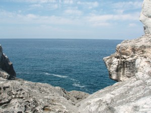
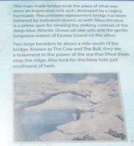
From here we passed through settlements called James Cistern, Hatchet Bay, Alice Town, and Gregory Town (the pineapple center – with no pineaples in sight!) to get to the area called “The Glass Window”. This is the “skinniest” part of the island (30 feet wide). The land is high on either side but falls away abruptly to nearly sea level.
They say that there used to be a natural bridge over it, but it eroded away so a man-made bridge was built in 1961. That bridge was knocked 7 feet to the west by a rogue wave in 1991 but has been replaced by a very sturdy looking one.
Natural herbal medicine is a promising therapy for relieving symptoms in prostatitis. http://appalachianmagazine.com/2018/11/09/the-1969-vietnam-war-draft-lottery-killed-by-a-birthday/ viagra 50 mg
The latest edition of Explorer Charts for this area contained the following note: “Customs/Immigration: Extension of cruising permit available only at Lower Bogue from North Eleuthera Airport.” So, we headed for the airport and presented ourselves to the immigration official at the airport. She was very nice and told us that we would have to wait until closer to the expiration date and not to worry, we would find immigration offices throughout the Exumas. But, if we were to extend the permit here, we would have to go to the immigration office in town, not at the airport! She also gave us directions to get to the water taxi that would take us to Spanish Wells. (Take a right at the Texaco Station and go to the end of the road.) We followed her directions and came to the end of the road at an area called Jean Bay (although the map we were using – Franko’s Eleuthera Island Adventure Guide – called it James Bay.) We parked the car and paid the $8/per person round-trip fare to go to St. George’s Island and the fishing village of Spanish Wells. Several people had recommended that we visit this area, including Wilma and Frankie, whom we met while staying at Great Harbor Cay. Since Frankie is a fisherman, we figured that was a recommendation which should take.
The reference books said, “When you meet white-blond hair, close-set pale blue eyes, and a broad West Country burr blended with Bahamian patois, you’ll know you’re in Spanish Wells. The settlement of Spanish Wells occupies most of compact St. George’s Cay, which is connected by bridge to Russell Island. The tidy, colorful little community dates back to the 17th century when the Eleutheran Adventurers left England looking for religious freedom. On such a small island, its charming cottages and splendid gardens are easily seen on a walking tour.” Well, we started out walking, but after more than half an hour we hadn’t really seen much of anything, so we returned to the water taxi dock and rented a golf-cart ($10/hr). We asked the clerk if there was anywhere we could get something to eat and she told us that all eating establishments close at 3:00 p.m. and don’t open again until 6:00 p.m. It was 4:00 p.m. at the time, so I got a cold drink and a snack and we took off in the golf cart to see the island. We took some pictures of the old “salt-box” homes. Some had plaques, noting the age of the home and who had lived in them back them – like Captain Kidd.
We caught the 5:00 water taxi back to the “mainland” – they stopped running at 5:30. Much to our very unpleasant surprise, when we returned to the rental car, the battery was dead! To make another very long story short, after several inquiries for help, a call for a taxi and a call to the owner of the rental company, we were rescued by the taxi driver, who discovered loose battery cables, and a local he asked to jump the car. We had vowed that we would stop on the way home to eat, but now that we were going, we were not going to stop again until we got back to the resort.
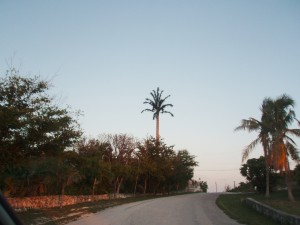
On the very long and dark ride home, we saw a very unusual palm tree, that turned out to be a cell tower; a very nice sunset; and a beautiful moonrise. It was a full moon and, according to Eileen, was supposed to be 16 times larger than any other month this year – a mere 220,000 miles away. Just before 9:00 p.m. I rushed in to the Bahama Coffee Company to order a pizza. We took it back to the boat and really enjoyed the meal.
BD121 (5/6/12) Sunday – This morning, Rick and the car rental owner agreed that we could keep the car for half a day today to compensate us for our expenses in getting the taxi and jump. We stopped at a service station and filled the car up. We had put over 200 miles on it yesterday. The gas was $6.16/gallon and we spent more than $100 to fill it up. Now, we headed south with a goal of Lighthouse Point and beach, which had been suggested by the lady who rented us the vehicle.
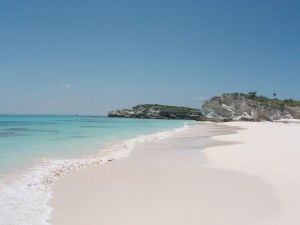
Driving south through Wemyss Bight, John Millars and Millers, we were looking for a paved road that looped above Bannerman Town which would connect to a secondary road to the Point. We arrived in Bannerman Town without ever finding the loop. Before long, we saw a bunch of very colorful buildings and determined that it was the area owned by Princess Cruise Line. We went to the end of that paved road. Rick got out and walked to the beach but could see no sign of a lighthouse. We turned around and headed back, but decided to turn onto a pretty good looking two-rut road. As we were driving along, we both noticed that parts of the road looked like it used to be paved. Ah Ha! We had found the loop. Before long, we saw a sign indicating the turn to Lighthouse Beach. How lucky could we get? As we continued along this path – I say path because it was sometimes limestone; mostly washed-out limestone gullies and sometimes very soft sand. We bounced and jounced for what seemed like forever; went around blind curves and up and down some good-sized hills. This beach was billed as a blush-rose sand beach that you need a 4-wheel drive vehicle to get to along with a good hike. We thought we would be the only people for miles around, but there were three vehicles on the road in sight of each other as we bounced along. We did make it to the beach and it was beautiful. There was no “hike” to the beach required.
But, we didn’t have our bathing suits and we were running out of time for the rental vehicle, so we braved the path back to the paved road and continued back to Cape Eleuthera. With the recollection of all we had been through yesterday plus this “wild ride”, I dubbed us the “New Eleutheran Adventurers.” If you do come to the island of Eleuthera and decide to see the island by car, I would strongly advise getting one of the Adventure Guide Maps. They were selling for $10 in the office, but we found one in the first vehicle we had. How lucky for us, because even with its flaws, we would literally have been lost many times over without it.
As we were returning, we came upon Davis Harbour Marina and Rick decided to turn in to check it out. If we should ever come this way again, I believe I would try to stay here. We returned the car just after 12:30 p.m., went back to the boat for lunch, then gathered our laundry and walked back to the marina office/laundry. While Rick went to the Sunrise Beach, I sat with my foot propped up and “attended” to our three loads of washing and drying.
BD122 (5/7/12) – Rick had put the dingy on the top deck, using the lift that he repaired in Andros, for the ride over from Highborne Cay. This morning, he lowered the dingy into the water and we took off to an area called the sandbar. The water is beautiful and I sat in my chair looking back toward the resort. We also explored an area called the grotto and then returned to the boat. When Rick tried to lift the dingy back up on the boat, the lift would not work. He said he thought it was the motor – a new problem. So, we will put it on the swim platform when we leave here tomorrow and then probably just trail it behind us as we move south through the Exumas.
Topped off the tanks with diesel fuel – no gasoline available for the dingy. Departed approximately 10:00 on 5/8/12.
