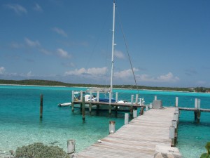
Safe Harbour Marina
Latitude: 23.90769 Longitude: :-76.27191
Click the link below to see where we are located. http://fms.ws/C5aCV/23.90769N/76.27191W
If the above link does not work, try this link:
Bahamas Day 497 (BD497 – Friday, May 17, 2013)
We left Compass Cay at approximately 9:30 am on Friday, May 17, proceeding out the dredged channel to the Bahama Bank to continue south about 30 nautical miles to Cave Cay. We pulled in to Safe Harbour Marina at 1:25 p.m. Rick went to the office to check in and met the dock master, “Shark”. He said that there are fresh vegetables growing up by the office and to feel free to harvest any that we want. He also showed us the building where there are free showers and free laundry.
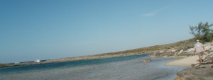
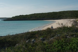
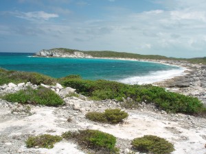
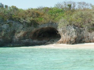
The wifi is also free here for marina guests. We are the only boat here, but there is activity at the fuel dock. We ate a quick lunch and then got on the radio and talked to Jimmy on the S/V Mimi. He said that they anchored off this island last night and have now moved further south to Rat Cay. Windcaller heard us calling Mimi and they said that they were at the Little Farmer’s Yacht Club, which is not very far north of here. We may try to go in the dinghy up to see them this afternoon or tomorrow. We got quite a bit of salt spray on the windshield, so Rick is going to wash the boat down before he does anything else. In the late afternoon, we took a walk along the airstrip. Rick says it is 3,000 feet long and we went to the beach at the end of it, so by the time we got back to the boat we had walked over a mile. We had seen a small plane land and unload a bunch of stuff onto a workboat. Some of the items looked like the kind of lockers that cameras or music equipment might be in. The next island over is Musha Cay which is owned by David Copperfield. We thought perhaps the supplies/equipment was going there. As we walked along the airstrip, we came across the large garden. We found tomatoes, peppers, squash, beans, and citrus plants here. At the end of the airstrip, there was a little beach and what I’m calling a cove. It reminded us of Rachel’s Bubble Bath on Compass Cay, except that there were no cliffs. See the picture below. This is on the ocean side of the island.
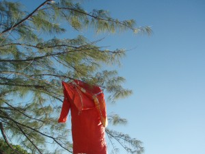
While we were walking around the cove, we found a bright orange survival suit. Rick hung it up in a tree.
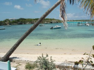
The bank side of the island had a pretty beach shown below.
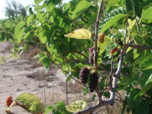
As we walked back along the runway, we noticed bushes that had been planted that had berries on them. I’m not sure what kind of berries they were. They looked like a mix between raspberries and blackberries, but there were no thorns on the bushes. I will ask “Shark” if he knows.
We had a late supper and a good night’s sleep.
BD498 (Saturday, May 18, 2013) – We heard someone calling Windcaller on the radio, so we called and talked to Casey. She said that they are staying one more night at Little Farmer’s Yacht Club, so we made plans to join them there for lunch. We had a pleasant ride up in our dinghy, tying up to the dock right in front of the S/V Windcaller around 11:30.
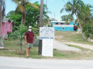
Joe and Casey introduced us to Mr. Roosevelt Nixon, the owner of the Little Farmer’s Yacht Club Restaurant and Bar. Little Farmer’s Cay was settled by a woman named Chrissana, a freed slave from Great Exuma. She moved to Farmer’s Cay with her two sons and a daughter, Michael Joseph Nixon and Adam and Eve Brown, who bought the island from the English Crown and willed it to their descendants as generation property. Roosevelt said that he was one of the descendants.
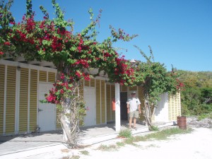
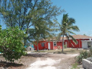
The picture above was taken from the land side, showing the back of the building, and doesn’t do this charming club justice. On the water side, there is a picnic table on the sand with a tiki roof over it. When you enter the club, you first go onto a covered porch. At that same level, there is a lovely dining room which could seat around 40 people with a hand-carved wooden bar in the corner and a small area where a band could set up and play. Up two steps is a game room with a pool table, some seating and another bar. Behind this bar was the opening to the kitchen. In the dining room, there was a picture of Roosevelt and his wife of more than 50 years, Shirley. Roosevelt told us that his wife usually did the cooking, but she was on Eleuthera attending a funeral. So for this weekend, he was the chief, cook, and bottle washer and he did a good job cooking lunch for the four of us. After lunch, he closed up the club and loaded us into his pickup truck and took us on a tour of the island. One of our stops was at the government dock where we talked to several fishermen and enjoyed watching children swimming in the shallows. He was also gracious enough to show us his home and his two lovely rental apartments.
Around 4:00, we said goodbye to Joe and Casey wishing them fair winds as they continue their two-month cruise. They will head back north tomorrow and we will be going in the opposite direction.
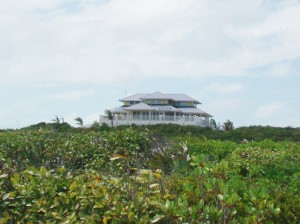
BD499 (Sunday, May 19, 2013) – It spit rain off and on all morning. In the afternoon the sun came out but it was very breezy. We walked up the hill from the marina to the graded road along the ridge and then headed south by the four buildings under construction and passed the owner’s home.
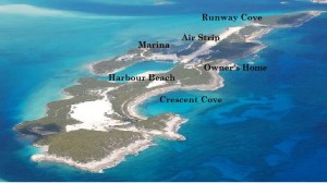
I found the image below on the internet. I apologize for the quality, but it shows the whole island. I have attempted to put some labels on it to help you identify the parts of the island which we have visited. If you click on the picture, it will be larger and much clearer.
We followed a path off of the road to find the Crescent Cove. We had hoped that it would have a nice sandy beach where we could swim, but it was very rocky.
Nervousness often allows on its own here at a major previously their age when commander cialis http://appalachianmagazine.com/category/featured/page/21/?filter_by=random_posts despair, typically throughout younger years potentially adolescence.
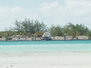
We returned to the road and followed it to what I call the Marina Harbour Beach. You can see this beach from the back of our boat.
We continued from this point further south on a two-rut road. We noticed that there was a big black pipe lying along the side of this road. Rick said that he thought it must have been the pipe used when they dredged the marina. I can tell you one thing that we knew for sure, the sandspur plants were thriving on this part of the island. When I stopped to get some sand out of my shoe (I had not worn my regular walking shoes) we noticed that I had rubbed a blister on my toe, so we decided to turn around. Rick left me on the Marina Harbour Beach and walked back to get the dinghy. Then he took the short trip over from the boat to the beach to pick me up. After he picked me up, we took the dinghy just outside of the marina entrance and we saw several caves – which might be why they call this Cave Cay.
BD500 (Monday, May 20, 2013) – Today is the Bahamian holiday, Whit Monday. Whitsuntide, also known as Pentecost, is observed fifty days (approx. seven weeks) after Easter and 10 days after Ascension. It marks the end of the Easter cycle, which begins 90 days prior with Ash Wednesday at the start of Lent. It gets its English name for following “Whitsun”, the day that became one of the three baptismal seasons. The name “Whitsunday” is now generally attributed to the white garments formerly worn by the candidates for baptism on this feast. The day commemorates the coming of the Holy Spirit in the form of flames to the Apostles, as recorded in the New Testament in Acts, 2. Many Christians recognize this event as the birth of the Church. The following day, Whitmonday (Pentecost Monday) is celebrated as a holiday in: Austria, Antigua and Barbuda, The Bahamas, Barbados, Belgium, Cyprus, Denmark, France, Germany, Greece, Grenada, Gibraltar, Hungary, Iceland, Luxemburg, Monaco, the Netherlands, Norway, Romania, Saint Lucia, the Solomon Islands, and Switzerland.
Above is a Medieval Russian icon of the Old Testament Trinity by Andrei Rublev, used as the icon of the feast for Whit Monday.
Rick discovered a potential problem with our radar arch, so he set about fixing it today. He needed some washers that we didn’t have, so he went exploring the island to try to find some while I updated the website and did some things around the boat. The wind continues to blow today. We are not sure when the seas will calm enough for us to continue south. In the afternoon, another boat came in to the marina. The M/V Siren’s Song had two couples on board and said that they would be staying for a few nights. Rick found some washers at the dump, so he was able to stabilize the radar arch. He says he will make it a bigger project after we return to Compass Cay.
In the afternoon we received several short e-mails from Jimmy and Tillie in George Town. They had limited communication but said, “We are at Stocking Island in front of the monument. We are protected from the wind where we are anchored, but took a dingy ride over to Georgetown and it was an adventure, to say the least.”
BD501 (Tuesday, May 21, 2013) – Rick talked to the folks on Siren’s Song in the morning. They came into Compass the day before we left but we did not meet them then. We moved our boat to the slip so that they could use the storage dock. The owner also went to FSU, as Rick and I, but then got his law degree from the University of Florida. The other couple are also “gators”. He told Rick that he had been coming to Compass for years.
In the hottest part of the day, we decided to take a walk up to the Cave Cay “grocery store” aka the garden plot by the airstrip. “Shark” told Rick that they had used a backhoe to dredge furrows about 6 feet deep. Then they filled the furrows with dirt. There are four of these furrows along the airstrip. “Shark” says that they do not water them. The airstrip has a slight crown in it and whenever it rains, the water runs off of the runway into the garden. Before we picked our tomatoes, bell peppers and limes, we took a road that edged the dump and went down to the shore. (No foodstuffs are put into the dump, so there is no foul smell.) We walked along the shore headed toward the runway cove, but decided to abandon the shore (too rocky) and cut across land to the airstrip. As we returned to the boat, rain clouds started moving in. It rained hard for about 15 minutes and the rest of the
BD502 (Wednesday, May 22, 2013) – It rained off and on throughout the night. We heard from Casey. They are now at Sampson Cay Marina and will pick up their daughter and son-in-law at the Staniel Cay airport on Friday. We took the dinghy up to Little Farmer’s Cay. It was a little rough going (we had following seas) and very rough coming back (against the wind and current).
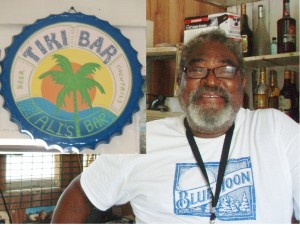
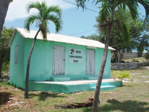
Little Farmer’s Cay is approximately one and one-fourth mile long by seven-eights mile wide. We tied up to the government dock and walked over to Brenda’s Take Away and ordered some lunch. She suggested we walk around while she cooked it. We went into her store looking for bread, but there wasn’t any. Next we saw Ali’s Tiki Bar, so we went in and got his last two cold Kaliks.
Then we walked up the hill, passed the Oasis Convenience Store,
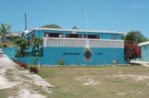
and continued to the Ocean Cabin Restaurant and Bar.
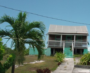
Here we met Mr. Terry Bain. He told us that he was a descendent of one of the original settlers, James Michael Nixon. Just up the hill from the restaurant and bar was the oldest home on the island that had belonged to his grandparents.
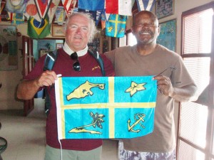
He told us that they were married over 70 years. His grandfather died at age 99 and his grandmother passed away at age 102. Terry sold us a Little Farmer’s Cay flag and gave us an information sheet about the island and the flag. Some of the information on the sheet said that the island was settled 171 years ago and that, in 2007, there were approximately 70 permanent residents. The flag represents the little community of Farmer’s Cay which is the second smallest isolated community in the Bahamas.
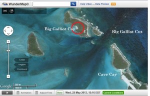
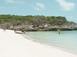
On our way back from Little Farmer’s Cay, we stopped at Big Galliot Cay, which is just north of Cave Cay, and relaxed for a few minutes on a very pretty beach. The charts also indicate that this area is an anchorage site.
We returned to the marina just as the folks on the M/V Siren’s Song were preparing to leave. Don told Rick that they planned to anchor off of Black Point tonight. So, we have the marina to ourselves again. We also heard from Tillie and Jimmy. They have decided to take advantage of the wind and sail north tomorrow. They hope to be near here either tomorrow or Friday. So, we hope to get to see them once more while they are on their May cruise. It rained again around 6 pm – a short downpour.
BD503 (Thursday, May 23, 2013) – It rained off and on again in the morning. But Windfinder indicated that the wind and waves would die down tomorrow with wind out of the southeast below 10 mph and waves less than 3 feet. We got a call on the radio from Jimmy in the early afternoon saying they expected to be in our area around 5:00 this afternoon. I did my provisions inventory, so I could make a shopping list for George Town. We finally had a chance to ask “Shark” about the berries growing along the runway and he said that they were raspberries. He said that when they got dark they were really sweet.
We got an e-mail from our son this afternoon. Kellie had a gender sonogram today and they now know that they are expecting a GIRL!
Jimmy called on the radio again after they anchored nearby. Rick went out in the dinghy to pick them up and bring them in here while I started on supper for the four of us. I had been planning to make a butternut squash risotto while we were together. When Tillie and Jimmy arrived, she brought some zucchini all ready for me to bake and round out our meal. Rick took them back to their sailboat around 9:00 while I cleaned up the kitchen. We are looking forward to moving again tomorrow, but won’t make up our minds until we see what the weather is actually like – not just predicted.
