I will identify the days of the trip with a code (LCD 001 will mean Land Cruise Day 1). The trip, as planned, will take us over 7,000 miles of highways and byways and will last about 8 weeks. I will add the states/provinces as we get to them. 1) Florida, 2) Georgia, 3) Tennessee, 3) North Carolina 5) Kentucky, 6) Illinois, 7) Missouri, 8) Arkansas, 9) Kansas, 10) Iowa, 11) South Dakota, 12) Wyoming, 13) Indiana, 14) Michigan, 15) Ontario, Canada, 16) New York, 17) Quebec, Canada, 18) New Brunswick, Canada, 19) Maine, 20) New Hampshire, 21) Massachusetts, 22) Pennsylvania, 23) Rhode Island, 24) New Jersey, 25) Delaware, 26) Maryland, 27) Virginia, 28) North Carolina, 29) South Carolina = Total of 26 states and 3 provinces in Canada.
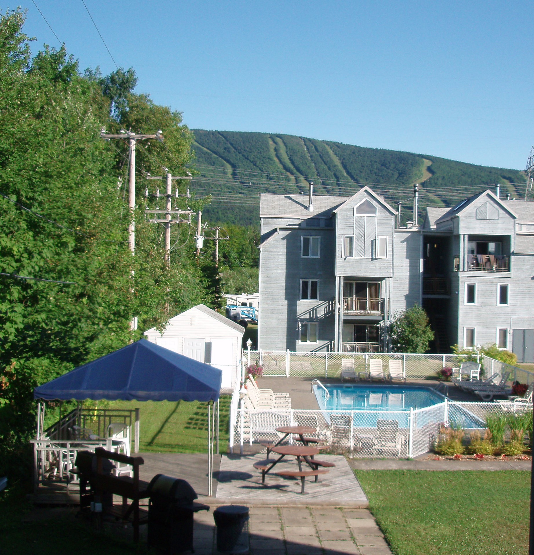
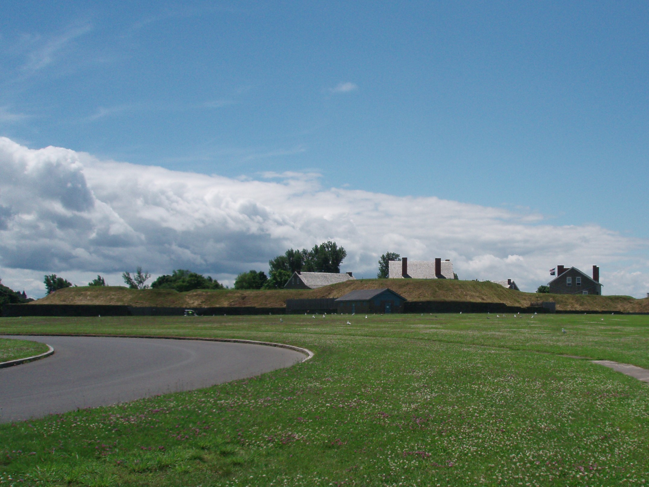
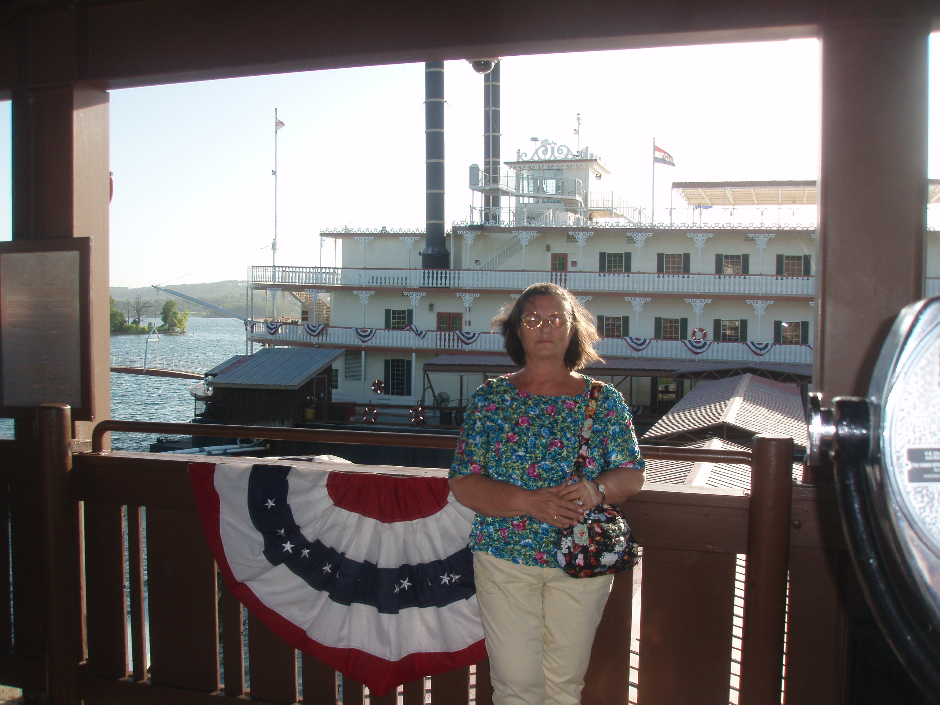
(LCD 052- LCD 058) – Monday, August 11 through Sunday, August 17 – Palmetto, Florida – We left Ormond Beach on Monday morning and drove to Palmetto, which allowed us to spend time with our granddaughter, Vanessa, before she returns to Palmetto High School next week. We were pleased to see so many friends during the week. We had dinner with Bill and Ruth, attended the Power Fleet Dinner at the Bradenton Yacht Club, and grilled steak and lobster with Steve and Joy, joined by Joe and Casey. We spent a lovely day out at Egmont Key with Ken and Jackie and ran into Richard and Deborah and their family while there. I also saw lots of old friends on Sunday morning, when Vanessa and I attended the morning church service at Palm View First Baptist. Of course, we also spent some quality time with our son and daughter-in-law and our other granddaughter, Emma, who will soon be one year old. This is the end of our “epic” Land Cruise for 2014.
We will leave Palmetto on Monday morning, August 18th, returning to the boat in Ft. Lauderdale. We will be inventorying what we have on the boat and what we need to buy before we go back to the Bahamas at the beginning of October. I’m not sure when we’ll have Wi-Fi again, I might not be able to update the blog until the end of the month.
(LCD 050- LCD 051) – Ormond Beach, Florida – We left Sumter on Saturday in a misty rain and got onto I-95 South. We stopped to fill up the car with gas just before crossing into Georgia and paid the least per gallon price (3.279) for the entire trip. Just before noon, we drove over the Savannah River entering the state of Georgia. When we drove through Jacksonville, Florida, the temperature was 97 degrees. This is the warmest temperature we have experienced on the whole trip. We enjoyed the rest of Saturday and Sunday visiting with Rick’s mother and brother.
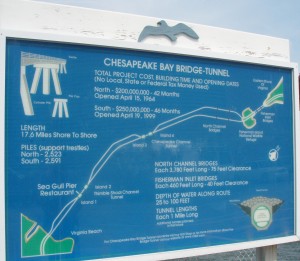
(LCD 049) Sumter, South Carolina – We left Dover, Delaware, driving south on US-13 at 7:30 on Friday morning August 8. This took us into Maryland and Virginia. We paid a $15.00 toll to go over/through the Chesapeake Bay Tunnel/Bridge. This was actually three bridges and two tunnels with a combined length of over 17 miles.
Not long after we got off of this bridge/tunnel, we went through another tunnel in Portsmouth, Virginia, near the naval yard. We eventually made our way to I-95 south. We have planned a long day of driving today, so that we can get in to Rick’s Mom’s mid-afternoon tomorrow. We checked into the Hampton Inn in Sumter around 6:00 p.m.
(LCD 048) Dover, Delaware – We left the B & B about 9:45 Thursday morning and soon crossed our first toll-bridge for the day going over to Jamestown, $4.00 toll. At 10:30, we were on I-95 headed south. Within just a few minutes, we crossed over the state line into Connecticut. The GPS said we could save an hour by getting off of I-95 and taking the Hutchinson River Parkway. It was a scenic road and definitely less crowded, but eventually we met back up with I-95 and drove through the Bronx, New York, before going over the Hudson River on the George Washington Bridge and continuing through New Jersey on I-95 which is also known as the New Jersey Turnpike. Our toll for this stretch of the road was $13.85. At the end of the NJ Turnpike, we crossed over the Delaware Memorial Bridge (another $4.00 toll) and continued south on US 13. After paying two more tolls totaling $1.50, we arrived at tonight’s destination of Dover, Delaware.
(LCD 046& LCD 047) Newport, Rhode Island – Tuesday & Wednesday, April 5 & 6, 2014 – What can I say – we changed our minds!
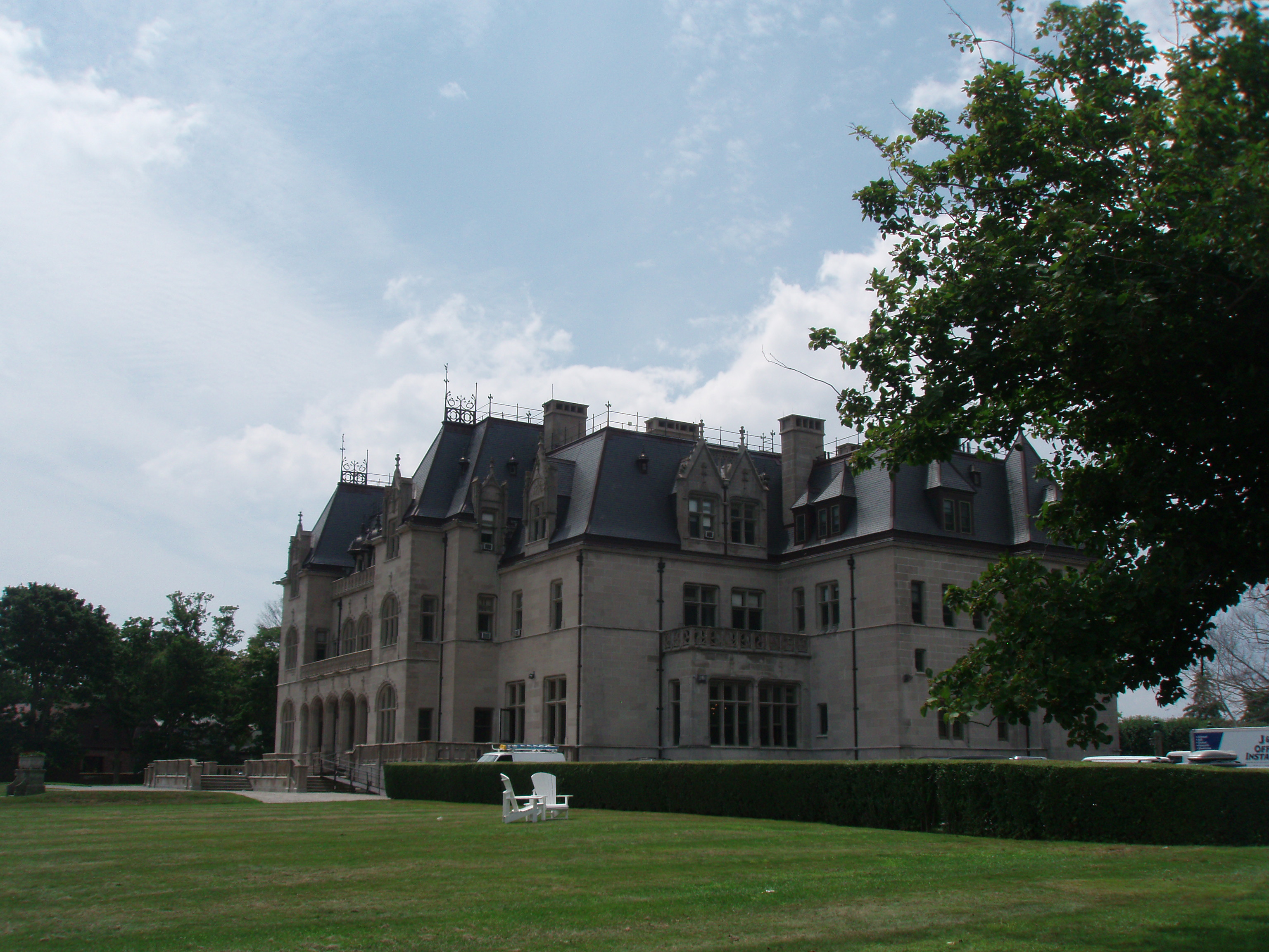
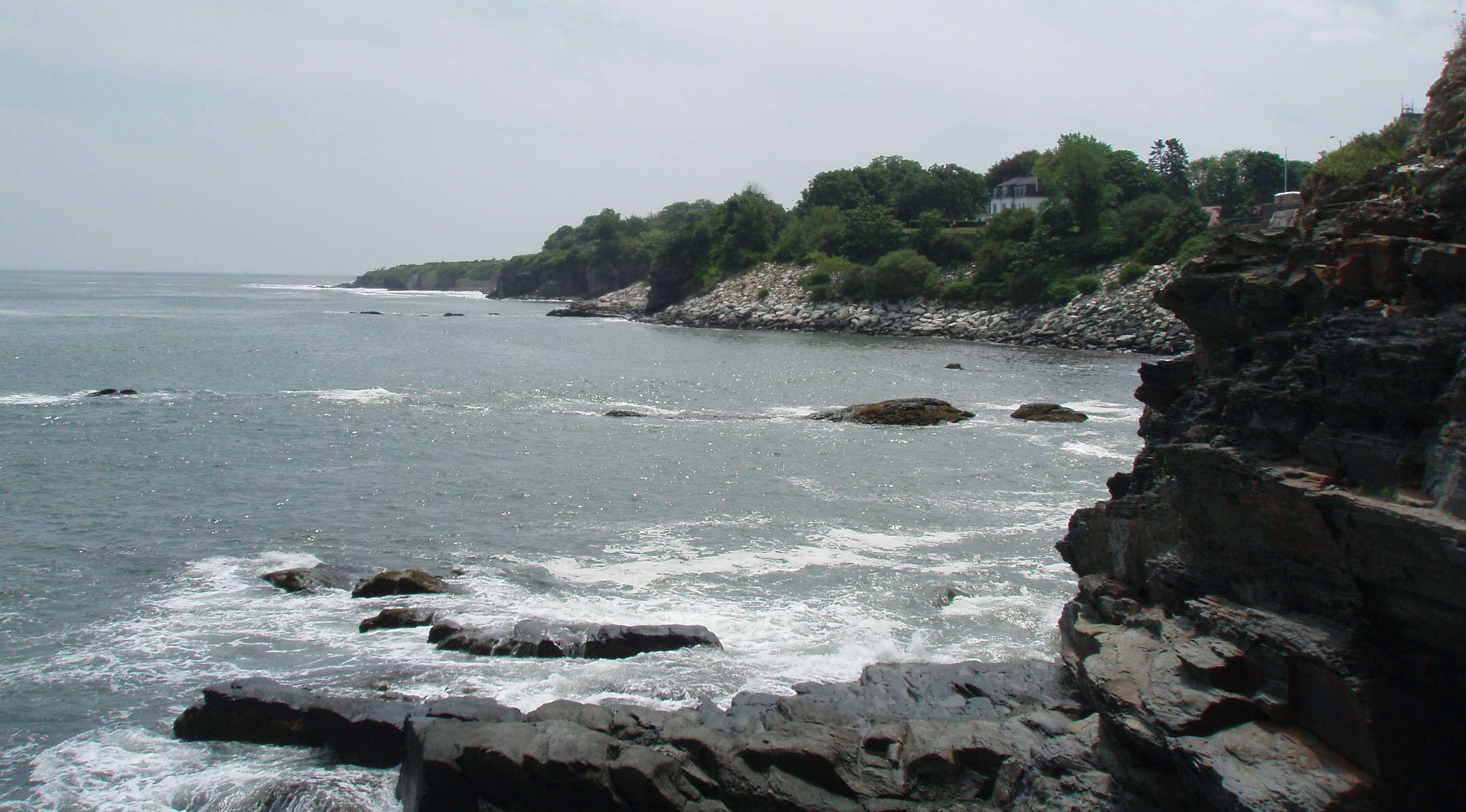
On Wednesday, we drove the car on the scenic ocean drive, through Breton Park on the south point of the island and then up Bellevue Avenue to see the many mansions that date back to the 1800’s. We stopped next to Ochre Court which overlooks the sea and was once the 50-room summer cottage of Ogden Goelet. After he and his wife died, their son gave it to the Catholic diocese who gave it to the Sisters of Mercy for the establishment of a college. The entire college was housed in this building for the first few years of its existence. The eight faculty members were nuns who lived in the mansion’s servants’ quarters. The original 58 women students lived on the third floor and took classes on the second floor. Students ate, studied, and used the library on the first floor. Over the years, the college expanded to the 21 historical buildings and 23 modern buildings that make up a 75-acre campus. The college became co-educational in 1973 and, in 1991, it became Salve Regina University.
From here we walked a short distance on the Cliff Walk to the “40 Steps”.
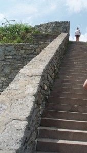
- Newport’s Cliff Walk’s 40 steps
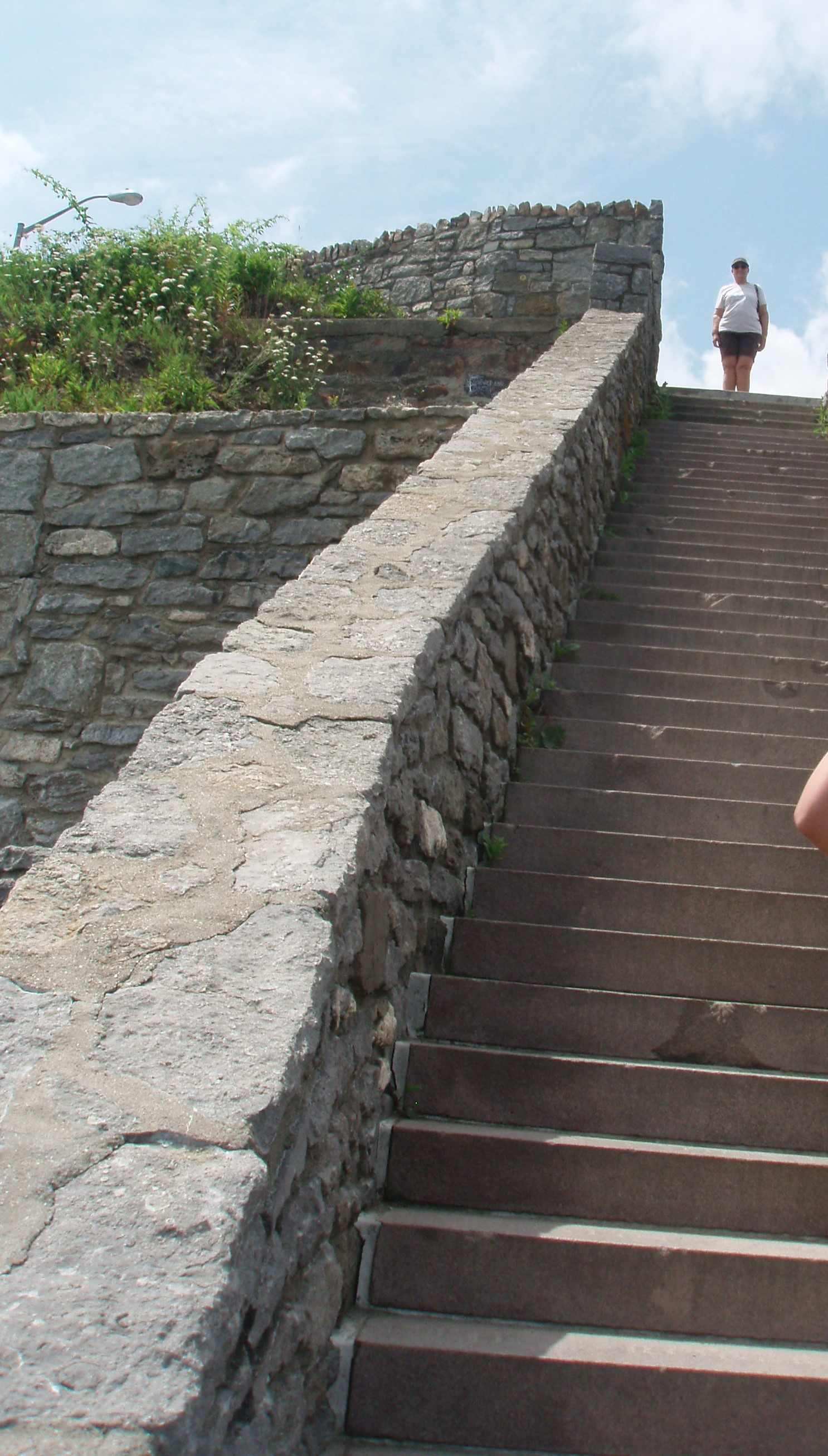
Like the shore path in Bar Harbor, the property for the Cliff Walk was donated by residents. It affords quite a view.
After all that walking, we decided to go up the road a little bit to Middleton’s Newport Vineyards where we participated in a wine tasting, had some lunch at the deli next door and bought a half-dozen bottles of wine for re-provisioning the boat. About 8:00, our friends, Barry and Janine and Natalie, came in to the dock on Sea Clef. They had left the owner’s, Ed and Karen, in Portland this morning and moved the boat to their dock in Newport to stay through the end of September. We had supper with Janine and Barry at one of their favorite Mexican restaurants and said goodbye to them until next winter when we will see them again at Compass Cay.
We backtracked on Tuesday and wound up at the Pilgrim House Inn B&B in Newport, Rhode Island. We were lucky to find a 1-hour parking spot on Spring Street just across from the Inn while we checked in and unloaded the car. Barry, the innkeeper, told us that they had reserved parking for us about three blocks down this one-way Street at the United Baptist Church. This church was built in 1846 and is said to be the oldest congregation on the island, established in 1638. After parking the car, we walked past the Touro Synagogue which is the old existing synagogue in the United States (Built in 1763). And down towards the waterfront where there are a number of wharfs. We had skipped lunch, so we stopped at the first place we could find for an early supper which was the Brick Alley Pub. The Inn provides sherry for consumption with snacks in the afternoon, but Rick found a spirit shop on the corner and we enjoyed some wine both in the living room and on the 3rd floor deck which overlooks the harbor. After our wine, we went for a walk up Spring Street going by many old homes and other historic buildings until we came to St. Mary’s Catholic Church. This large Gothic Revival brownstone was built in 1852 and is where President John F. Kennedy married Jacqueline Bouvier in 1953.
(LCD 045) Matamoras, Pennsylvania – Monday was a travel day. Originally, we had planned to go from Boston to New Port, Rhode Island, see two sets of friends that we thought would be staying there for the summer. As it turned out, one couple was in Portland, Maine and the second two were in Annapolis, Maryland. So, we are now heading (in a round-about fashion) to Annapolis. We followed our GPS instructions leaving Revere/North Boston and it took us right through the middle of downtown Boston to get onto I-90 W. On our way to I-90, we crossed over a bridge that said there was a $3.00 toll but you could not pay cash. The bridge was under construction and the toll booths were not accessible. The signs said that they would charge you by your license plate, so we are waiting to see how that bill will find us. I-90 is also known as the Mass. Pike (that means toll road). It is over 3,000 miles long, starting in Boston and ending in Seattle, Washington. We have travelled on I-90 several times already on this trip. Our first toll on the Mass. Pike was $1.25, then we paid another $2.90 before getting onto I-84 to finish this day’s driving. While on I-84, we passed into the States of Connecticut, New York, and Pennsylvania before arriving at tonight’s destination of Matamoras. We did not choose this destination for any special reason. It just seemed to be a reasonable distance for a stop-over between Boston and Annapolis.
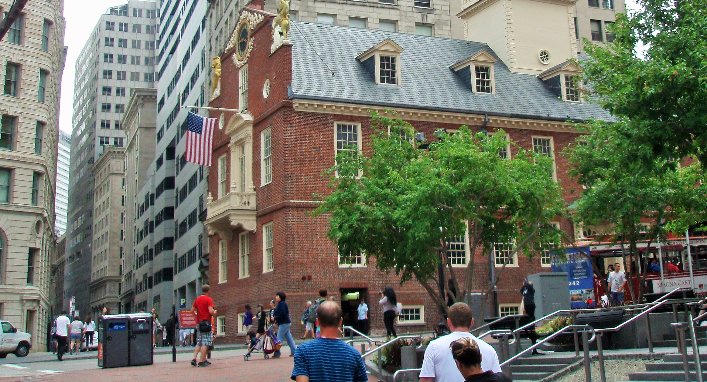
Boston Area – (LCD 043 & 044) Saturday & Sunday, August 2 & 3, 2014 – We chose to stay at a Fairfield Inn in the Revere/North Boston area because it advertised a shuttle to the “T” which is what Boston calls its subway system. Taking advantage of this made it possible for Rick not to have to drive into downtown Boston for our time here. On Saturday, we took the T to the Aquarium Stop. Just steps from here, we boarded the “Old Town Trolley Tour” bus. We had purchased the tickets on-line receiving a substantial discount. Since it was a rainy morning, we stayed on the trolley for the entire two-hour narrated tour and then got off/on where we wanted to in the afternoon, when it was supposed to clear up. There are numerous “trolley tours” around the city, but this one was good for two consecutive days and it also included free admission to the “Boston Tea Party Ships and Museum” or a 45-minute cruise on Boston Harbor. After making the initial circuit, we took the Boston Harbor Cruise and then returned to the trolley. We disembarked near the “Old State House”. The Declaration of Independence was read, in 1776, from the balcony shown in the picture.

- Old State House
From here we walked to the Faneuil Hall and Quincy Market. The hall is operated by the Parks Department. Mr. Faneuil was a wealthy merchant in Boston in 1742 and he had the hall built to serve several purposes. The bottom floor was divided into stalls and used as a market and the second floor was used as a meeting room and the third floor housed “the Ancient and Honorable Artillery Company of Massachusetts which was founded in 1638 and has occupied space in the Hall since 1746.

- Faneiul Hall Meeting Room
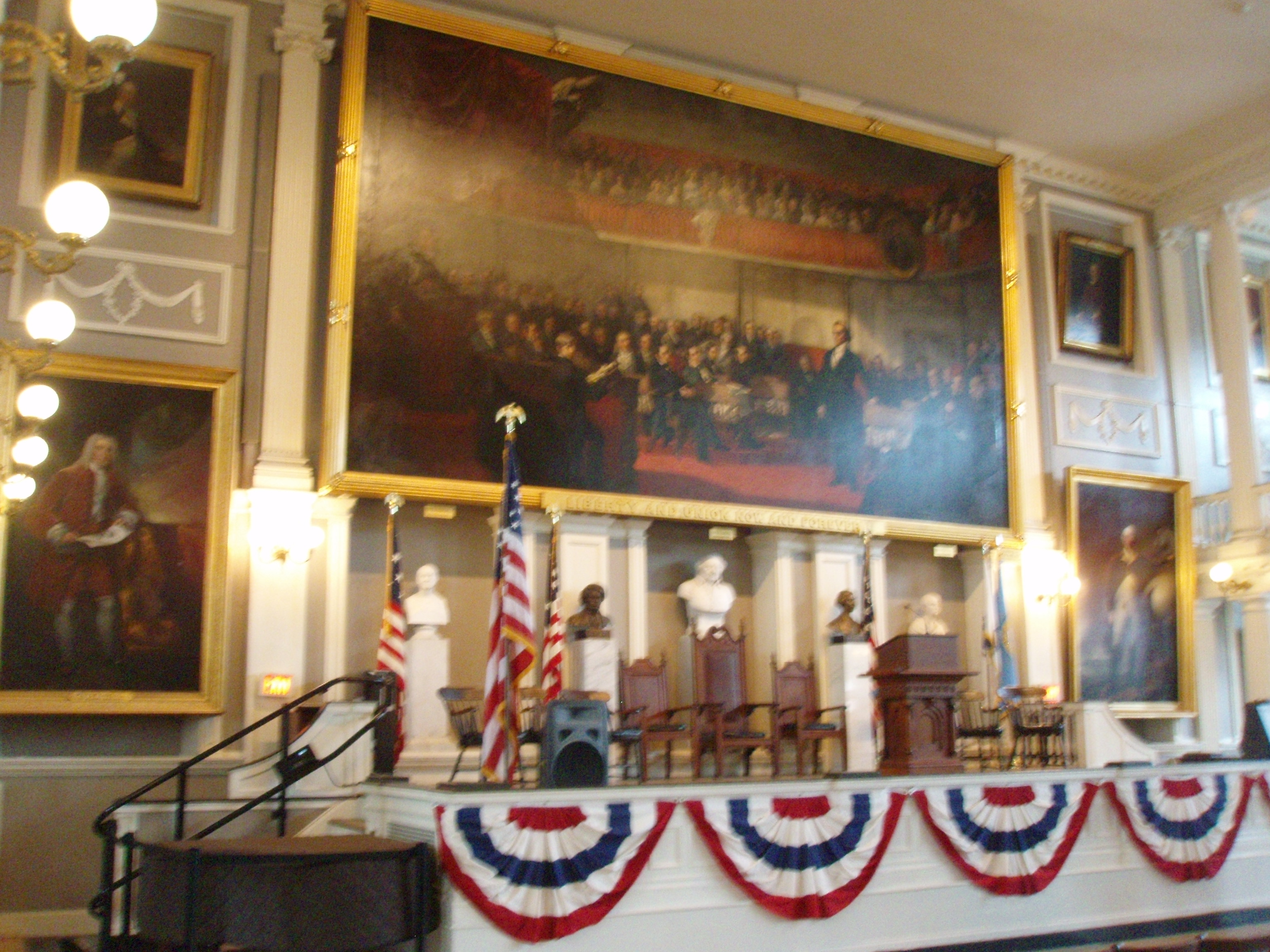
Subjects such as the revolution, anti-slavery, and women’s suffrage have been debated in the meeting room by well-known speakers such as: James Otis, Samuel Adams, Dr. Joseph Warren, William Lloyd Garrison, Wendell Phillips, Charles Sumner, Frederick Douglas, Jefferson Davis, Daniel Webster and Susan B. Anthony. The Hall is also known as the “Cradle of Liberty.” In addition to these sites, we also visited the Granary Burial Ground next to the Park Street Church. There are three signers of the Declaration of Independence buried here. We learned that John Hancock was the president of the continental congress at the time of the signing and that his was supposed to be the only signature on it. But, the others signed (in smaller handwriting) to protect John Hancock from being prosecuted for this act of revolution. They figured the government would have a harder time prosecuting all of them. There are a number of other well-known figures buried here, including all of the Franklin family (except Ben) and the woman who inspired the “Mother Goose” nursery rhyme. Her last name was actually Goose. After walking around the cemetery, we went across the street to “wet our whistles.”
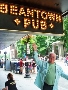
- Rick in front of the Bean Town Pub with the Granary Grave Yard in the Background

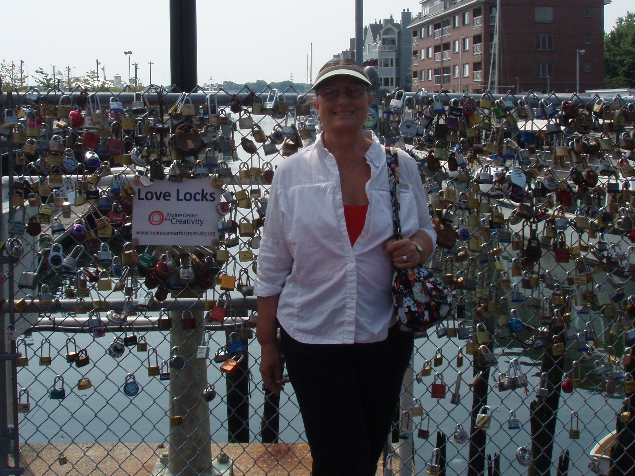
(LCD 042) Friday morning, 8/1/14, before leaving the city of Portland, we drove downtown and took a sightseeing tour aboard a vintage fire engine. We boarded the fire engine near the “Love Locks” – an art installation/fundraiser where couples buy a lock, write their names on it and lock it onto the fence forever.
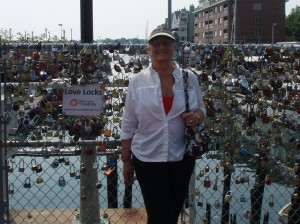
- Love Locks
After our $15/50-minute tour, we drove south to Cape Elizabeth to see the Portland Head Light which was commissioned by George Washington in 1790.
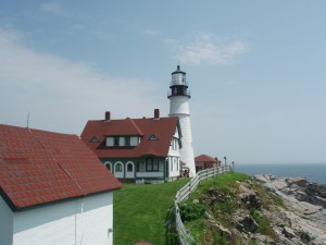
- Portland Head Light

From here we made our way south on US 1, passing briefly through New Hampshire and then into Massachusetts to a suburb on the north side of Boston called Revere.
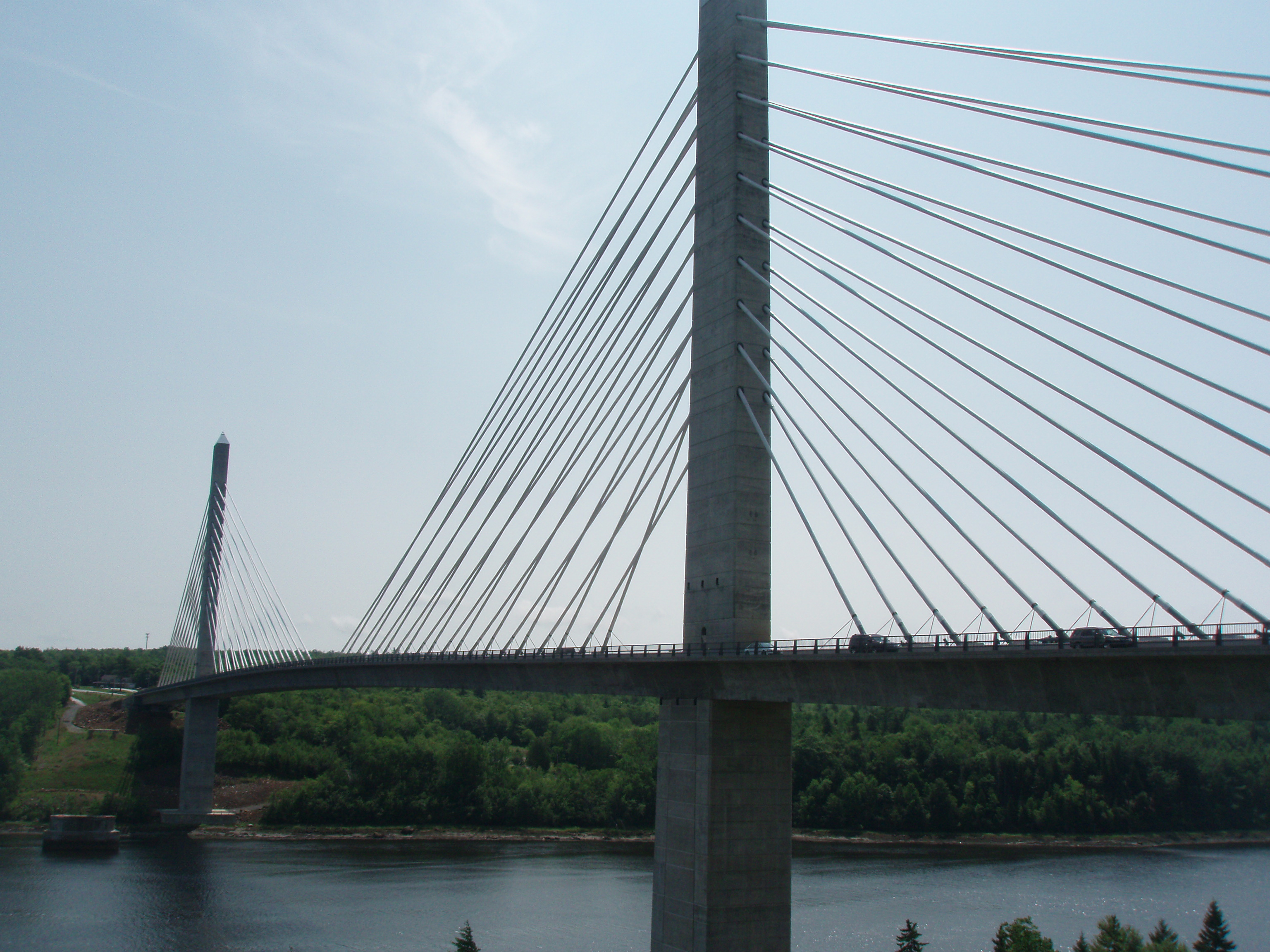
(LCD 041) On Thursday, 7/31/14, we left the motel in Bar Harbor about 10:00 a.m. heading to visit friends from Florida, Barbara and Jim Young. Barbara is Jackie Sosville and Ann Mahoney’s sister and she used to live in our neighborhood in Palmetto, Florida. On the way, we crossed a river on the Penobscot Narrows Bridge and Observatory, a 2,120 feet long bridge with an observatory built into one of its towers (420 feet high). The original bridge here was the award-wining Waldo-Hancock Bridge built in 1931. When they were refurbishing it, they found that it had lost its structural integrity, so they built a new one which reminded us of the Skyway Bridge over Tampa Bay.

- Penobscot Narrows Bridge and Observatory
After a short visit with Jim, Barbara and her mother, Gladys, we drove a little further south to Portland, Maine.
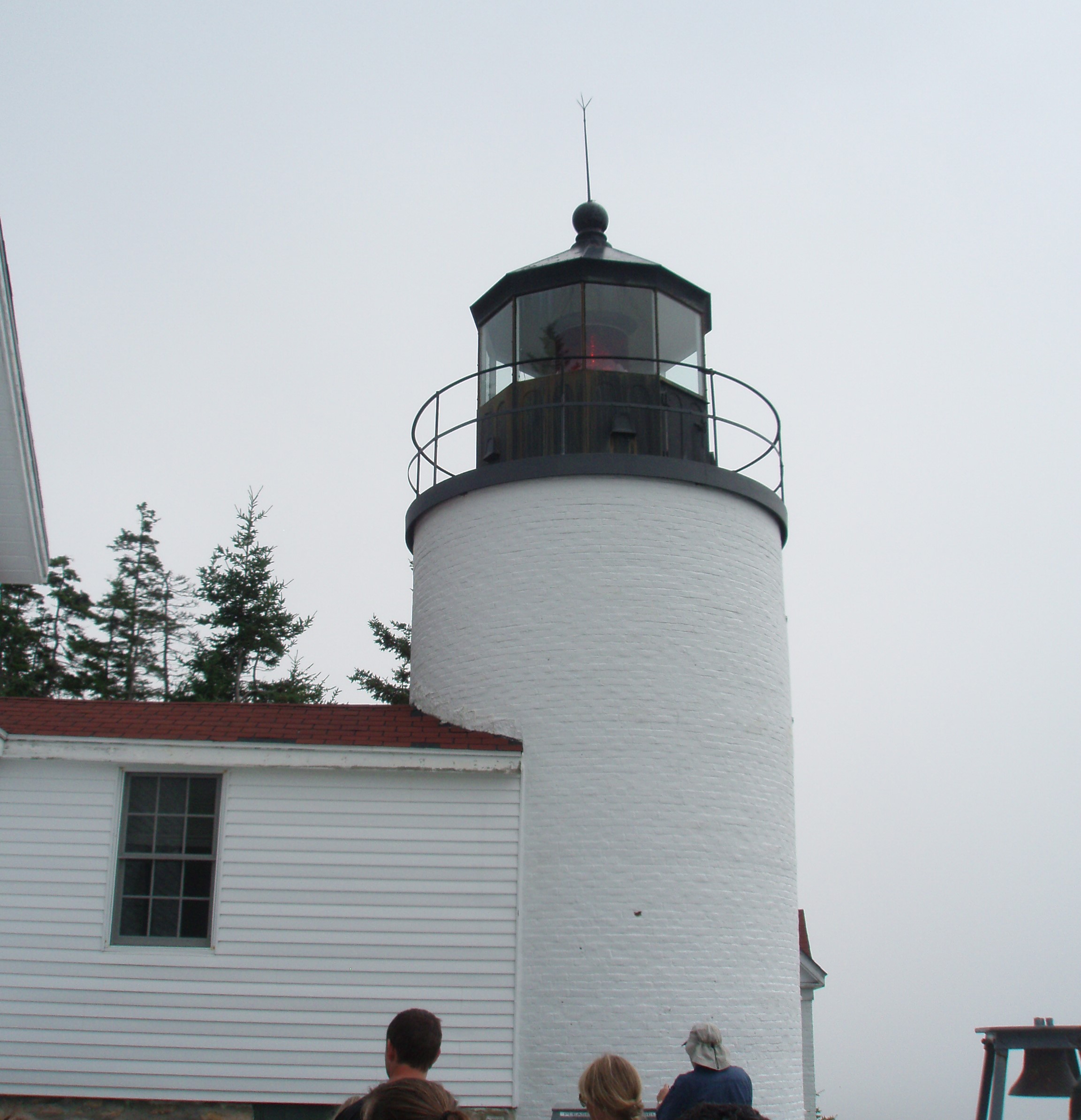
(LCD 039-41) – Monday, July 28 thru Wednesday, July 30, 2014 – Bar Harbor, Maine (LCD 041) On Wednesday, we drove to the “Quiet Side” of Mt. Desert Island passing through Southwest Harbor, Seawall and Bass Harbor which has a lighthouse that has been continuously operated since 1858.
This was the only evening in Bar Harbor that Rick did not eat Lobster for supper (but he had a lobster roll for lunch.)
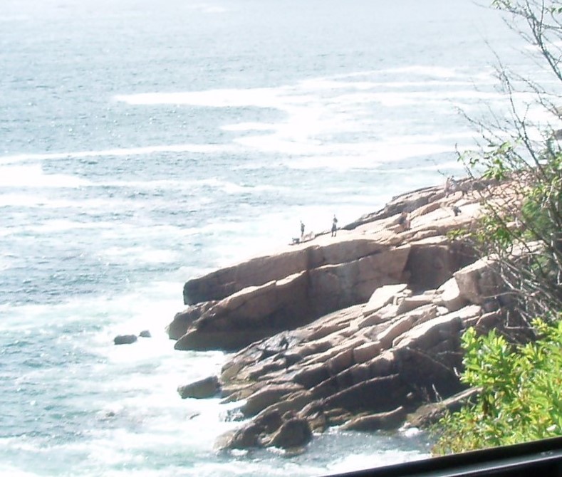
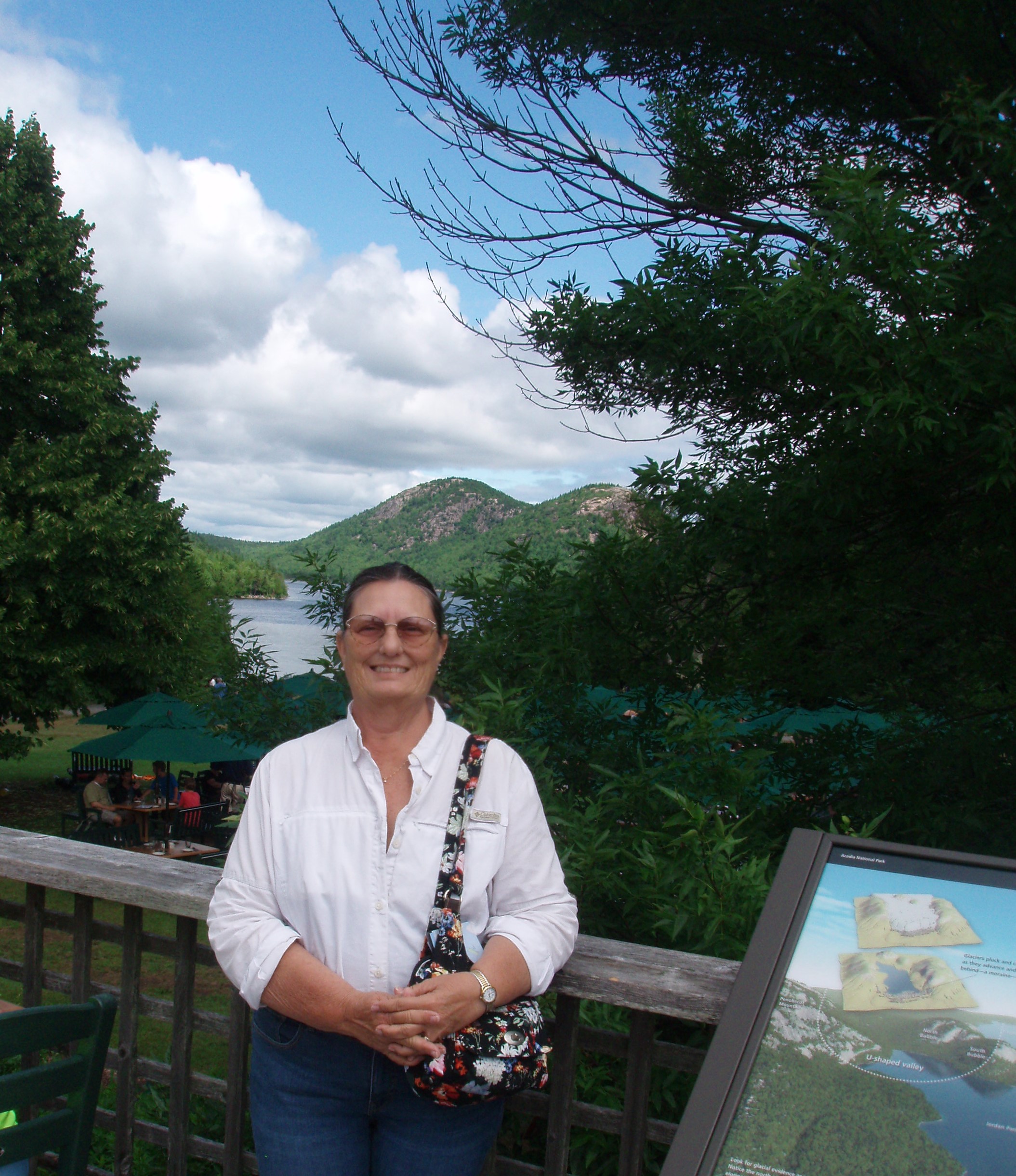
(LCD 040) On Tuesday, we took a bus tour of the Acadia National Park. We learned that Bar Harbor is located on the island of Mount Desert. Samuel Champlain founded a French settlement here in 1604. (Remember he also founded Quebec.) Over the next 150 years the land was disputed between the French and British and finally the British won out. Within that 150 years, many of the French were transported down to New Orleans becoming what is today known at the “Cajuns” of Louisiana. (This includes my father’s family.) This national park is different than others in that all of the property was donated and named the first national park east of the Mississippi in 1919. It is the third most visited park in the US. We were really glad that we were in a bus, rather than our car, because the park did seem to be very crowded and parking for cars was often difficult to find. In fact, after we returned to town, we heard that they had shut the park down for a while because of the overcrowding. We stopped at Beaver Lake, Sand Beach, Thunder Hole, Jordan Pond and Cadillac Mountain. Cadillac was a Frenchman who was given a land grant here by the French. He made a deal with the British to lead the remaining French residents of the area away to avoid further conflict. The British would not let him take them to areas that were already settled by French (like New Orleans or Quebec), so he took them to what is now the Detroit area.
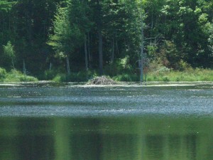
- There were two beaver dens in this pond

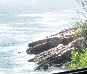
- Acadia Park Coast

- The Jordan Pond House Restaurant is famous for its popovers
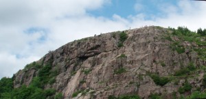
- Can you see the people on the top of Cadillac Mountain?
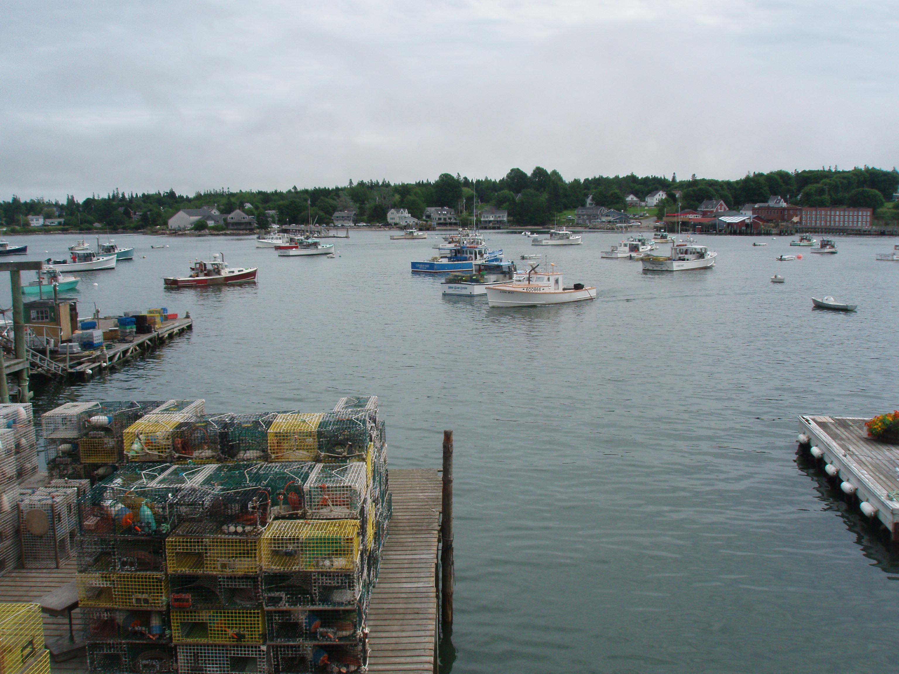
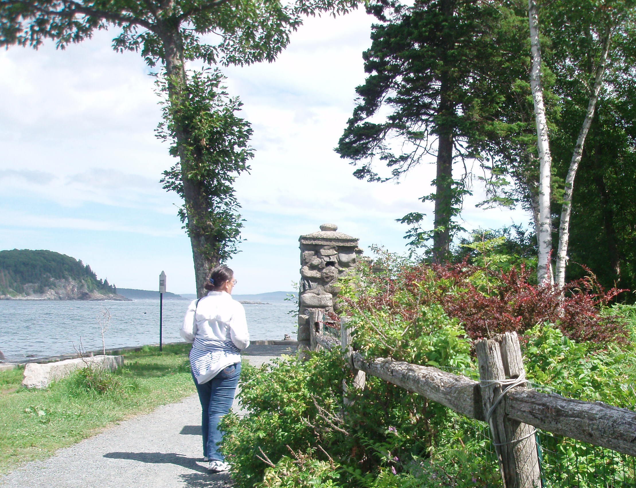
When we stopped at the top of Cadillac Mountain, our bus driver, Roger, showed us wild cranberries and wild blueberries. He told us that these are two of the best anti-oxidants known to man. The cranberries were very tart and the blueberries very sweet. A word of advice, if you take this bus tour (which we thought was great) you get better pictures while riding down the road if you sit on the left! After the bus tour, we had lunch (Rick had lobster) and then, we walked along the Shore Path. This path was established around 1880 and runs along the coastline for about a mile. The property for this path was also donated by the wealthy landowners in the area.

- The Bar Harbor Shore Path
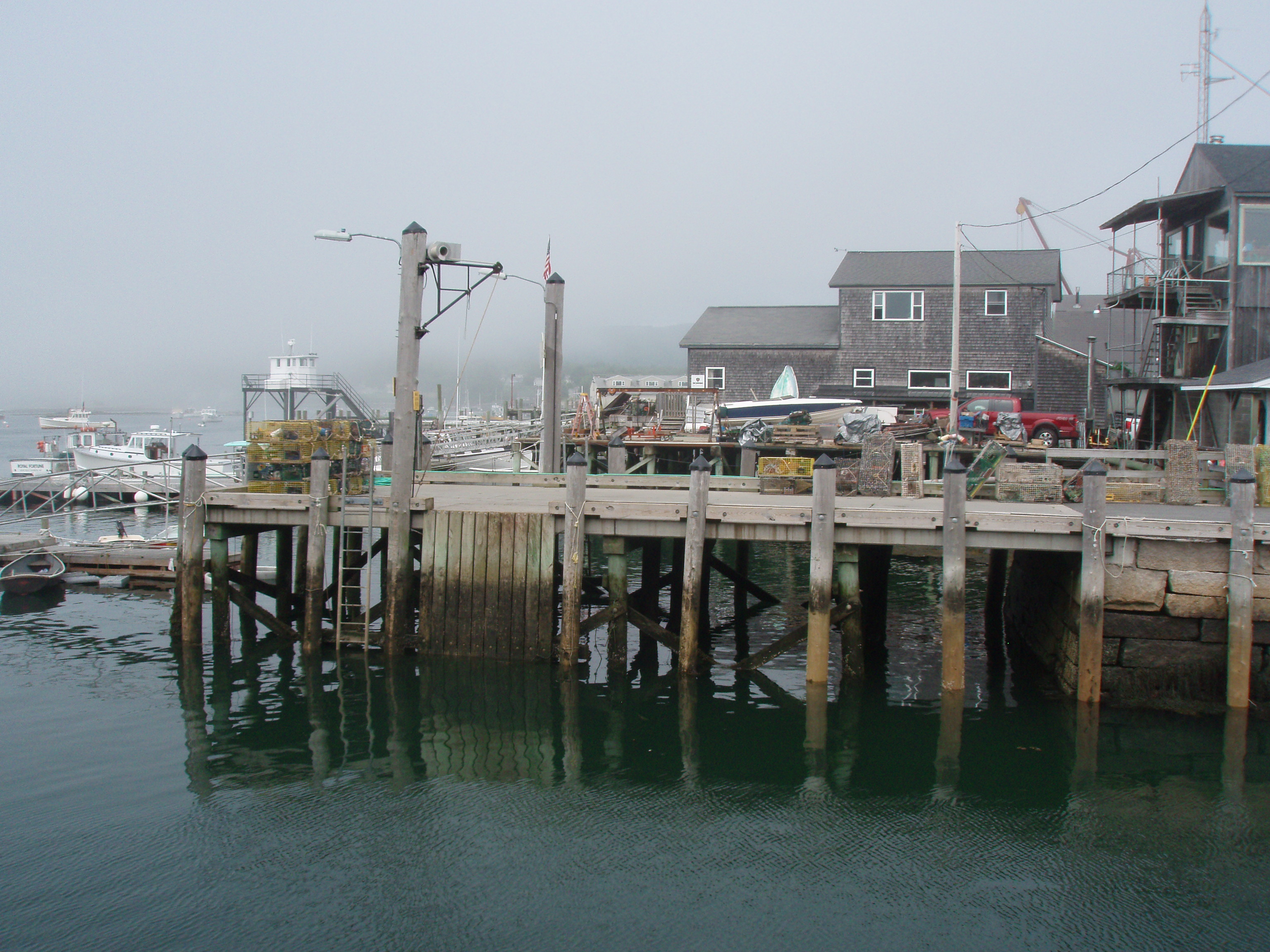
The Bay of Fundi says that they have the biggest tide change in the world and here, in Bar Harbor, they say that they have the biggest tide change in the US. We took a picture of the municipal dock at both low and high tide.
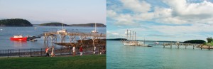
- Bar Harbor Municipal Pier
We walked back down Main Street in the evening to have a “Lobster Bake” for supper at the Terrace Grille of the Bar Harbor Inn. The Lobster Bake included clam chowder, a bowl of mussels and clams, lobster, boiled potatoes and corn followed by a piece of blueberry pie. We were happy to have a chance to walk off some of our dinner going back to the motel.
(LCD 039) When we left St. John Monday morning, 7/28/14, it was misting and raining and that continued through most of the morning. We crossed into the US at Calais, Maine, and also went back into the Eastern Time Zone, arriving in Bar Harbor about 1:30 in the afternoon. After settling in, we took a walk down Main Street. When we booked the Villager Hotel here, we got a package that includes a bus tour of the nearby Acadia National Park, a “lobster bake” dinner for two and dinner in the “Reading Room” of the Bar Harbor Inn and Spa. Our walk allowed us to identify the shop where we need to go to get our tour tickets in the morning and to talk with the staff at the Terrace Grille (which was closed tonight).
(LCD 037-38) – Saturday, July 26 and Sunday, July 27, 2014 – St. John, New Brunswick, Canada (on the Bay of Fundi)
(LCD 038) We went back to the Reversing Falls, drove through the Irving Nature Park and then up the Fundy Coastal Drive to the Fundy Trail Parkway on Sunday. Most of our afternoon was spent driving the Fundy Coastal Drive and the Fundy Trail Parkway ($12.40 toll). This coastline is exactly what I expected to see.
 Along the trail, we stopped to see Fuller Falls. This was the first time we had ever seen “suspension steps”. The steps down to an observation deck for the falls were literally held together by cables and some of the wooden 4 x 4 boards were suspended off of the ground.
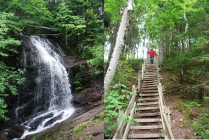
Fuller Falls And Suspension Steps
We went to the 600-acre Irving Nature Park in the morning and drive the 7.5 Kilometer driving/walking/running loop which has some amazing views. In addition to the loop, there are numerous, fairly easy, walking trails along the coast line and a number of observation platforms. At one of those overlooks, we saw a seal swimming in the water just off of the coast.
We also returned to the Reversing Falls. But, while the reverse flow between the Bay and the St. John River is very obvious, unfortunately, it is hard to capture the change with a photo. But, we did take a picture of the same structure on the bank at both high and low tides. I have put the two together to give a picture of how much the tide changes in this area.
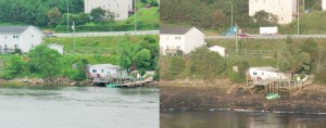
- Compare High Tide to Low Tide (Click to see Enlargement)

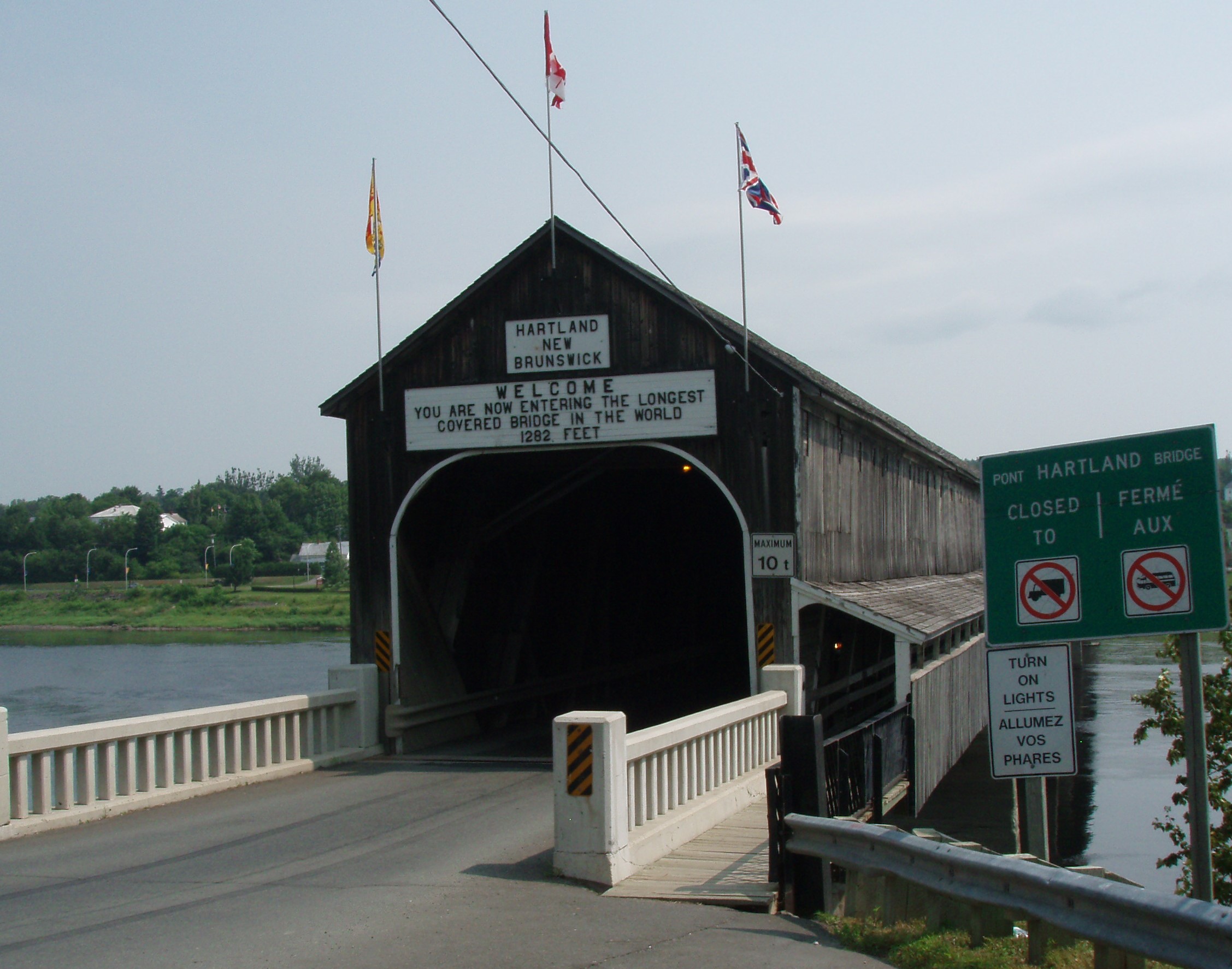
(LCD 037) We left Edmundston in the morning heading east to the coast. Made a short detour to go through “the world’s longest covered bridge” in Hartland. The Hartland covered bridge is 1,282 feet long. It was opened on July 4, 1901 and covered in 1922. In 1906 it was a toll bridge – the toll was 3 cents. They carried the Winter Olympic Torch through the bridge in 1988 and Canada created a stamp with its image in 1995.
About 40 miles before reaching St. John, we got off of the TransCanada Highway #2 and took “The Loyalist Route” on the Scenic Valley Trail aka Route 102. Along this road we saw a number of historic sites, including homes gravesites and churches that were established in this area after the American Revolutionary War. According to the information we received, about 14,000 Loyalists settled in this area in 1783-1874, forming the province of New Brunswick out of what had been part of the province of Nova Scotia. Most of them settled along the lower St. John River, clearing farms from the forest and establishing the small communities that continue to survive today.
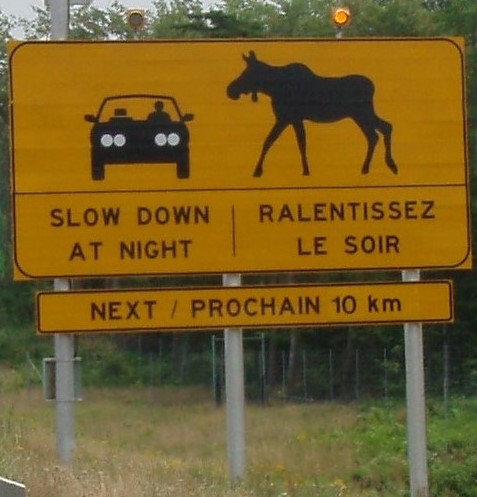
Moose are apparently a big problem along the roadways. The sign that we saw today, gives a good idea of the size of the moose you might encounter.
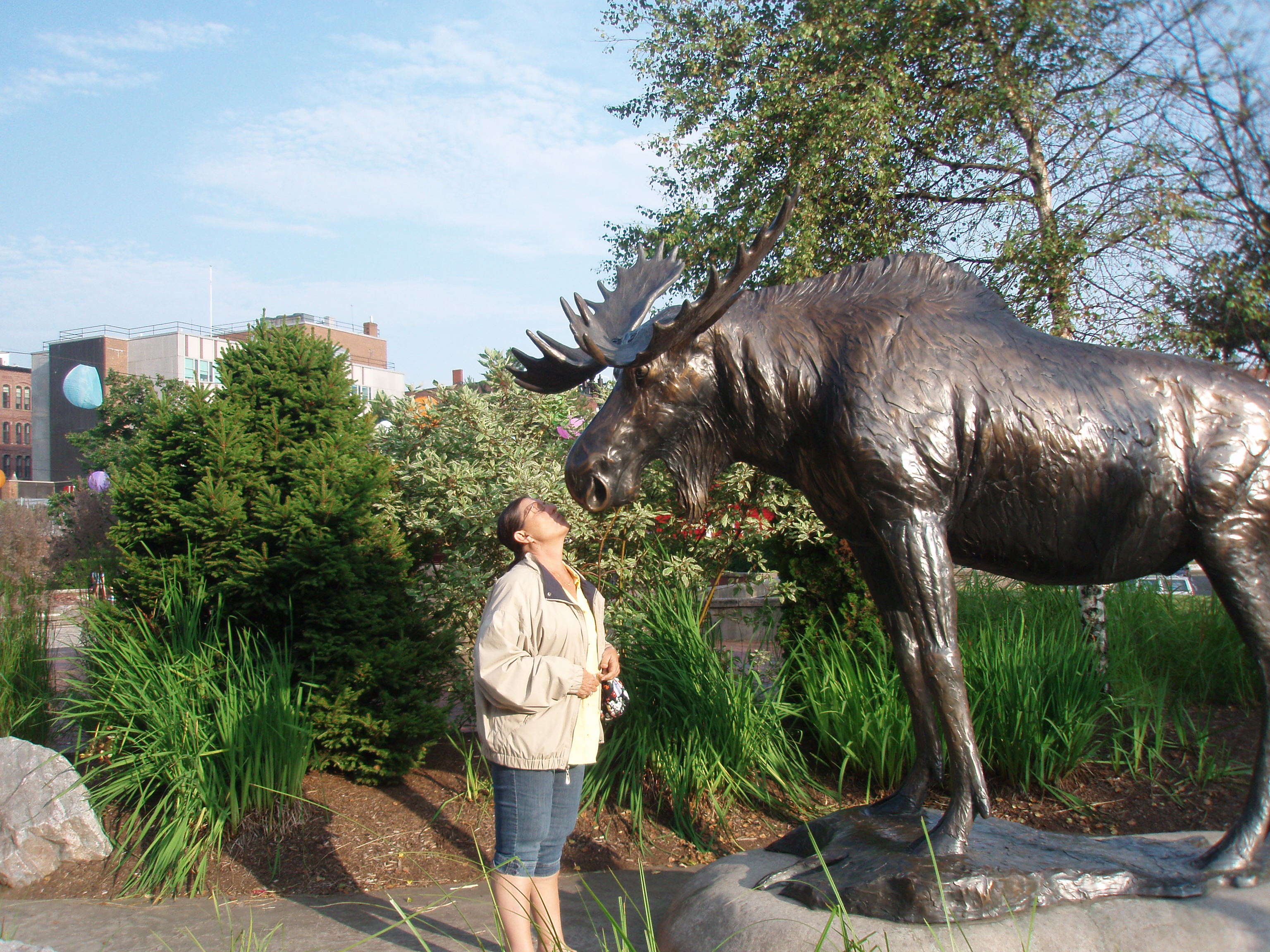
We checked into the Hampton Inn and went to an early supper at Market Square, one of the oldest parts of the city. Here, we saw our first Moose, but he was made of bronze and was donated to the City of St. John by the folks that make Moosehead Beer!
 After supper, we went to Falls Parks to see the area known as the Reversing Falls. When the world’s highest tide comes in to the bay, it pushes the water in the river in one direction and then when the tide is low, the water flows in the other direction. We took some pictures this evening when the tide was low and will try to take some more tomorrow around in the early afternoon when the tide is high to see the difference.
(LCD 036) – July 25, 2014 – Edmundston, New Brunswick, Canada – We left our condo on Friday driving back to Quebec City over the St. Lawrence and then on the other side of the St. Lawrence, eventually turning southeast and entering the province of New Brunswick. I hate to admit it, but I had no idea that North America had five time zones. When we crossed into New Brunswick, we also crossed into Atlantic Time, moving our clocks forward another hour. In North America, Atlantic Time is only observed in the eastern provinces of Canada – nowhere in the US.
LCD 29-35 – July 18 through July 24, 2014 – Club Vancances Toutes Saisons – St. Anne de Beaupre in the Province of Quebec, Canada
Thursday (LCD 035) – After walking up and down and around old Quebec City for the past two days, I have to admit that my legs are sore today. So, we continued our drive around the Ile d’Orleans. This island provides much of the food for the city of Quebec. We saw lots of things growing on farms including: strawberries, blueberries, apples, corn, wheat and potatoes. Some of the homes have been there for hundreds of years. It was a nice way to spend time out of doors while not walking. After we returned to the condo, Rick went in the pool even though it was only 75 degrees today. While in the pool, he saw a bear walking on the slopes of Mont St. Anne seen in the background of the picture below.
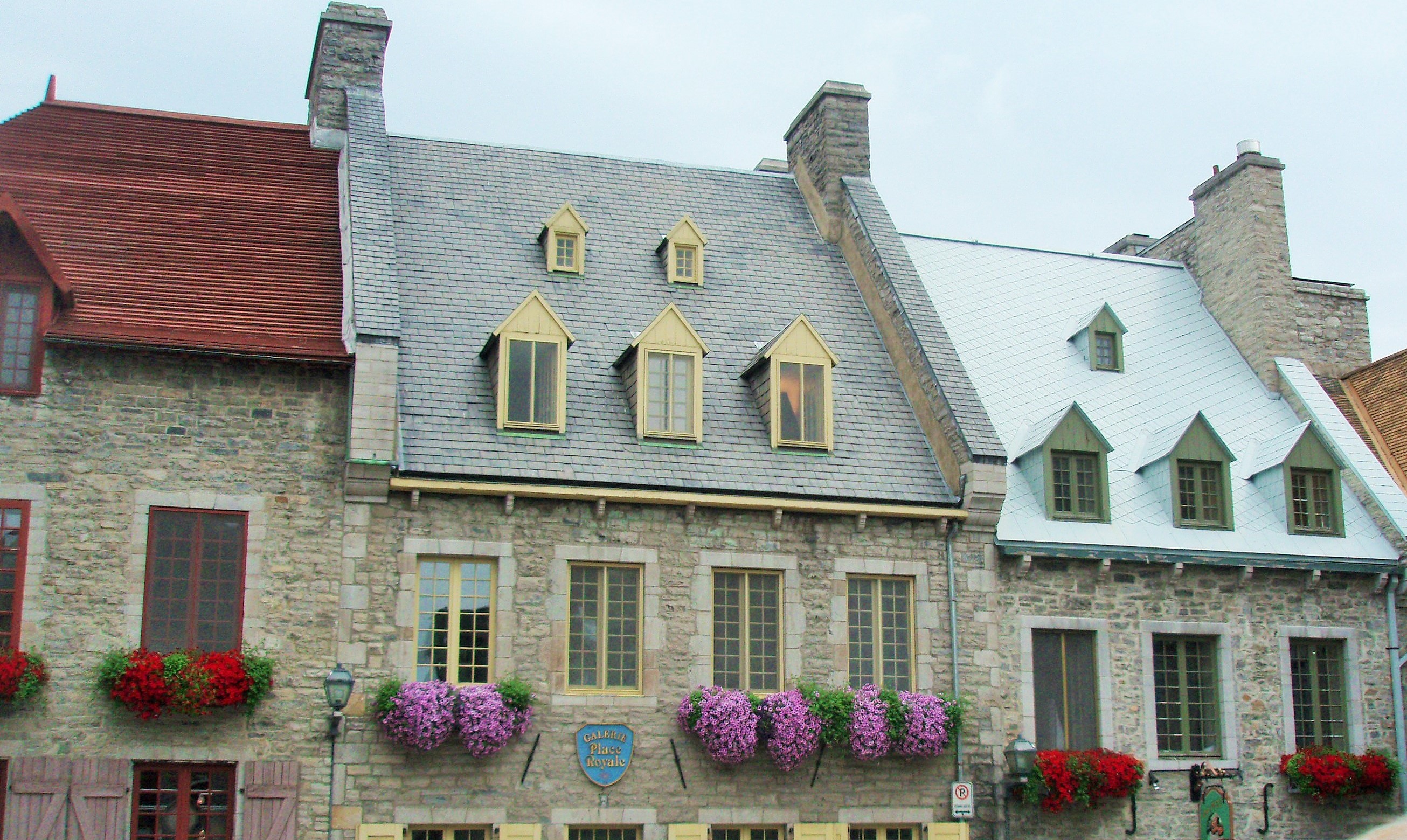
Wednesday, July 22, 2014 (LCD 034) – We participated in a guided tour through old Quebec City arranged by the resort. All along the 40-mile trip into the old city, the bus driver told us about the area through which we were passing. One of the things that he mentioned was that all of the churches (and there were a lot of them) were built on high ground and they each have distinctive steeples. These steeples were used as landmarks by the people sailing on the St. Lawrence. After departing from the bus, we started a one-hour walking tour of the lower city. The city was founded by Samuel Champlain and our tour was of the PetitChamplain District and Place Royal which is where Samuel Champlain established his trading post in 1608. One of the first things that our guide, Pierre, talked to us about was the various styles of building in the old city. As time passed, the government realized how much of a problem fire was and so they no longer allowed wooden roofs. In the picture below, you see a wooden roof on the left, slate in the middle, and tin on the right. Also, buildings like this one were required to have a fire wall between them. We had noticed many tin roofs in the country-side. Some of the houses also had tin siding.
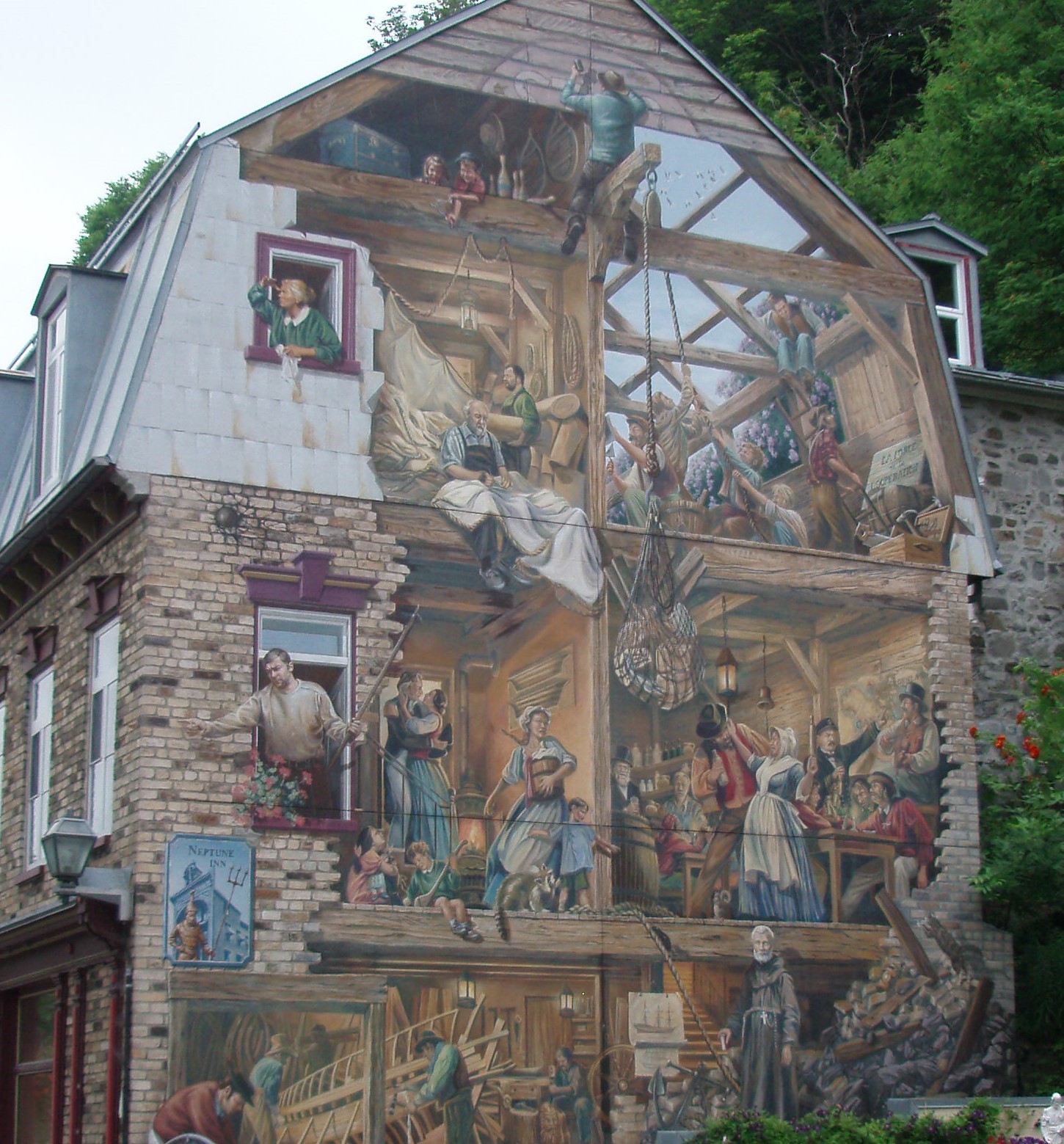
In another part of this quarter (or district) we saw a mural that had been painted on the side of a structure which depicted the every-day activities of the working class families who had lived in the area. Don’t forget that you can click on the picture to enlarge it.
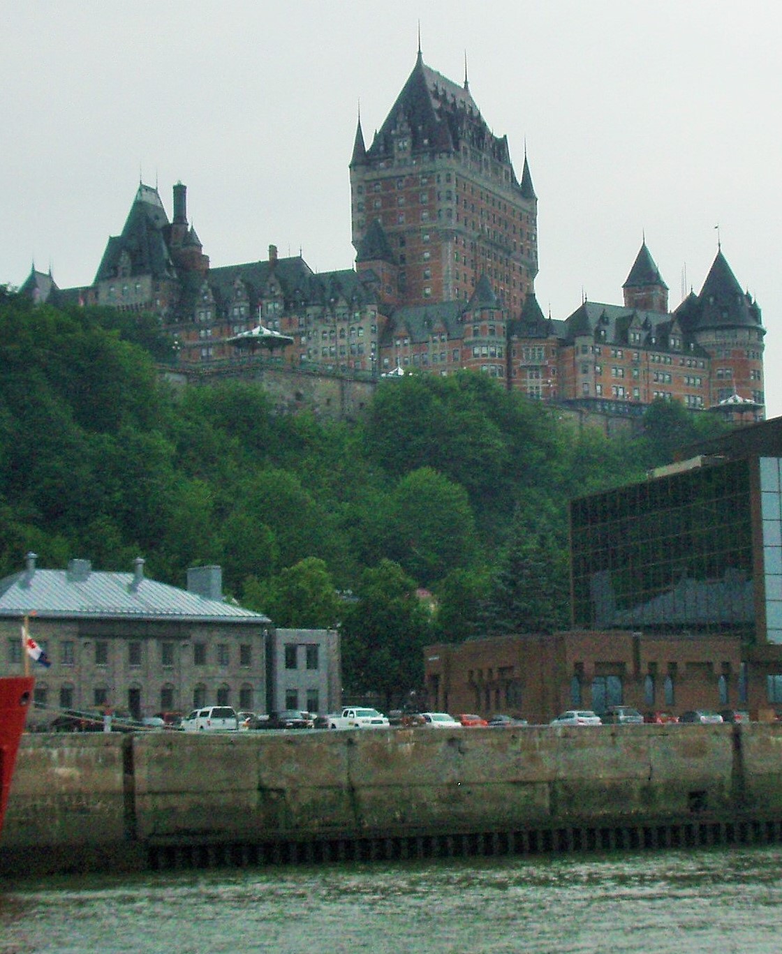
Next, we boarded a sightseeing boat called the Louis Joliet. Our guide for this tour was dressed as Louis Joliet would have been in his time (September 21, 1645 – last seen May 1700). Apparently, Louis Joliet was the first child born in Quebec. He became an explorer and sailed all around Quebec. He also sailed into the Great Lakes and down the Mississippi to within 435 miles of the Gulf of Mexico when he turned around and went back to Quebec. Soon after leaving the dock, we passed by the Fairmont Hotel which is even more impressive from water level.
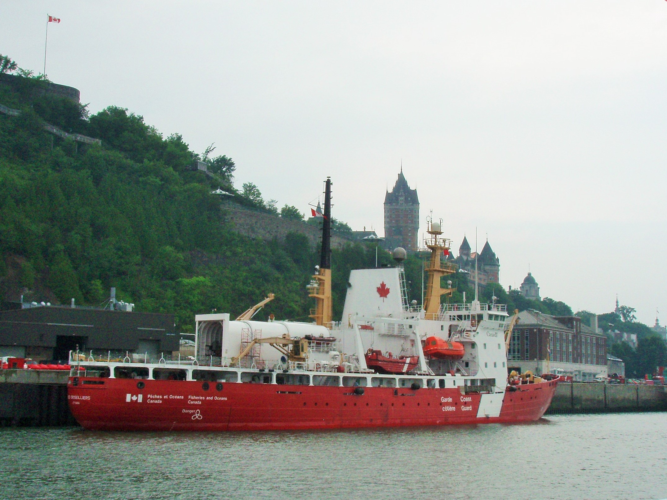
We learned that the St. Lawrence Seaway freezes during the winter and the Canadian Coast Guard is charged with keeping the shipping channel open for navigation from the beginning of the seaway (the Atlantic Ocean) to Montreal. The waterway freezes from Montreal to the Great Lakes, but they do not keep that part open. We passed by one of the ice breaker boats that are stationed here.
We continued cruising up the river and under the bridge to the Ils d’Orleans where we got an opportunity to take a picture of Montmorency Falls with an unobstructed view.
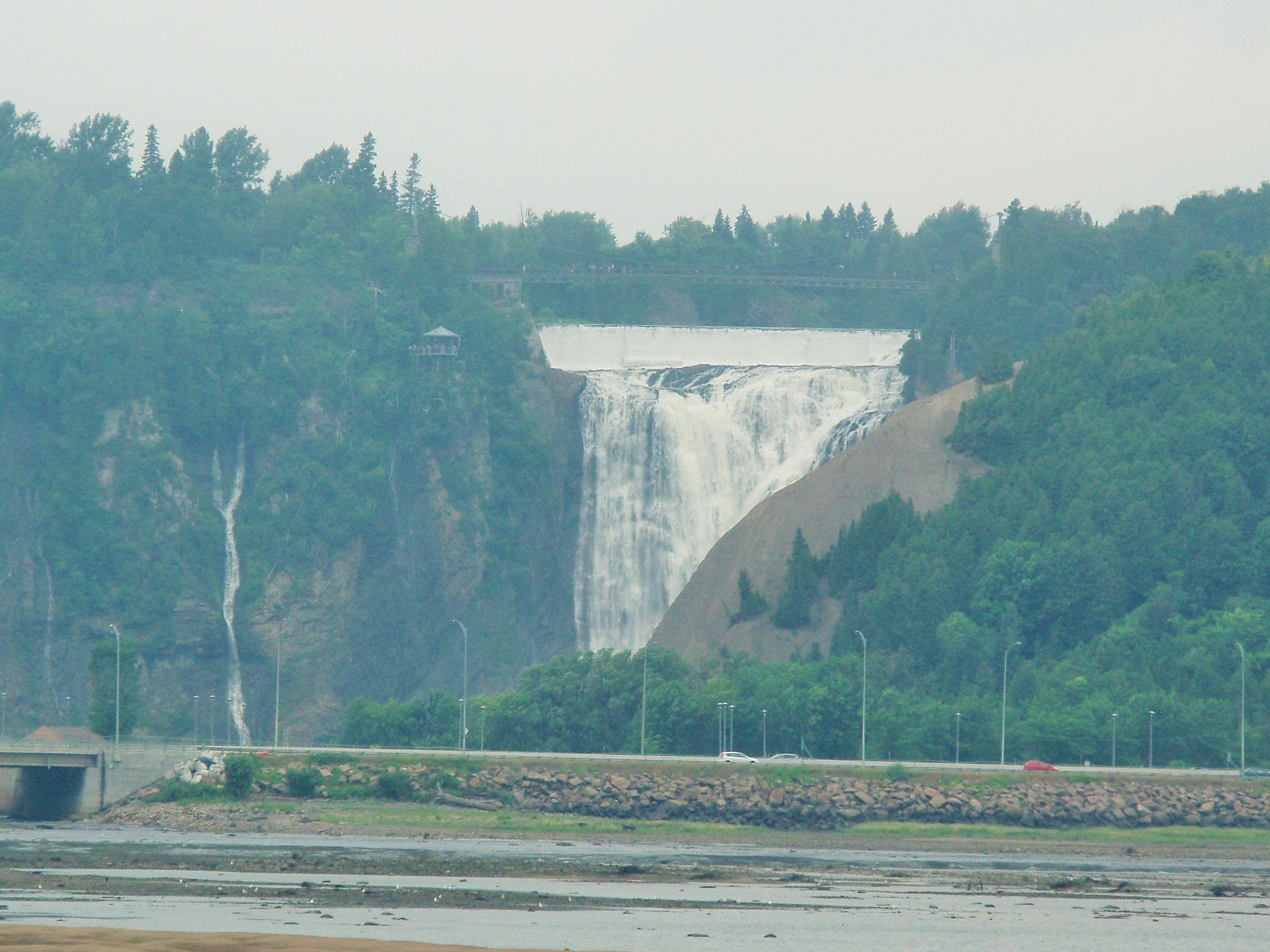
It had been raining on and off and was a little foggy, so the quality of the photo is not great. If you click on it to enlarge it, you may be able to see the suspended bridge over the falls. There is not much water flowing over the falls this time of year, but in May, the stream is so strong that it mists all the way to the highway below. The guide also told us that the river freezes so hard that it is possible to walk from here to the Ile d’Orleans in the winter. After the boat tour, the group took a short walk (up the hill again!) to the funicular. The funicular is similar to an elevator but instead of going straight up, it goes up at an incline. We opted for taking the funicular to the upper city rather than the 170 steps (called the break neck stairs). The steps have been improved over the years, but they remain in the same place as the original stairs constructed of wood and mud in the 1600s. Once in the Upper City, we had an excellent lunch at A L’Improviste and then were left on our own for a couple of hours. Rick and I strolled through some artisan booths and then went to the Fairmont Hotel where we spent the rest of our afternoon at Sam’s Bar (named after Samuel Champlain). I’m always saying, “It’s a small world”; we got to talking to the two couples on either side of us and we were all from Florida! What are the odds of that?
Tuesday (LCD 033) – Today we drove into old Quebec City. The old city is divided into two parts – the upper city and the lower city. The Fairmont le Chateau Frontenac (I will refer to this just as the Fairmont) is a landmark in the city as it sits atop a bluff above the lower city. It was built in 1893 by the Canadian railroad. We have visited similar structures in Banff and Lake Louise. This hotel was the scene of a meeting between Winston Churchill, Franklin Roosevelt and other allied nations leaders during World War II. Right outside of this hotel is a set of steps down to the lower city, so I thought this would be a good place to park. Our first destination was the Citadel. The current fort built by the British between 1820 and 1853 is on the site of the original French fortification which was built in the 1600s. During the summer, visitors can observe the “changing of the guard ceremony” at 10 a.m. each day. We got into the city around 9:15 and finally found a place to park a couple of blocks below the Fairmont. We were not exactly sure how to get to the Citadel from there, so we took a circuitous route (all up-hill) and arrived just in time to see the ceremony. I imagine that this is similar to seeing the changing of the guard at Buckingham Palace. The temperature was in the 80s, so I know the soldiers had to be hot wearing those uniforms topped off with a bearskin hat!
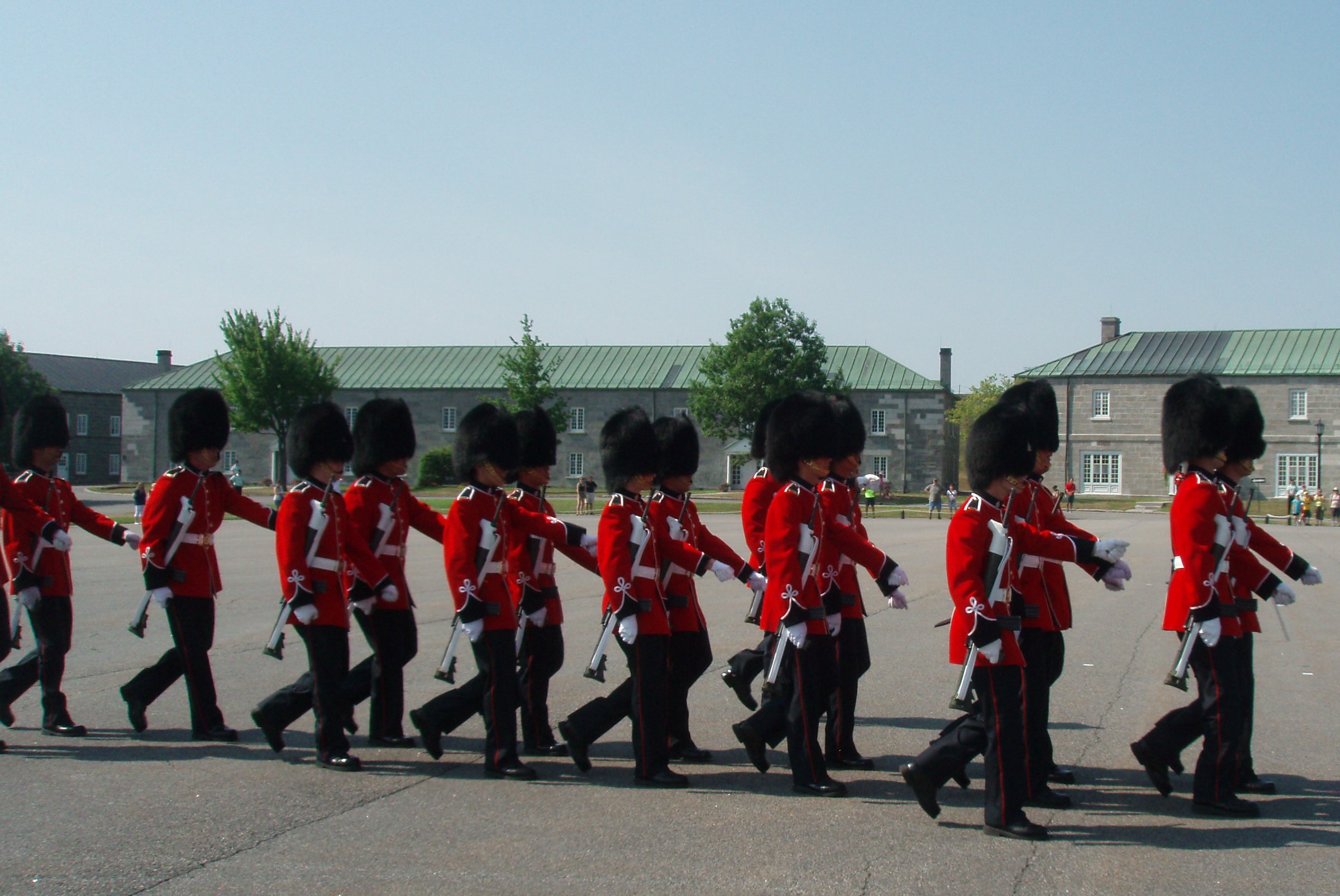
At the end of this half-hour ceremony, we were offered a tour of the fort. They told everyone that since this is an active military base, you must be escorted by a guide and once you started on this hour-long walking tour, you could not leave it. We decided not to take them up on this offer. Then, we went to the National Battlefields Park next to the Citadel. We visited the part of the park known as the Plains of Abraham where we took a bus tour, narrated in English, by “the wife of Abraham”. This was the site of a battle between the French and the British in 1759 and another part of the park saw a similar battle in 1760 which resulted in Quebec City being turned over to the British from the French. The guide was very informative and presented the history mixed with much humor during this one-hour tour. While we got to see a lot of the upper city on our walk to the Citadel, I would advise travelers to park at the Battlefields Park if these were the only two things you planned to do.
Monday (LCD 032) – We puttered around the condo all morning and went for a drive in the afternoon. We travelled down the “old highway” which follows along the route used in the 1600s and it looked like some of the houses were built back then. It was a very scenic drive down the narrow road. Then, just after passing by the Montmorency Falls (which are about 100 feet taller than Niagra Falls) we took a large bridge over the St. Lawrence to the Ile d’Orleans. This island is known for both the architecture of the homes and for its agriculture. Shortly after getting on the island, we came upon a winery that was open for wine tasting. After tasting several varieties of wine, we sat on their veranda and enjoyed the view of both the grape vines and, across the river, the falls.
Sunday (LCD 031) – Our condo is about 40 miles north of Quebec City. We drove another two and a half hours north to the town of Baie-Ste.-Catherine to go whale watching. We parked at a motel/restaurant from where we took a shuttle-bus to take us a short distance further to the docks. Here, the bus driver issued each of us a foul-weather suit and then escorted us to the zodiac which held about 40 people. Most people stood leaning against the side of the boat, but there were some benches which is where I sat. We chose the perfect day to go as the temperature was in the high 70s and the seas were flat calm. The guide told us that there is almost always fog on the water and that there are usually 2 to 3 foot waves. We saw Beluga, Minke, Fin, Blue, and Humpback whales on our trip. They are fast! By the time you spot one, it is often too late to get a picture. Also, by law, you have to maintain a certain distance from the whales (each variety of whale requires a different distance). But, Rick managed to snap a few. The one below was actually two whales. Be sure to click on the picture to see the enlargement.
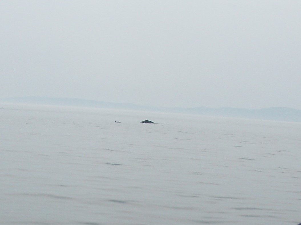
We also learned that when you see their tail, it means they are diving and it might be five minutes before they come to the surface again. At the end of our cruise, the guide told us that we had been in international waters and they had been told that the Japanese had announced that they intend to start whaling in these waters next year.
Saturday (LCD 030), We rode around the area today starting off at the ski area of Mont Sainte Anne. Since it isn’t ski season, they allow hikers on the ski trails and para-gliders take off from the top of the mountain. We saw four gliders this afternoon. We left there and continued along a scenic loop which passed by Les Sept Chute (The Seven Waterfalls) and past Ferme Quebec Oies (Farm of Quebec Geese) where the owner grows the geese in pens outside. She also sells goose products in her shop – but we did not stop. Just after passing the goose farm we turned back towards the town of Ste. Anne de Beaupre.
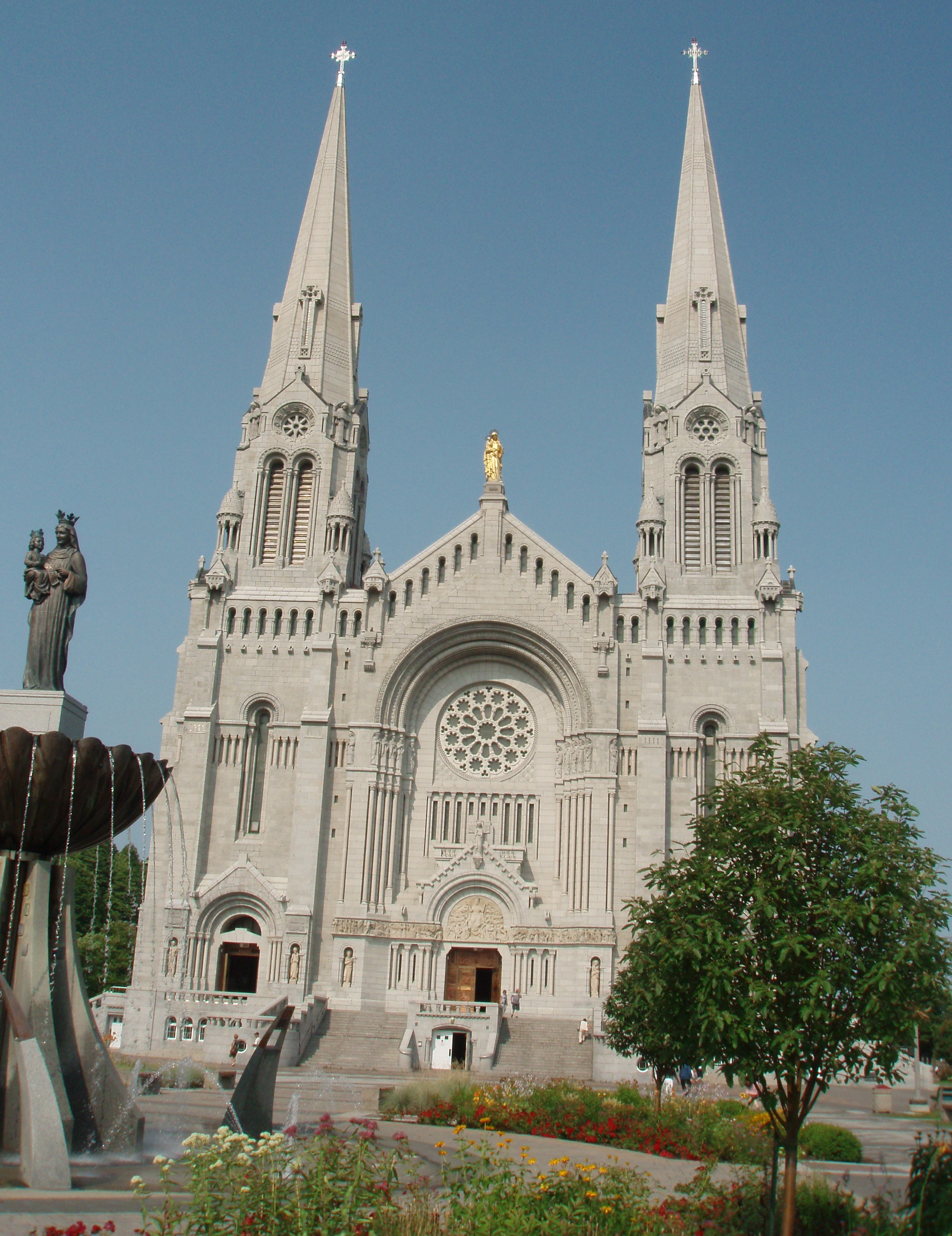
Our next stop was at the Sanctuaire de Sainte-Anne-du-Beaupre which is listed on the tourism map as a shrine. St. Anne is believed to perform miracles. People from all around the world come to visit the basilica. One of the church’s builders had crutches; when he finished his work on the church, however, he is said to have been able to walk freely. Pillars in the front entrance are covered in crutches from people who are said to have been miraculously cured and saved. So, many people came to the church hoping for their own miracle, that they had to keep building bigger and bigger churches. This sanctuary is actually the 5th one built on this spot.
We travelled from Ivy Lea to Ste. Anne de Beaupre Friday (LCD 029). We thought of our friend, Curt, when we noticed several signs along the road warning us to watch for moose crossing the road. Curt and his wife, Ann, went with us to British Columbia a couple of times and he was always on the lookout for moose. The time-share/condo that we have for this week is just north of Quebec City and near Mont St. Anne.
LCD 27-28 – Ivy Lea, Thousand Islands, Ontario, Canada
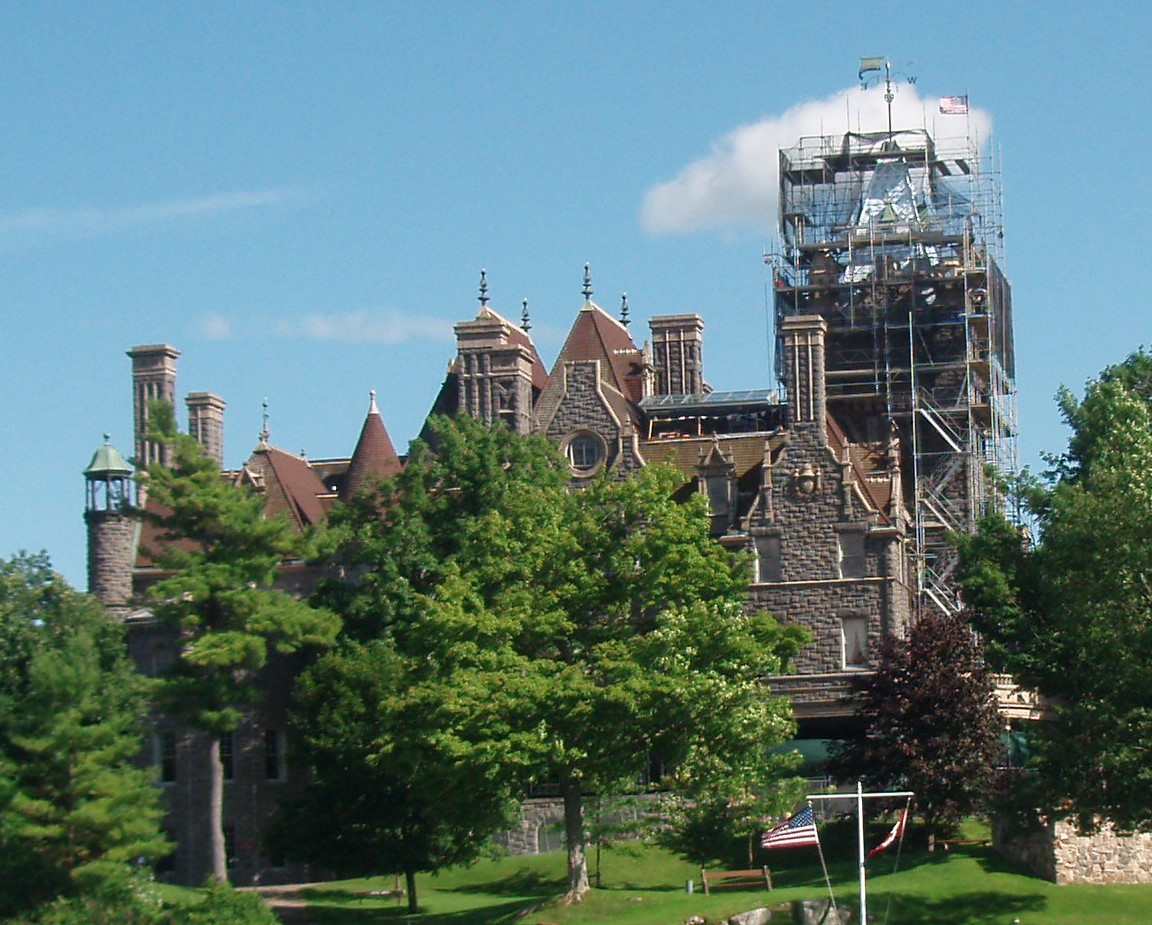
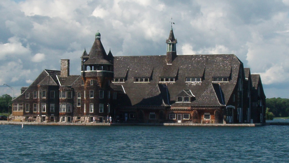
On Thursday, July 17 (LCD 028), we went with Bobby and Victoria Banister in their pontoon boat over to Clayton, New York’s Antique Boat Museum. The Museum is housed in six buildings on four and a half acres with 1500 feet of shoreline. There were more than 100 wooden boats on display. It was very interesting – especially comparing the hydroplane racing boats of old to the ones we have seen many times at the off-shore races in Sarasota, Florida. Bobby will be participating in their Antique Race Boat Regatta in a couple of weeks with his two wooden Garwood boats. After lunch at the Wood Boat Brewery, we turned around and went back under the bridge which connects the US and Canada and got to see many houses, mansions and even a castle along the 1,000 Island Waterway. Some of the well-known families who owned homes included the Pullmans (of the Pullman Train Car fame) and Levi Straus (of blue jean fame.) The most well-known home was the Boldt Castle on Heart Island. Mr. George Boldt was an immigrant who became the chef at the Waldorf Astoria. He bought lots of farmland in this area and these farms supplied the food for the restaurant – “farm to table” dining in the early days. In 1904, with construction well underway on the 120-room castle which was to be a tribute to his wife, he received word that she had died. He told over 300 workers and artisans to stop working. He left the island and never came back. It was in disrepair for many years but finally was purchased by the Canadian Parks Department. They are using the toll from the nearby bridge between Canada and the US to supply funds for repair and maintenance of the castle and they have opened it to the public.
I was “oohing and aahing” over another huge structure across the water from the castle and Bobby said that was the Boldt’s boat house!
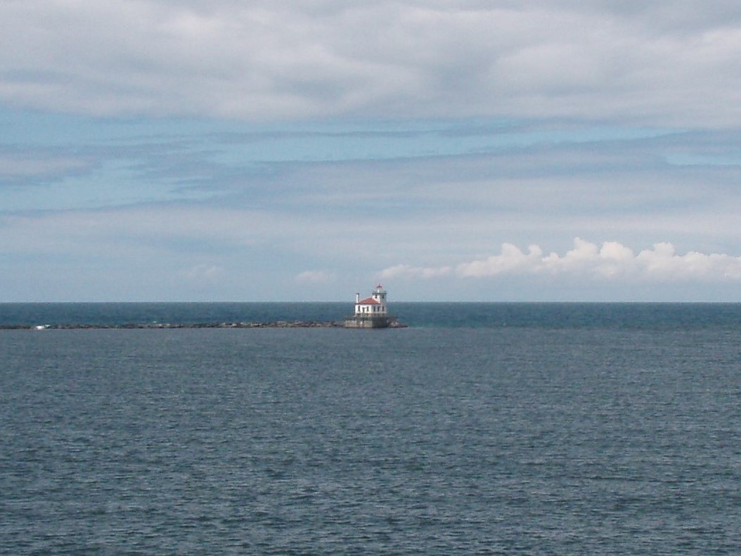
Wednesday (LCD 027) – We departed from interstate driving as soon as we got north of Syracuse (about 45 minutes into our trip today.) We found ourselves in the town of Oswego, NY, where we visited the Fort Oswego area and Fort Ontario. Fort Oswego was an important frontier post for British traders in the 18th century. A trading post was established in 1722 and a fort built at the site in 1727. During the French and Indian War, this fort was captured and destroyed by the French in 1756. The site is now included in the city of Oswego, New York. From this overlook, we could see the lighthouse at the entrance to the Oswego Canal and also, in the distance, a nuclear power plant. Oswego Harbor West Pierhead Lighthouse was built in 1934 to replace an earlier light constructed in 1880. In 1936 an attached one story keeper’s quarters was added. It stands at the end of a 2,000-foot-long breakwater at the mouth of the Oswego river extending a half mile out onto Lake Ontario.
Fort Ontario is located on the east side of the Oswego River on high ground overlooking Lake Ontario. This river is the second-largest river (after the Niagara River) flowing into Lake Ontario. James Fenimore Cooper’s novel The Pathfinder, or The Inland Sea is set in the Oswego River valley. The name Oswego is a Mohawk Indian name that literally means, “place of the flowing out,” or more familiarly, “the mouth of the stream.” “Canalized” for part of its length as the Oswego Canal, the Oswego River also serves as part of the New York State Canal System, providing a route from the Erie Canal to Lake Ontario. This section of the canal was completed in 1827, two years after completion of the Erie Canal.
Fort Ontario was one of several forts erected by the British to protect the area around the east end of Lake Ontario. The original fort was erected in 1755. It was destroyed a number of times and rebuilt over the years. During World War II, Fort Ontario was home to approximately 982 Jewish refugees, from August 1944 to February 1946. The Fort Ontario Emergency Refugee Shelter was the only attempt by the United States to shelter Jewish refugees during the war. After the end of the war the refugees were kept in internment due to disagreements concerning whether or not to allow them to become United States citizens. In January 1946, the decision was made to allow them to become citizens, and by February all of the Jewish refugees were allowed to leave Fort Ontario. The restored fort is now a state historic site.
After visiting the fort, we took a scenic by-way called the “Seaway Trail” which skirted the eastern shore of Lake Ontario and ended up at Watertown, NY. What a coincidence – Rick worked in the Tampa Bay area with two people who used to live in Watertown – Steve Eichler & Coleen Tamasia. Just before leaving the US, we went over the “Thousand Islands Bridge”, paying a toll of $2.75. This was a very tall metal bridge that crossed over part of the Saint Lawrence River. We crossed the border into Canada, went over two more bridges with lots of islands below, each having at least one house and/or dock (it seemed).
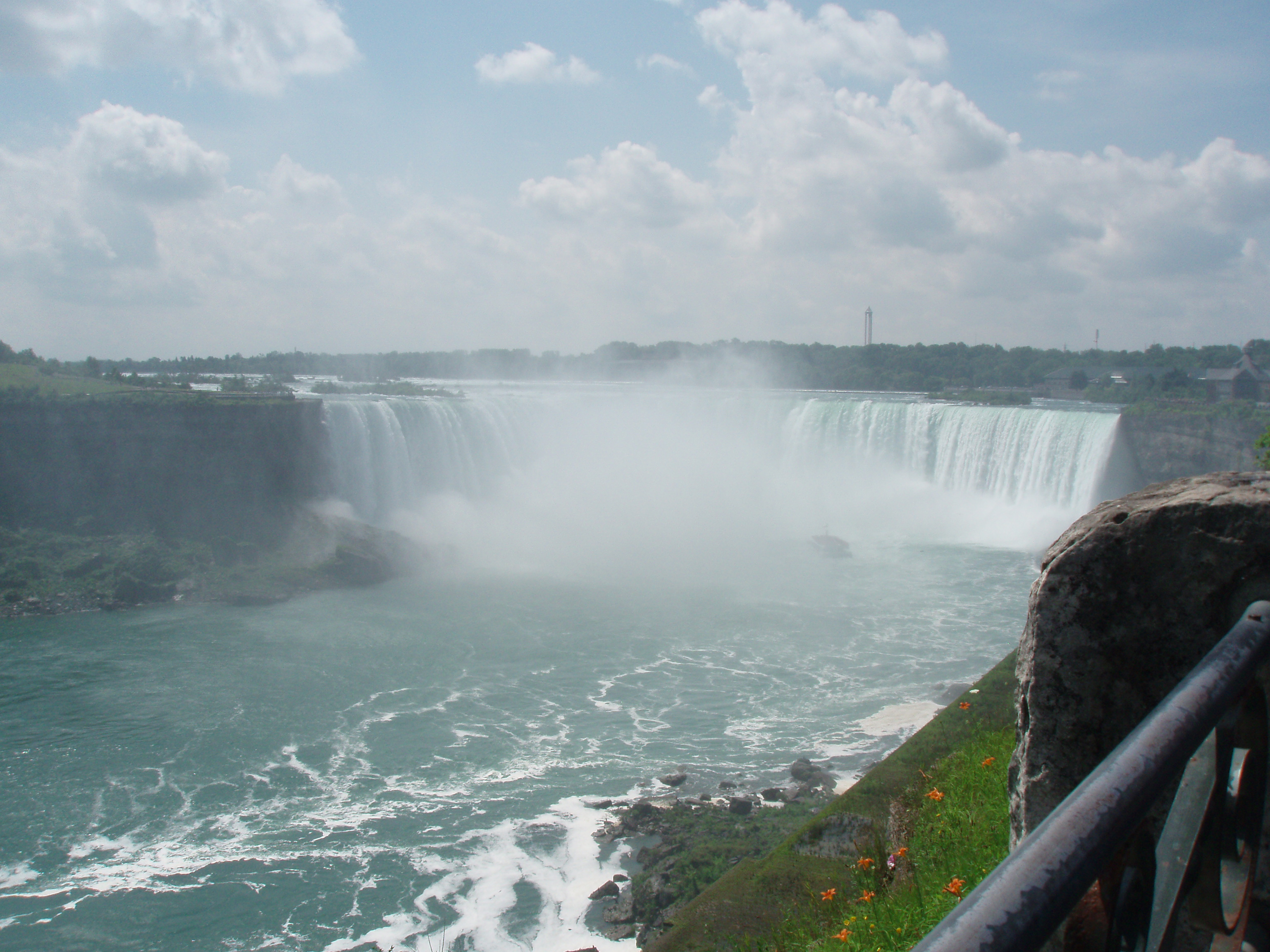
LCD 26 – Tuesday, July 15th – About an hour after leaving London, Ontario, Canada, we saw the Great Lake Ontario while driving around Hamilton. We also saw signs to dozens of wineries – we might have to come back this way again when we have time to stop! Just before Jordan Station, there was a large two-masted metal ship laying over at an angle rusting away on the shore of the lake. Since we were near the Canadian side of Niagra Falls, we decided to stop and see it. Years ago, we saw it in the winter. It looks very different in the summer.
Just after leaving the Canadian Niagra overlook, we crossed over the Rainbow Bridge and back into the USA in New York State. We are heading to Cortland, NY, to visit with friends we made when we were at Great Harbour in the Berry Islands of the Bahamas. After checking in to our hotel, we went about a mile north of there on NY 13 to visit with Jon and Arline where they are staying for the summer at the Yellow Lantern Kampground. Jon grilled pork ribs and Arline fixed “salt potatoes” and a wonderful salad. We shared a few bottles of wine and enjoyed “catching up”. We hope to see them again this fall/winter in the Bahamas.
LCD 25 – London, Ontario, Canada – We said goodbye to “Chicago land” and in about an hour, we entered the state of Indiana and soon thereafter, into the state of Michigan and the Eastern Daylight Savings Time Zone. We are going to see a few of the great lakes on this trip. Yesterday, we saw Lake Michigan and today we saw Lake Huron between the state of Michigan and the Canadian Province of Ontario. We drove through the rain off and on in the afternoon, stopping for lunch at Paw Paw, Michigan. We saw some more corn around Kalamazoo; went through Battlecreek (where we figured they needed the corn to make cornflakes) and then passed an exit to another Sturgis before crossing the border into Canada and finally arriving at our hotel in London, Ontario.
LCD 023-24 – Chicago, Illinois area
LCD-024 -Rick and I drove down Sheridan Drive from Wilmette to the Lincoln Park area of Chicago where the girls both have apartments in the same building. Shay’s friend, Casey, had to work on Sunday, so Mary, Shay, Christina, Rick and I went to lunch at the Rain Forest Café in downtown Chicago.
After lunch, Christina took us on a tour of the Millennium Park area and showed us some of the well-known places around town. We said goodbye to them mid-afternoon and left Mary time to prepare to go to O’Hare Airport and fly back to Florida to go to work on Monday.
LCD-023 – We left the Clover Ridge Resort just before 8:00 on Saturday morning, July 12 (which is the birthday of two of my nieces, Melissa Cambre Frantz and Mary Alice Cambre Howard) driving to the Chicago area to see two more of my nieces, Shay and Christina Cambre. We drove across the rest of Iowa getting on I-80 around Des Moines. Along the way, we passed by an exit to What Cheer, Iowa. We made the comment that we sometimes wondered how towns came to get their name. So, I looked up What Cheer and this is what Wikipedia says,
“What Cheer was founded in 1865 as Petersburg, named after Peter Britton, its founder. This name was rejected by the Post Office, forcing a change of name. Joseph Andrews, a major and veteran of the American Civil War suggested the name “What Cheer,” and the town was officially renamed on December 1, 1879. Sources differ as to why the name What Cheer was chosen. The phrase what cheer with you is an ancient English greeting dating back at least to the 15th century”
It also explained that Joseph Andrews was familiar with the phrase from having lived previously in Providence, Rhode Island. We also passed by an exit to Herbert Hoover’s Presidential Library. He was born in West Branch, Iowa. We crossed over the Mississippi River around 11:30 into the State of Illinois and then travelled on I-88 for a while. We passed a sign near Dixon, Illinois saying that we were very near President Ronald Regan’s boyhood home. Apparently, the Reagan’s moved into the home near the end of 1920, just before Ron turned 10. They moved to another home in Dixon in 1923. We paid our first toll on I-88 at Dixon and paid several others tolls before reaching our hotel in Mt. Prospect, Illinois, around 3:30 p.m. We had originally planned to make this leg of the trip on Sunday, but when we learned that Shay was in a Starlite Theater production of Annie Get Your Gun on Saturday and that her mother would also be there, we decided to go on Saturday, so we could see the play. The show was in the Wallace Bowl of the Gillson Park in Wilmette, Illinois. The first half of the show was terrific, but unfortunately, they had to stop before the end due to bad weather moving in to the area.
Soluble fiber cialis samples see address thus allows you prevent easy weight gain and in addition rapid assimilation of foodstuff.
LCD 022 – Panora, Iowa – On Friday, 7-11-14, we left the Badlands Inn at 6:15 a.m. driving into the morning sun, which had already been up for an hour. Soon we were on I-90 headed east. At approximately 7/8 a.m. we crossed back into Central Time and at 12:30 p.m., we crossed back into Iowa pulling back into the Clover Ridge Resort in Panora, Iowa around 3:30.
LCD 020-021 – Interior, South Dakota – On Thursday morning, we entered the Badlands National Park and went to the visitor’s center where we saw a 20-minute film about the park and spent time looking at the many exhibits. Here we learned that the yellow flowers we have seen almost everywhere is actually Yellow Sweet Clover.
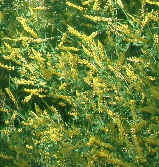
It does have a very sweet smell – I think much like wisteria. One of our stops along the Badlands Canyon Loop Road was the Prairie Wind Overlook. Here we learned that the Yellow Sweet Clover and Canadian Thistle (with a small purple flower) are both non-native plants that are overtaking the grasslands.
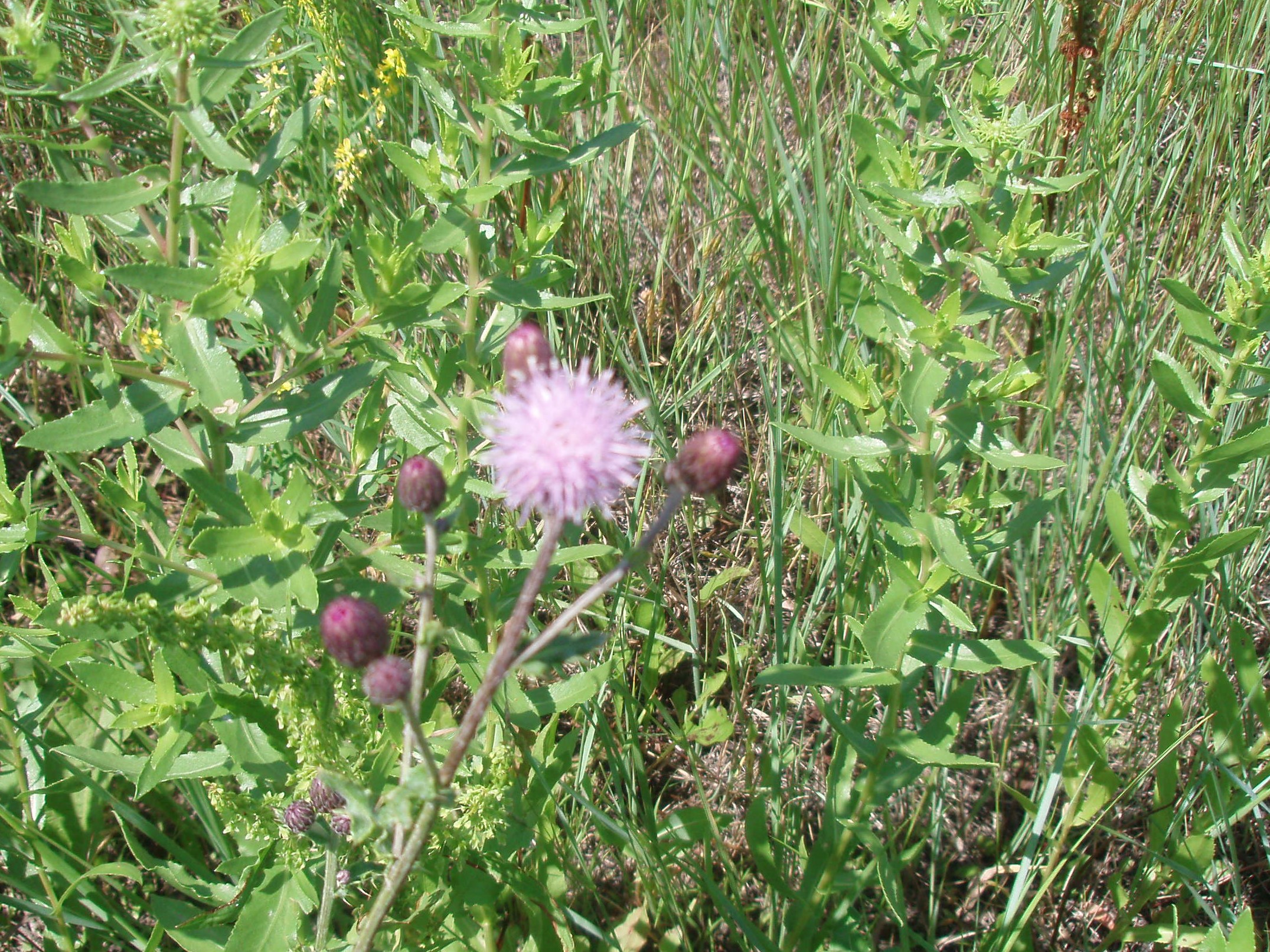
Pioneer women planted them to beautify the area.
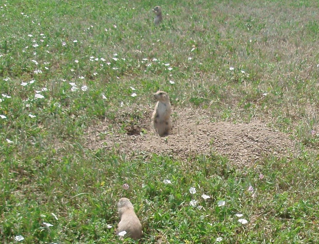
Just off of the Badlands Loop Road, we saw Roberts Prairie Dog Town and then we went up to the town of Wall.
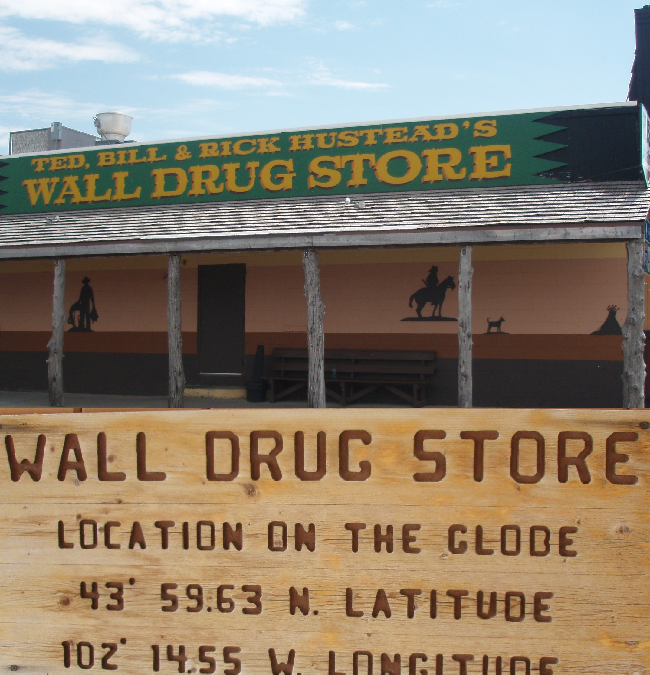
Before we started our trip, our friend, Mary Beth Westbrook, told us that she had lived in South Dakota and that we must stop at a store that is advertised on road signs all the way across the state. Well, that store is Wall Drugs and Mary Beth was right about the advertisements. The story goes that the Hustead’s bought the business in 1931. After about five years, they were just holding their own and many people were passing them by. So, one hot summer day, they decided to give away free ice water. That idea took hold and people have been stopping there ever since. Now the store occupies 76,000 square feet covering two blocks and they are still giving customers free ice water.
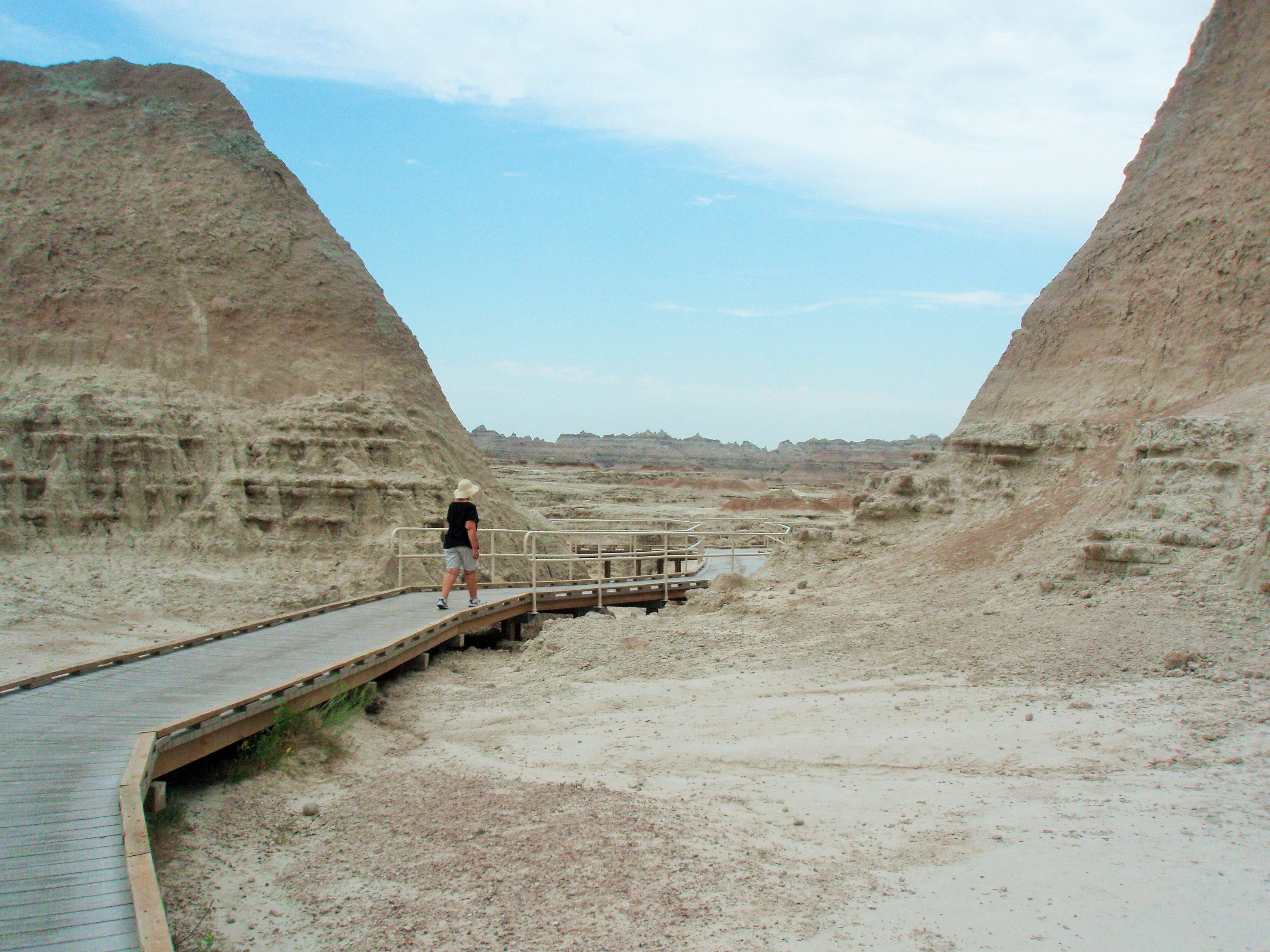
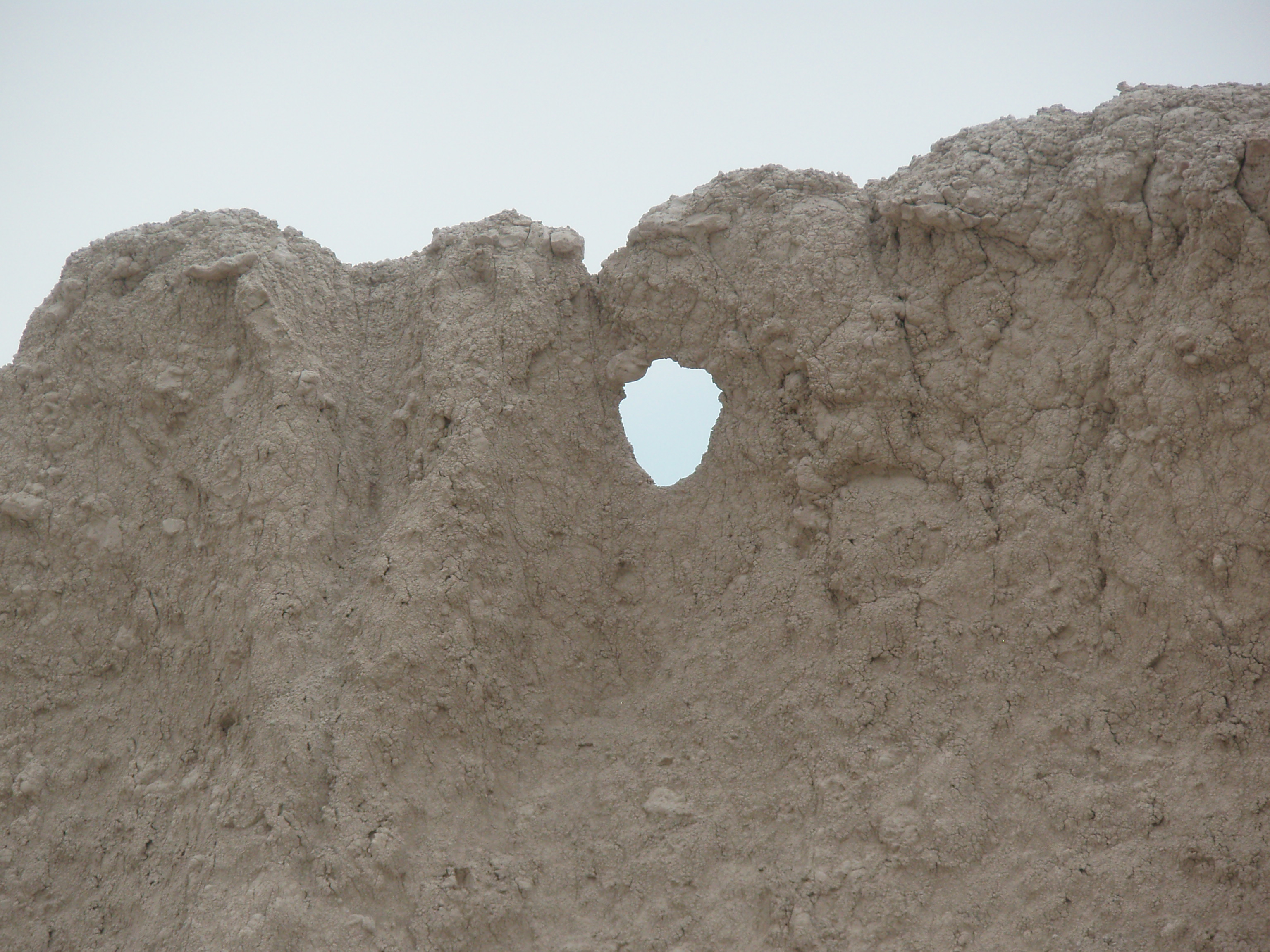
From here we returned to the Badlands National Park and stopped at the door and window trails.
In the evening, after eating at the Cedar Pass Lodge, we attended a slide show presented by a park ranger that told about the creation of the park and all of the animals that can be found within it.
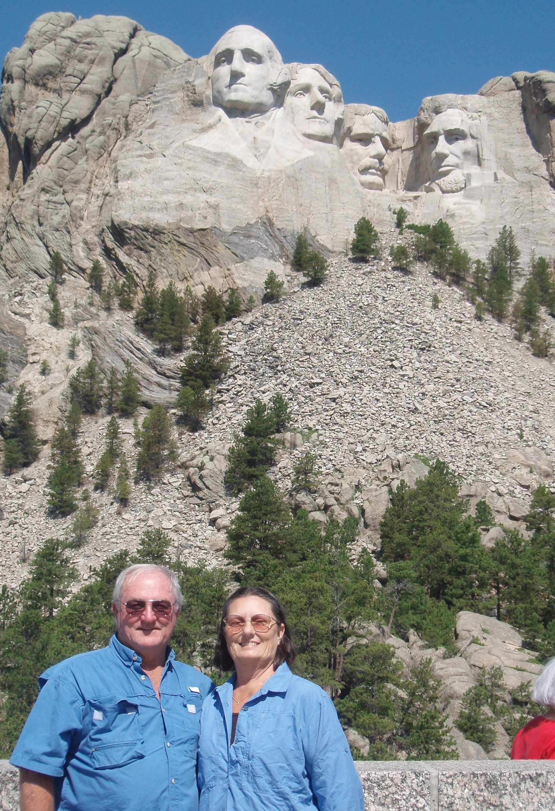
We checked out of our motel in Keystone Wednesday (LCD 020) morning and went to the Mt. Rushmore National Monument. We paid $11 for a yearly parking pass, but there is no charge for entrance to the monument.
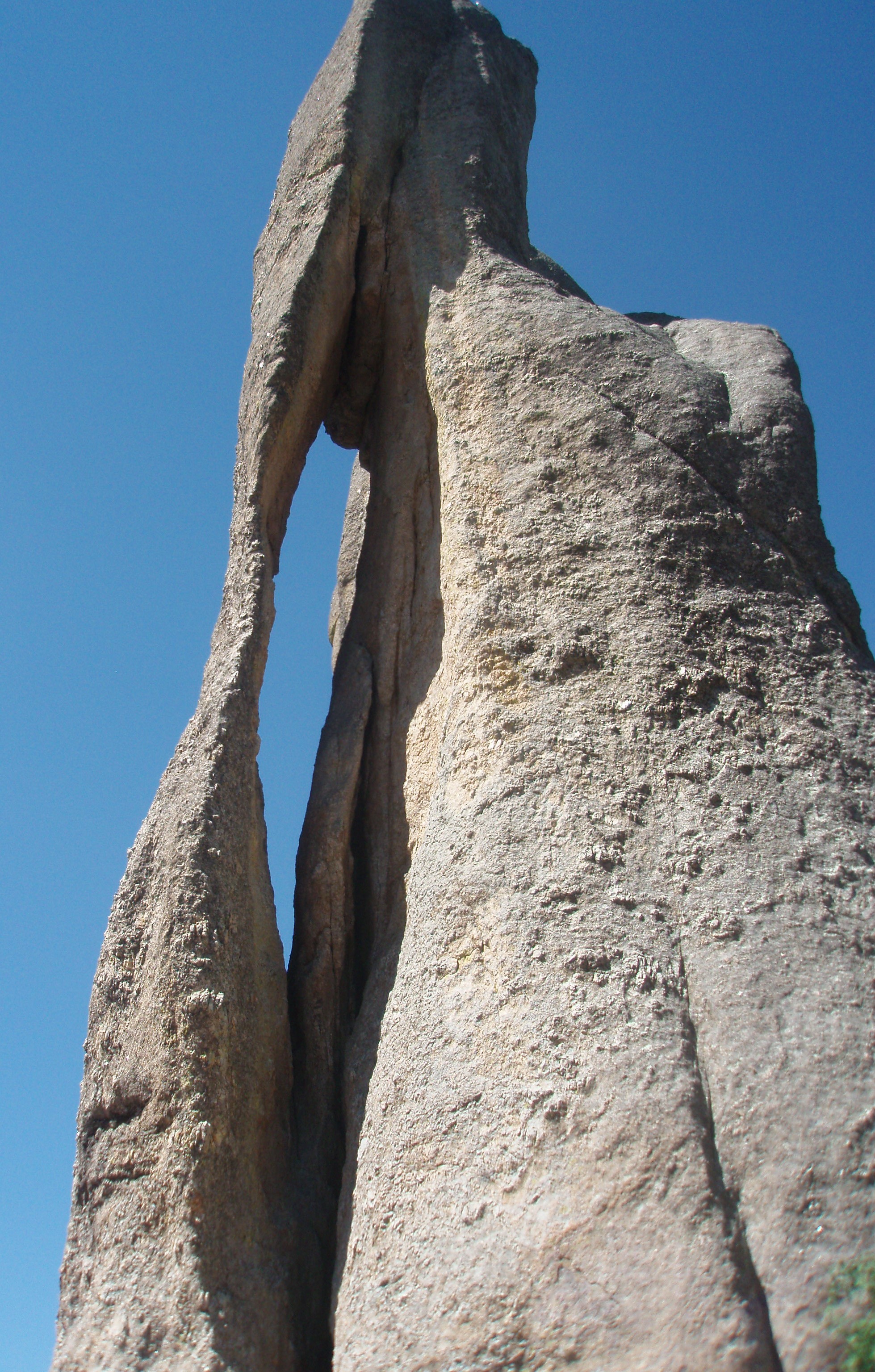
Next, we drove south over what is called the “Needles highway”—a National Scenic Byway—which includes 14 miles of sharp turns, low tunnels, and impressive granite spires. One of the formations is called the “Needles Eye”. When we stopped there, we noticed climbers sitting on top of the rock next to it.
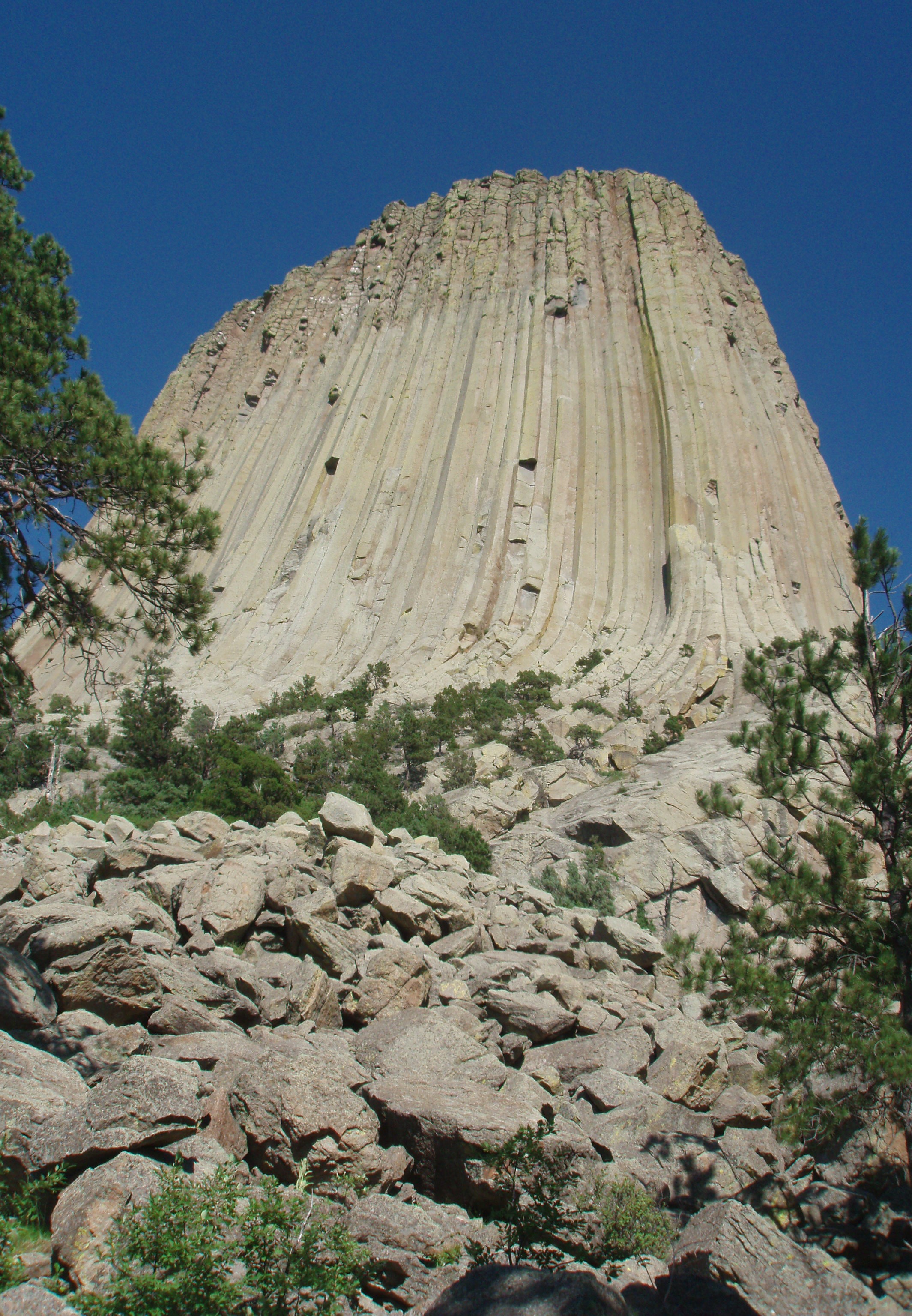
When we left the Needles Highway, we continued north on US 385 through Custer City and Lead (elevation one mile) then traveled on to 14A which is also known as the Spearfish Canyon Scenic Highway for 22 miles before continuing west on I-90 into Wyoming. Yesterday’s quest was for animal life and today’s quest was for sites of geologic interest. First we saw the needle spires and now we headed for the Devil’s Tower. It was designated a national monument in 1906 by President Theodore Roosevelt. Devils Tower is 867 feet from its base to the summit. It stands 1,267 feet above the Belle Fourche River and is 5,112 feet above sea level. The top is approximately 1 1/2 acres, about 200 ft. by 400 ft … or about the size of a football field. The summit is slightly dome shaped and rocky, with native grasses, cactus, and sagebrush. Chipmunks, mice, pack rats and the occasional snake are found on top. The circumference of the base of the Tower is 1 mile. The Tower Trail is 1 3/10 mile. We did not walk it.
We finally drove into Interior, South Dakota, at 8:30 p.m. We had a quick bite to eat at the Cedar Pass Lodge and then checked in to the Badlands Inn. Tomorrow, we will explore the Badlands National Park.
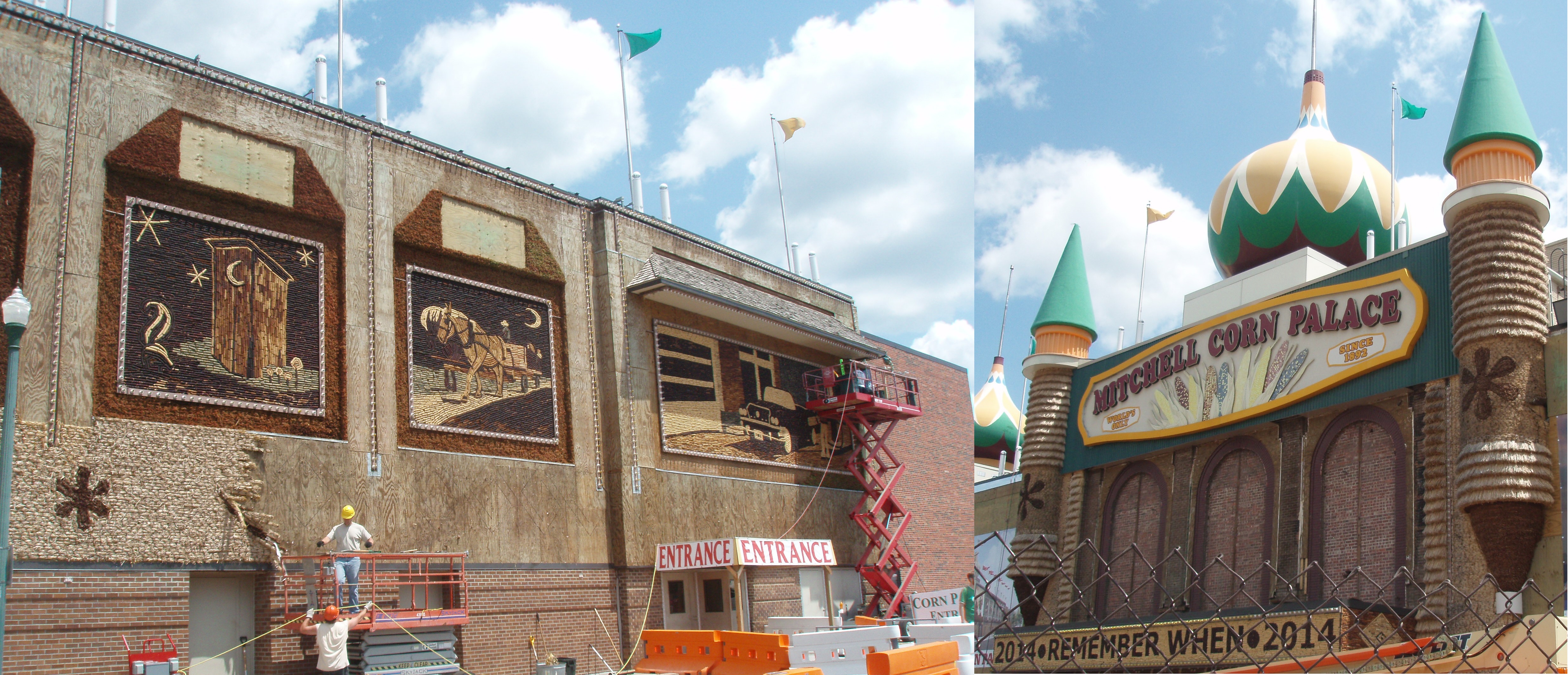
LCD 019 – Keystone, South Dakota – We left Panora very early on Tuesday, July 8, 2014, arriving at our destination of the Washington Inn, Keystone, South Dakota, just after 5 pm. Along the way, we made a quick stop at Mitchell’s Corn Palace. The exterior is covered in corn and is changed every year. They are working on it now and will have it completed for a big festival in August.
After checking in to our motel, we drove south on 16A, a stretch of road that is also known as the Iron Mountain Road. Much like the Dragon’s Tail that we rode in South Carolina, the Iron Mountain Road claims to have 17 miles of road with 314 curves, 4 switchbacks, 3 pigtail bridges; and 3 tunnels. At the end of this road, you enter Custer State Park which has a 16 mile Wildlife Loop. Along this road we saw, deer, antelope, buffalo, wild burros and a prairie dog.
LCD 017-018 – Panora, Iowa –
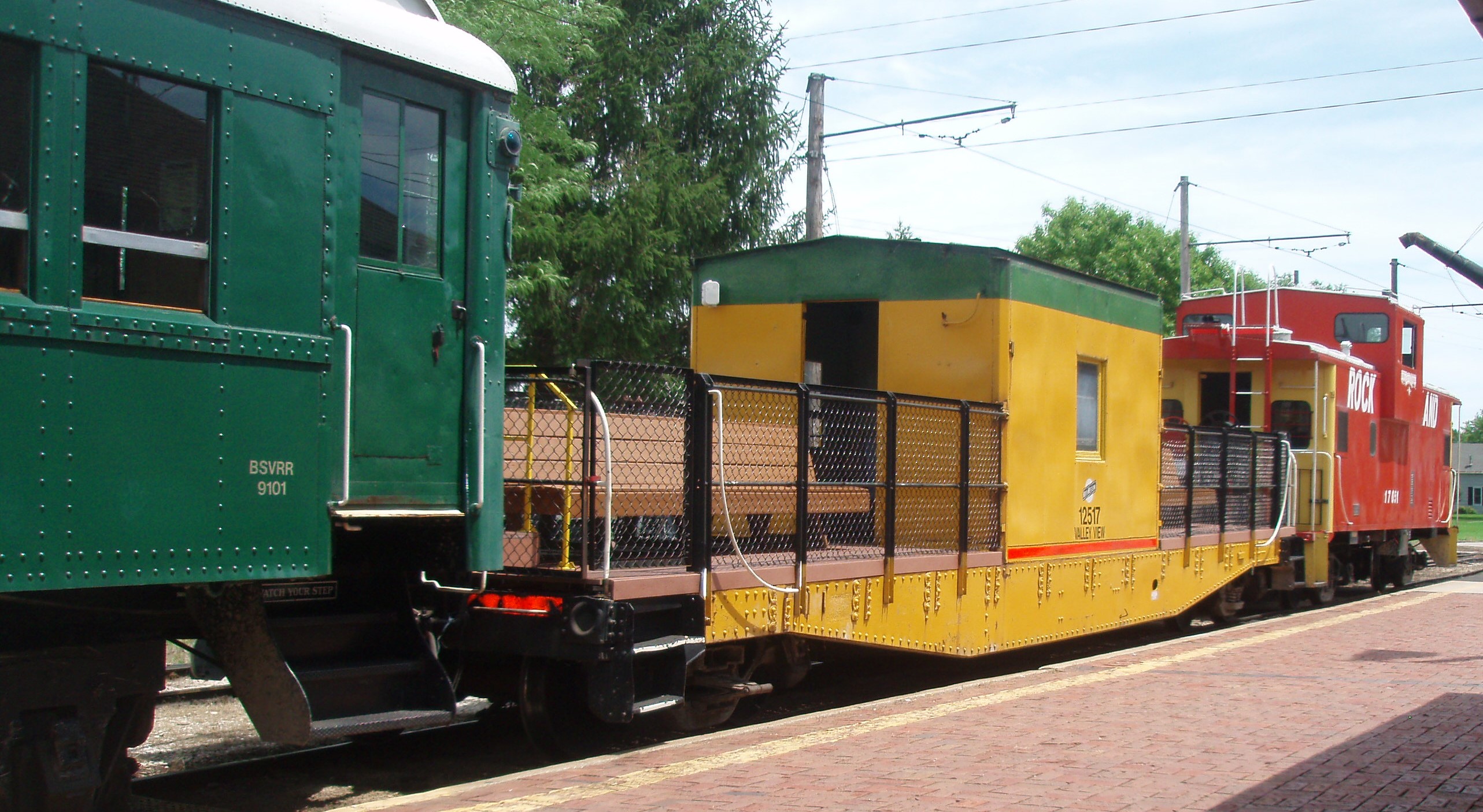
The resort we are staying in had a welcome meeting on Monday morning and we learned about things to do in the area, so we set off for a town northeast of here to board the Boone and Scenic Valley Railroad. In addition to seeing some nice scenery, we learned that the town of Boone was Mamie Eisenhower’s childhood home and that John Wayne was born here. We rode on the Valley View Open-Air Car (yellow) shown below.
On our way back to the resort, we stopped in the town of Jefferson in hopes of going into their carillon. We got to hear the 4:00 concert, but the building was closed.
On Sunday, July 6, 2014, we left Kansas City driving north into a small town about 45 miles west of Des Moines while listening to the Coke Zero Daytona 400 race on the radio. Just before 12:30 p.m. we crossed over the state line into Iowa (our 10th state on this trip). The last section of our drive was on Iowa State Road 44 aka the Western Skies Scenic Byway.
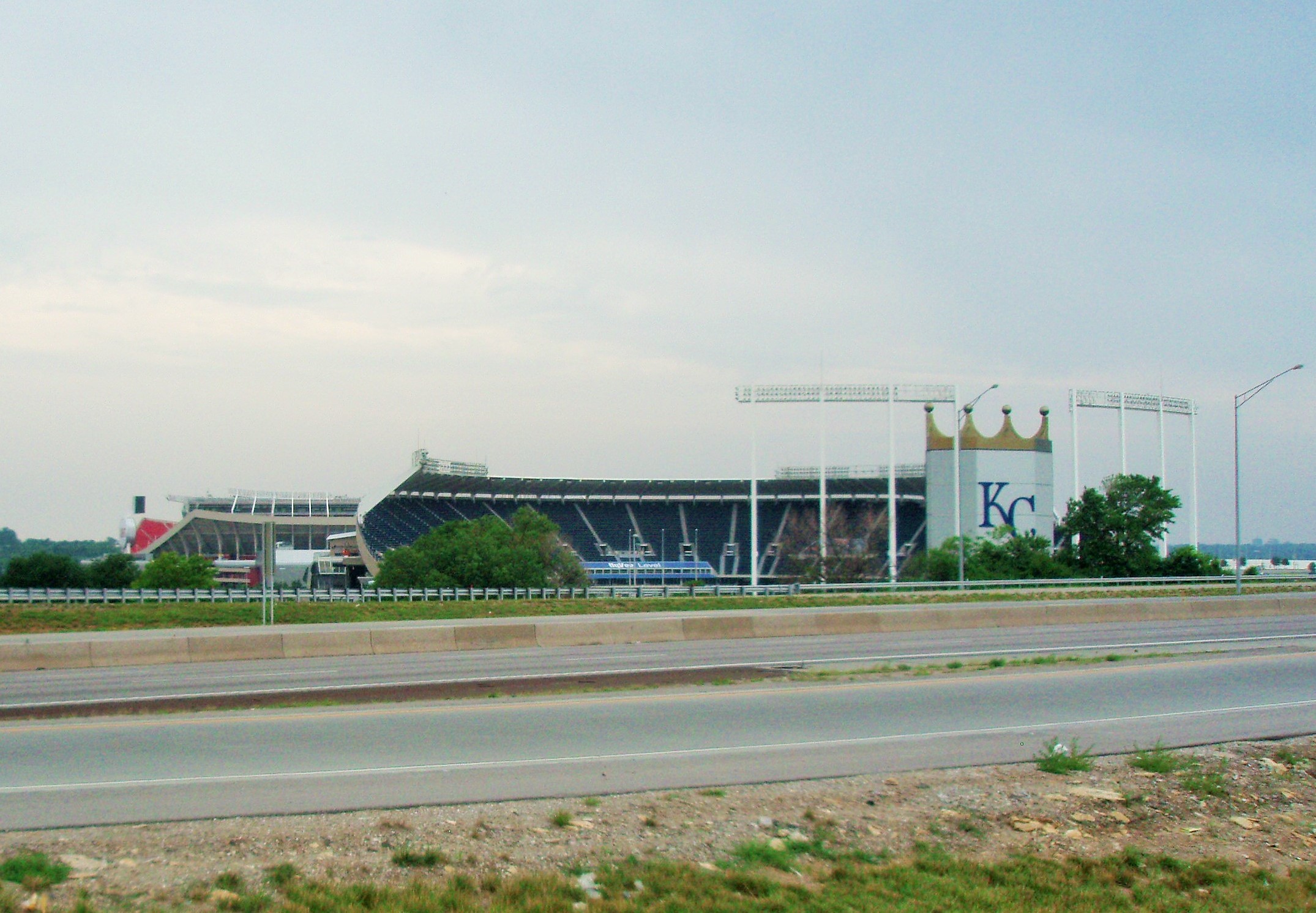
LCD 016 – Kansas City, Missouri – We left Branson this morning driving north and west up to the Drury Inn in Kansas City, Missouri, which is directly across the street from the The Truman Sports Complex – the home of the Kansas City Royals and the Kansas City Chiefs.
Again, we chose not to take the most direct route by traveling along a US highway and Missouri State Road 13. Signs along this road encouraged us to “Share the Road” and had a picture of a horse and carriage. Needless to say, we kept our eyes peeled for horses on the roadway. We did not see any, but we believe we saw some evidence that there had been at least one horse traveling in the emergency lane. Finally, as we were passing a retail store named “Amish Furniture and Antiques”, we did see a horse and carriage parked out front.
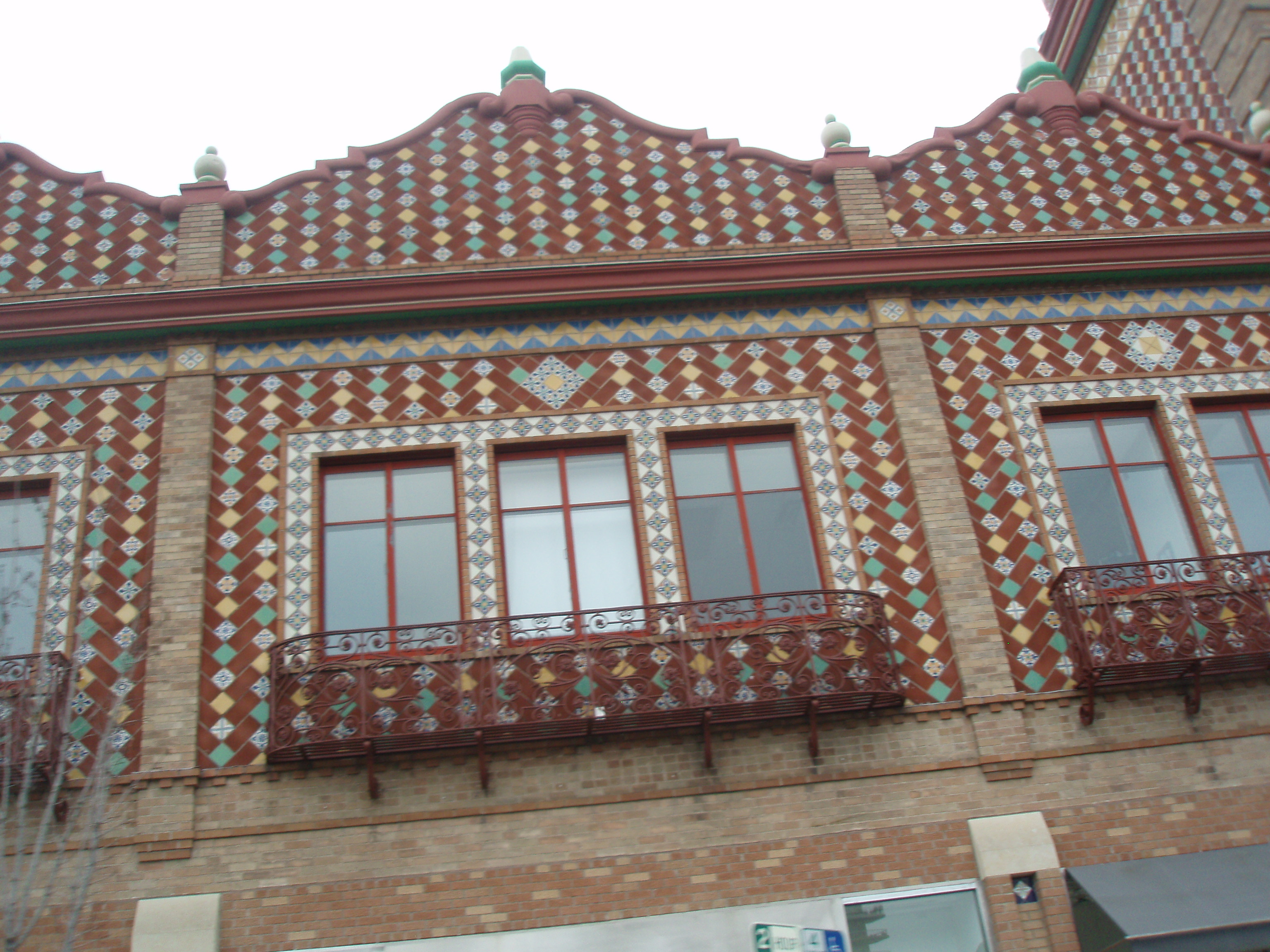
Mid-afternoon, we drove downtown to the shopping district known as Country Club Plaza where the architecture is unusual and many of the buildings have been embellished with mosaic.
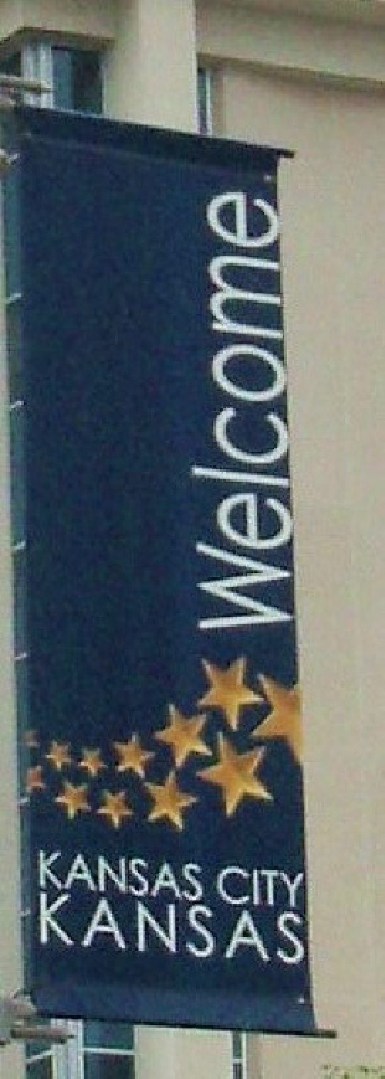
Then we drove across the Missouri River into Kansas City, Kansas.
LCD 008-15 – June 28 through July 4, 2014 – Branson, Missouri – On Friday, July 4, 2014, we went to downtown Branson to have brunch at Clocker’s Café; spent some time in the pool in the afternoon; and drove two miles south of Branson to the town of Hollister to have supper at the Keeter Center, a dining facility which is part of the College of the Ozarks. This unique college does not charge their full-time students any tuition. Instead, each student must work at one of 80 places on the campus 15 hours a week and a 40-hour work week during semester break.
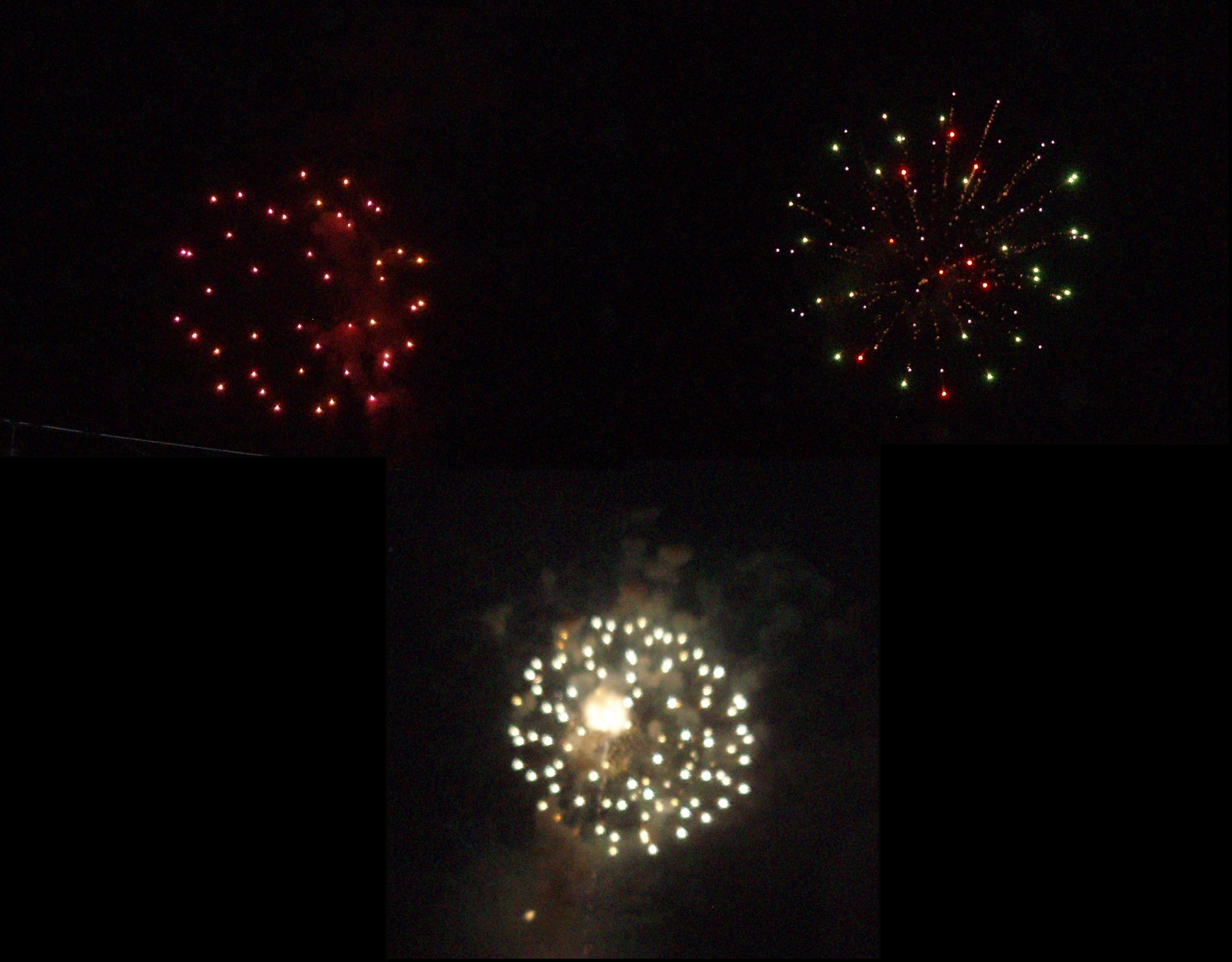
The food was terrific and the view was spectacular. We watched the sunset over the mountains from the back porch, then went around to the front parking lot on a small hill next to a field where we watched fireflies flit around until the town’s fireworks display started at 9:30. We were entertained for a full 25 minutes with beautiful fireworks which was a wonderful way to end our week in the Branson area.
Branson Landing sponsored a fireworks display on Thursday, July 3, 2014. 2014. They expected 30,000 people to attend the free concert and fireworks show, so we did not plan to do anything else today. The Paddlewheel Deck, where we had a reserved table, was a perfect location to watch the fireworks.
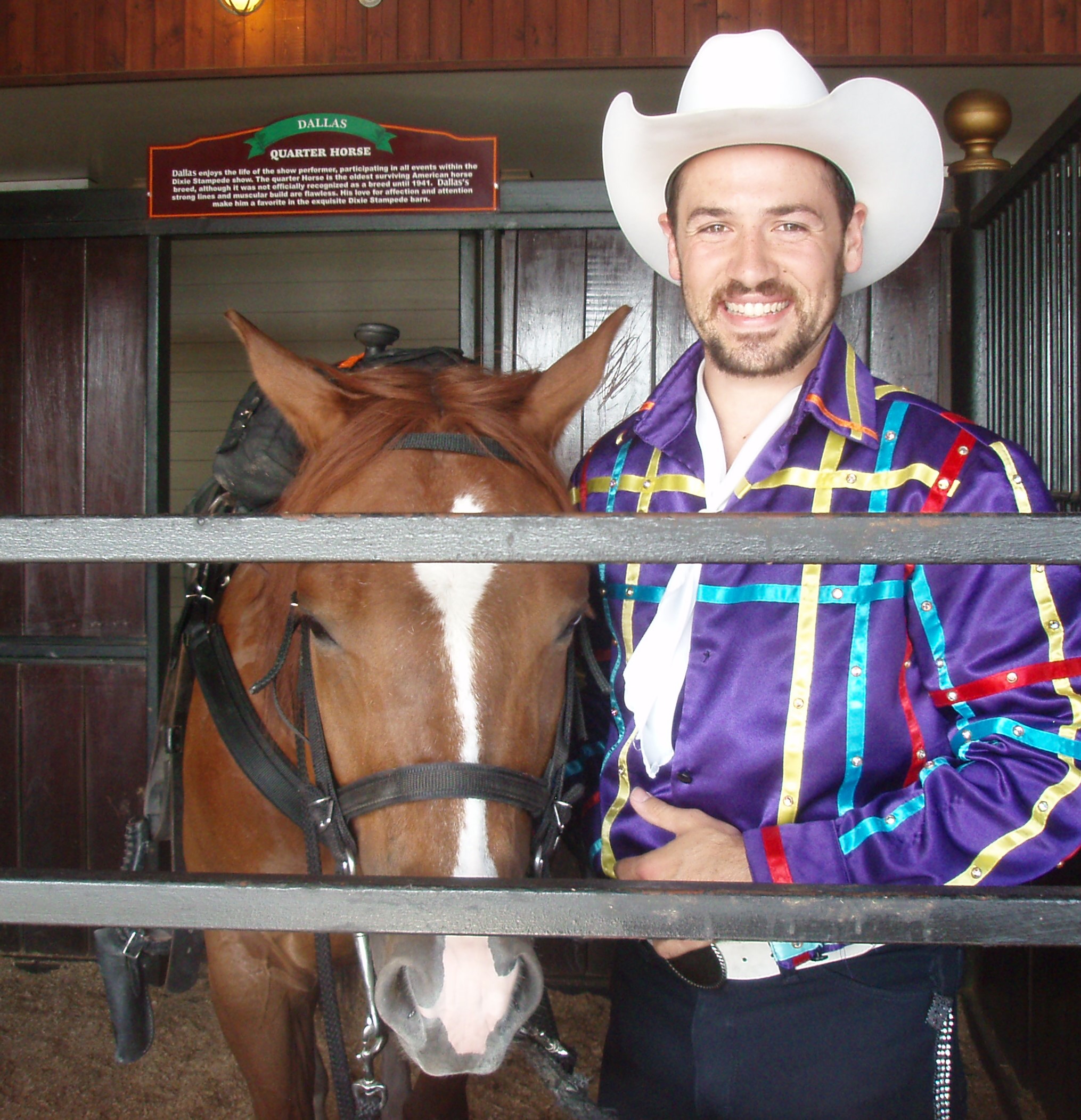
We went to a wine pairing session at the Mount Pleasant Winery on Wednesday afternoon and then we attended the Dixie Stampede Dinner Show in the evening. When we bought our tickets to the Dixie Stampede, they told us that they opened at 6:15 for the 8:00 show and we could come a little earlier if we wanted to go through the “horse walk”. While strolling the “horse walk” we caught an opportunity to get a picture of one of the entertainers with the quarter horse named Dallas. He stopped long enough for me to take his picture. During the show, he wore this outfit (they change an unbelievable amount of times during the show) for square dancing on horseback.
While in the lobby, we learned the history of the Dixie Stampede. The event was started by a Missouri carriage maker named Sam Mott in 1872. It started out as a carriage race and was won by the Mott team for the first 7 years. In 1879, an entrant from East Tennessee, named Lee Parton, won the race. Everyone was surprised when Lee Parton turned out to be Dixie Lee Parton – a girl! Well, of course, Sam fell in love with Dixie and they got married. After that, he renamed the competition the “Dixie Stampede.” And, now it is owned by Dolly Parton.
At 6:15, we were ushered into the Carriage Room where the 7:10 award-winning juggler pre-show took place. While getting there early insured us of a front row seat (there did not appear to be any bad seats) that left us nearly an hour in which to listen to piped-in Dolly Parton music and eat and drink whatever we purchased including popcorn or peanuts to eat and a number of specialty drinks along with soft drinks (another non-alcoholic show) served in a souvenir plastic glass. At 7:40, everyone was asked to move to their assigned section and row in the main arena and promptly at 8:00 the show started. As with most of the shows, no pictures were allowed. The show was good with some impressive horse riding and some cute comedy. Be forewarned, the very large meal you are served comes with no utensils! We started with a roll and a bowl of soup. The soup bowl had a handle on it so you could drink out of it. Next we were served an entire Cornish hen (to break apart and eat with your hands). This was followed by a good sized slice of pork, half of a baked potato and a small piece of corn on the cob. They did bring out large wetnaps after the main course and then gave us a very large apple turnover to finish the meal.
Tuesday afternoon we saw the Dublin’s Irish Tenors and Celtic Ladies perform at the Castle Theatre. There was some terrific harmony, but a little more opera than we expected. After the concert we went to a wine tasting at the Mount Pleasant Winery (www.MountPleasant.com) on Green Mountain Drive.
Monday found us driving south to visit Dogwood Canyon on the Missouri/Arkansas border after getting tickets to see Irish Tenors and Celtic Ladies on Tuesday; Dixie Stampede Dinner Show on Wednesday (www.dixiestampede.com); reservations at the Paddlewheel deck on the Main Street Lake Cruises property (www.MainStreetLakeCruises.com) to watch the fireworks at the Town Square in Branson Landing (www.bransonlanding.com) on Thursday; and dinner reservations at the Keeter Center (www.keetercenter.edu), a restaurant on the campus of the College of the Ozarks operated by culinary students serving food raised by the agricultural students, on Friday; and, last but not least, tickets for the 8:00 show on the Branson Belle ( www.showboatbransonbelle.com) for tonight.
The Dogwood Canyon Nature Park (www.DogwoodCanyon.org) covers over 10,000 acres in the Ozark Mountains. It was purchased by the founder of Bass Pro Shops, Johnny Morris, in 1990. It is managed by a non-profit foundation and offers a six-mile asphalt-paved gently sloping path through the park for which you can purchase a ticket to walk/jog, bike or Segway. We arrived about an hour early for the 3:00 tram tour, so the clerk gave us a wrist band which allowed us to walk the trail in advance of the tour.
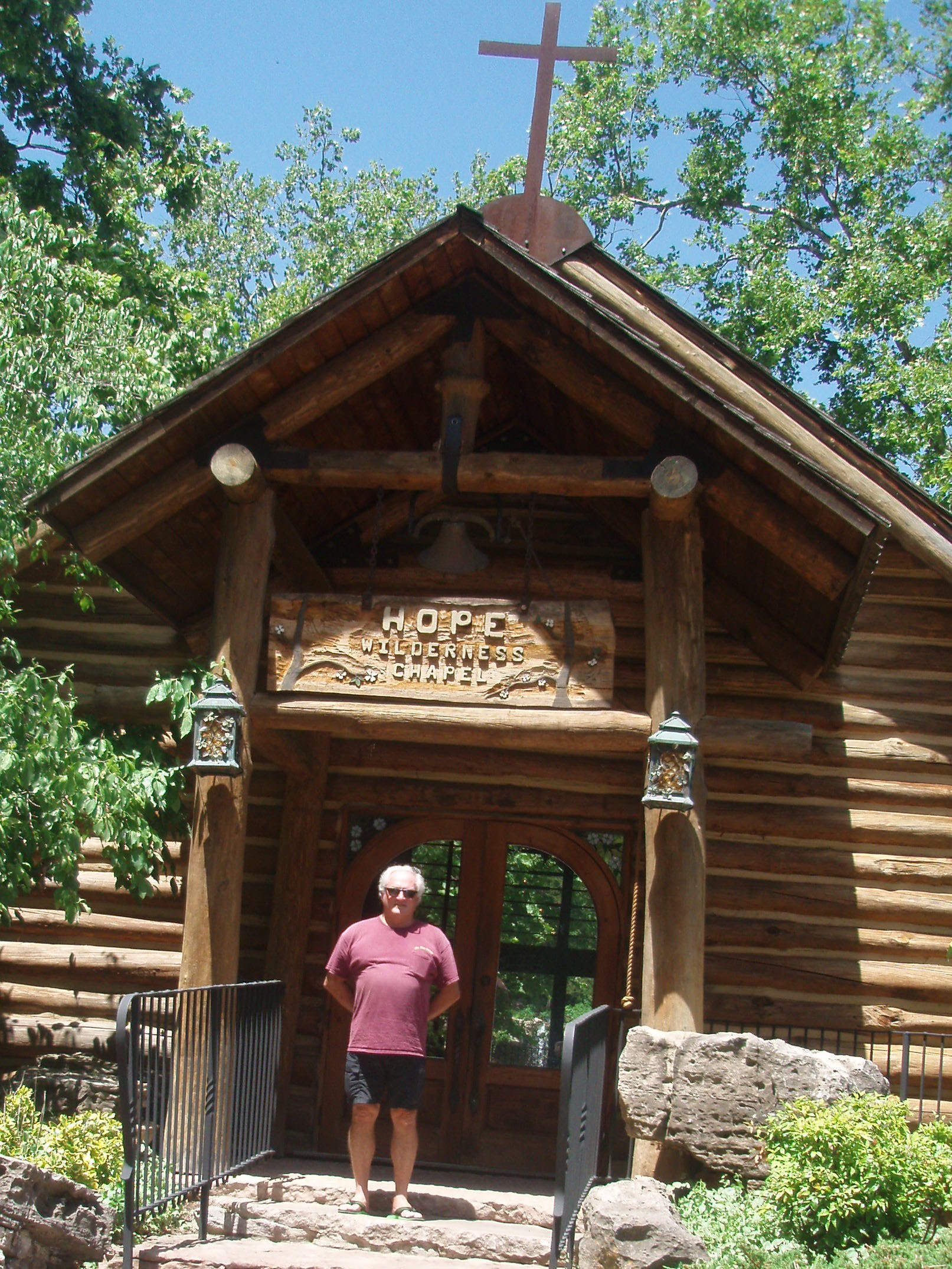
We walked about a half mile down the path until we reached the Hope Wilderness Chapel. This is a replica of churches from the 1800’s. It has a cedar ceiling, walls of pine logs, and an oak floor. The pews, hand hewn with curved backs, were brought in from an old church in Georgia. A good portion of the front of the chapel is glass through which you can see a waterfall. In the picture below, you can see all the way through the chapel. When we stopped here on the tram tour, we learned that they had 53 weddings in this chapel last year.
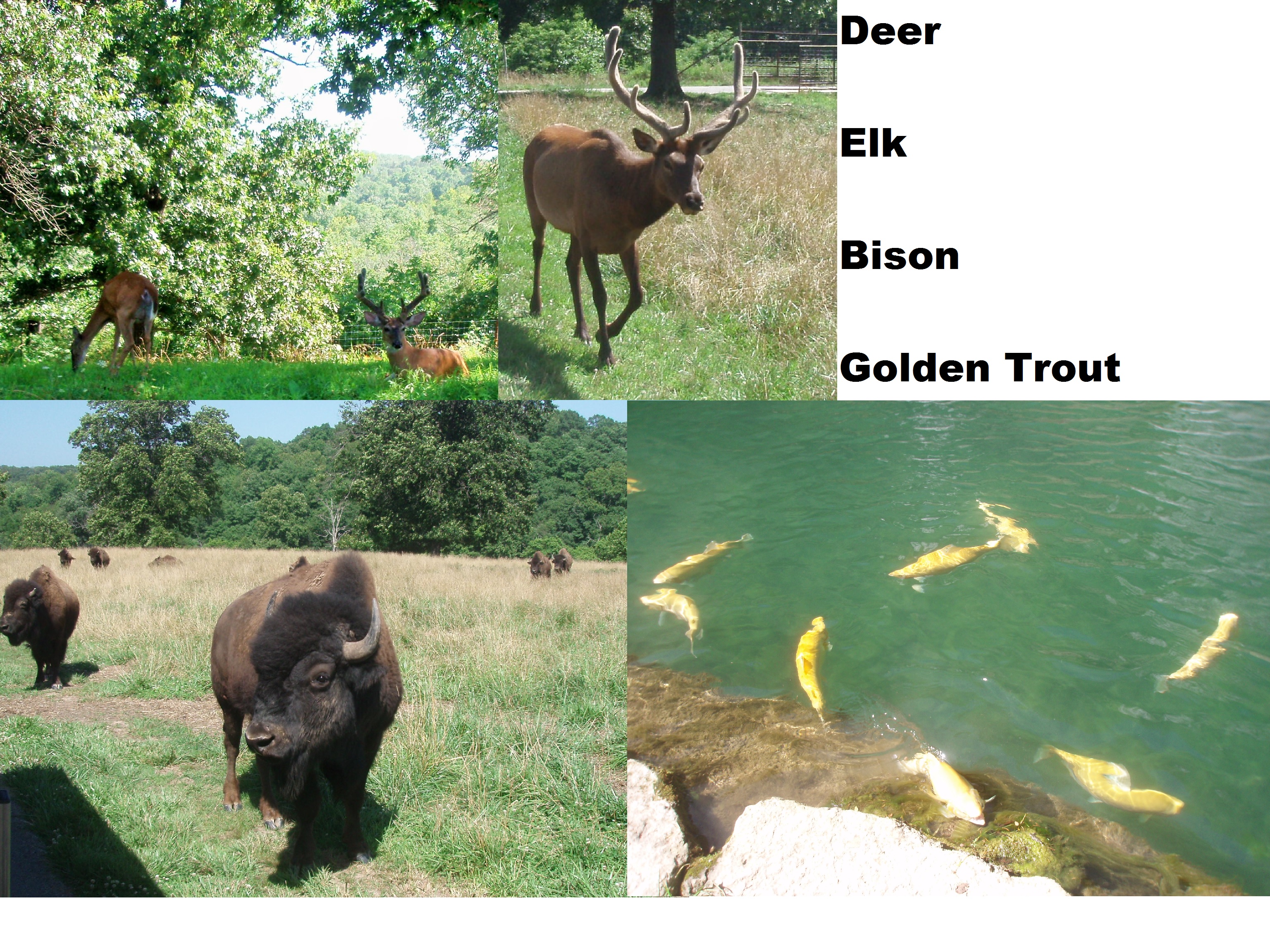
The two-hour tram ride covers the entire trail plus takes you over the Missouri/Arkansas state line and into their fenced elk and bison pasture where we saw white tail deer, elk, and bison, some long-horn cattle, and a wild turkey. We also saw rainbow trout and golden trout. They are fed daily by park staff, so when they see the tram they come right up to it. The fawns were hidden in the grass, but the bison calves came right up to the tram with their moms.
It was all very pretty and I can only imagine how beautiful it would be in mid-April when all of the dogwood and redbud trees are in bloom. We
We hurried back to the condo to change and then return to the Branson Belle for the 8:00 cruise. You board the boat an hour before the boat leaves the dock and this hour is when you eat. We decided to pay an extra fee to be seated on the second floor and choose our dinner from a menu selection instead of eating whatever three-course meal they wanted to serve us. We were right on the front row of the balcony which was great for seeing the show. The show consisted of a comedian/magician/host; a five-piece band; a five-man singing group; and a woman “fiddle” player, Janice Martin, who turned out to be extraordinarily entertaining. Not only did she play three different kind of fiddles; but, she also played the piano, sang and performed aerial acrobatics. She told us that she had attended the Julliard School of Music. We arrived at 6:45 to board the boat at 7:00 and didn’t leave the parking lot until 10:30.
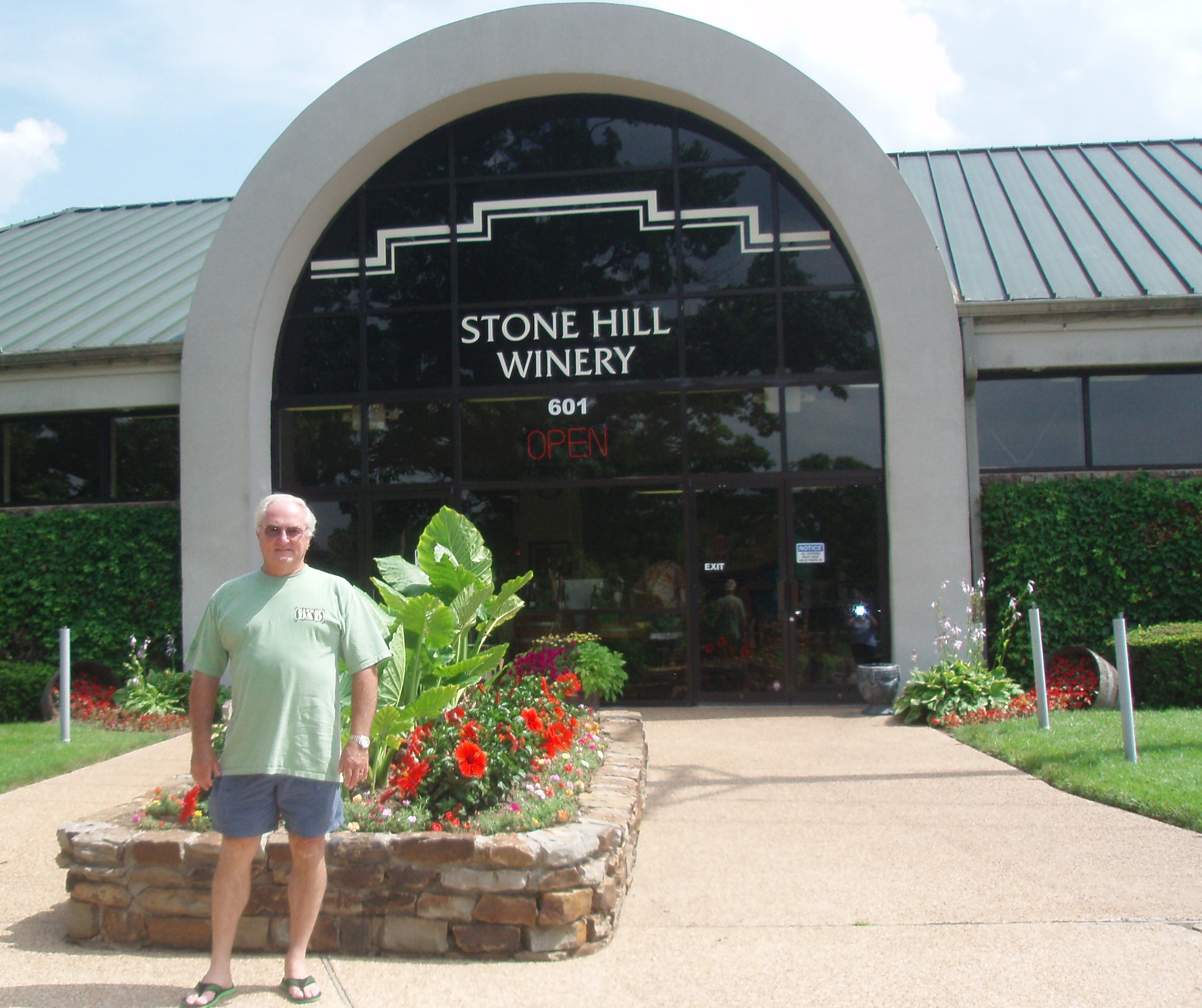
On Sunday, we drove into Historic Downtown Branson first visiting Dick’s 5 & 10. The brochures say that this store is over 50 years old and has over 50,000 items. We spent an hour here shopping and when we checked out, our bill was 27 cents! Next, we rode the free trolley through downtown to the Branson Landing shopping area. This area is about 4 blocks long running along the river. Next we went to the Stone Hill Winery where we took about an hour-long tour and tasting. We learned some very interesting things on the tour. This winery has been in Branson since 1986 but they only bottle their Spumante here. Most of the bottling is done in their Herman, Missouri, winery where the grapes are grown. That winery was started in the 1800’s but was shut down in the 1920’s with prohibition. They then grew mushrooms in the underground storerooms where they had kept the barrels of wine until the 1960’s. They also showed us how they add carbonation to the wine to make it Spumante and then bottle and cork it (similar to champagne).
Saturday, we got onto another Scenic Byway – US 160 just before 11:00 AM traveling west from Poplar Bluff to Branson and were awed by all of the wildflowers growing along the side of the road which were bright yellow, white, lavender, orange and some red. We reached our destination, an RCI resort called the Colonnade and waited about an hour before we could check in and get into our room.
LCD 008 – Poplar Bluff, Missouri – We left Tennessee on I-24 West soon crossing into the state of Kentucky where we saw miles and miles of cornfields. We never really associated Kentucky with corn, but realized that some people might associate Kentucky with corn liquor! While traveling on I-24, we, again, crossed over the Tennessee River. We turned off of the interstate just north of Paducah onto US Highway 160 heading to Poplar Bluff. Soon after we left the town of Wickliffe, Kentucky, we crossed over the Ohio River, which took us into the state of Illinois. About three minutes later, we crossed over the Mississippi River and into the state of Missouri. Rick says we have now been in seven states on this trip with many more to come. We stopped in Sikeston for lunch at Colton’s Steak House and Grill and had a terrific meal. We discovered the Drury Inn and Suites in Poplar Bluff. www.DruryHotels.com What a great place. They have an indoor-outdoor pool with a good size hot-tub and you get three free drinks and a hot meal in the evening as well as breakfast the next morning. We liked the place so much, we immediately made reservations at one in Kansas City for the 5th of July.
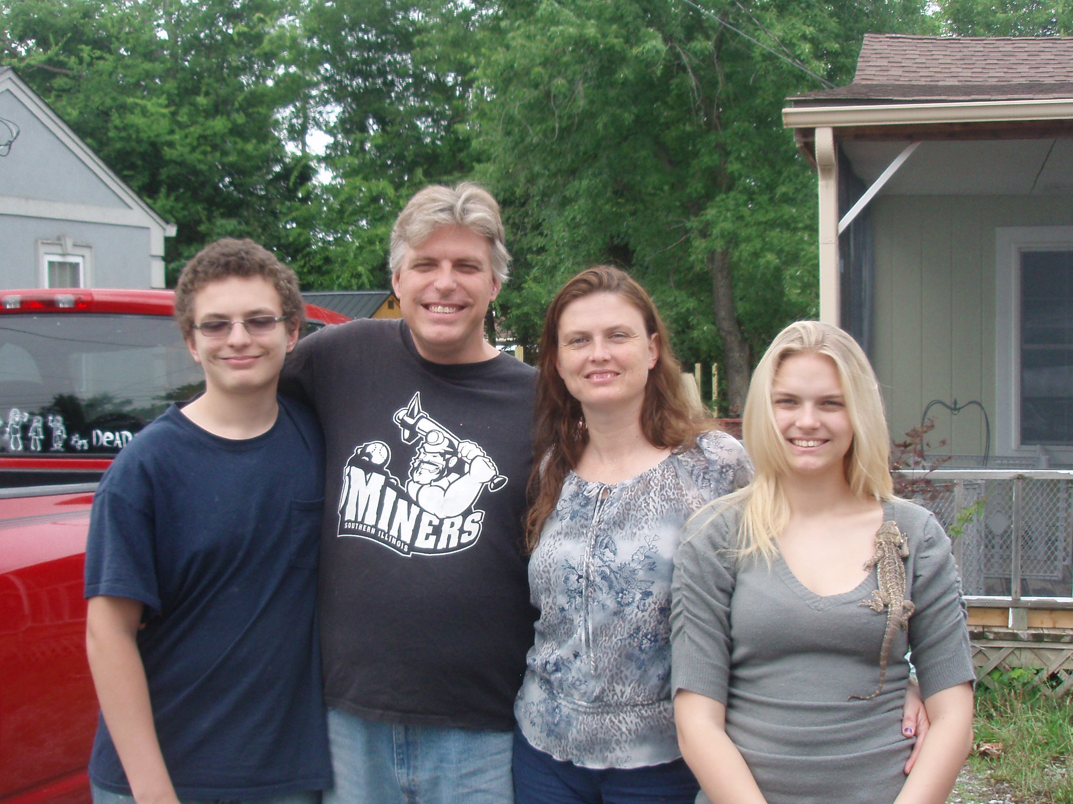
LCD 007 – Lebanon and Goodlettesville/Nashville Area, Tennessee – We left Lenoir City this morning and drove on I-40 West stopping for a brief visit with my niece Mary Alice Cambre Howard, her husband, Rich, and their two children, Savannah and Ethan. They have recently moved into a new home and they, and their myriad animals are still getting settled. Mary is about to start Veterinary Tech training and Savannah says she hope to study zoology with an emphasis in reptiles when she goes to college. We enjoyed our visit and wish them all good luck with their hopes and dreams for the future.
Tomorrow, we head to Missouri.
LCD 004-006 – Lenoir City/Knoxville Area, Tennessee –
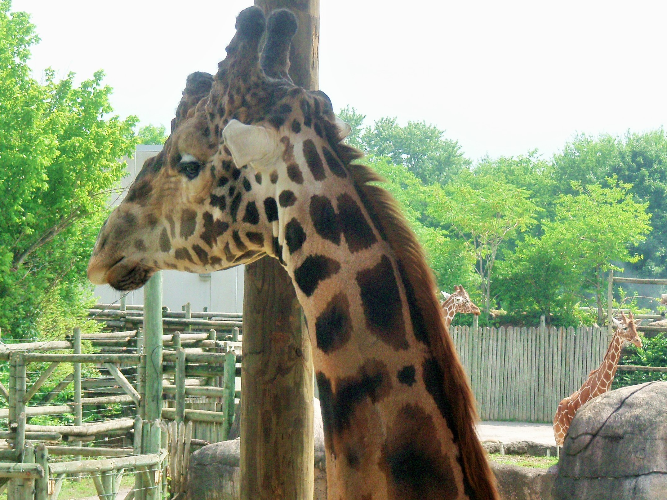
Wednesday (LCD 006), our third and last day in this area, found us in the City of Knoxville. After spending several hours at the Knoxville Zoo, seeing and learning about a variety of animals and some of the history of the Knoxville Zoo (i.e.: They had the first elephant born in a US zoo and they have made a lot of money selling paintings made by an elephant),
we had lunch on Market Square at the Stock and Barrel, a restaurant that specializes in burgers and bourbon www.thestockandbarrel.com . Mid-afternoon, we made our way to the Knoxville Art Museum www.knoxart.org/ where we got a personally-guided tour by our nephew, Robmat Butler.
We two weary travelers returned to the hotel around 5:00 to chill for the rest of the evening and prepare to move on to the Nashville area tomorrow.
On Tuesday (LCD 005) we headed south on I-75 to Sweetwater, Tennessee. From there we went to Tellico Plains to take the Cherohala/Dragon 120-mile scenic loop. The Skyway’s name comes from a combination of the two forests through which it twists and turns – the Cherokee and the Natahala. It took over 30 years to build this road at a cost of $100 million. Our first stop was at the Welcome Center. Here we received a number of very helpful brochures and maps. A very nice volunteer told us to be sure to take a short side trip down TN 210 to see Bald River Falls and a fish hatchery.
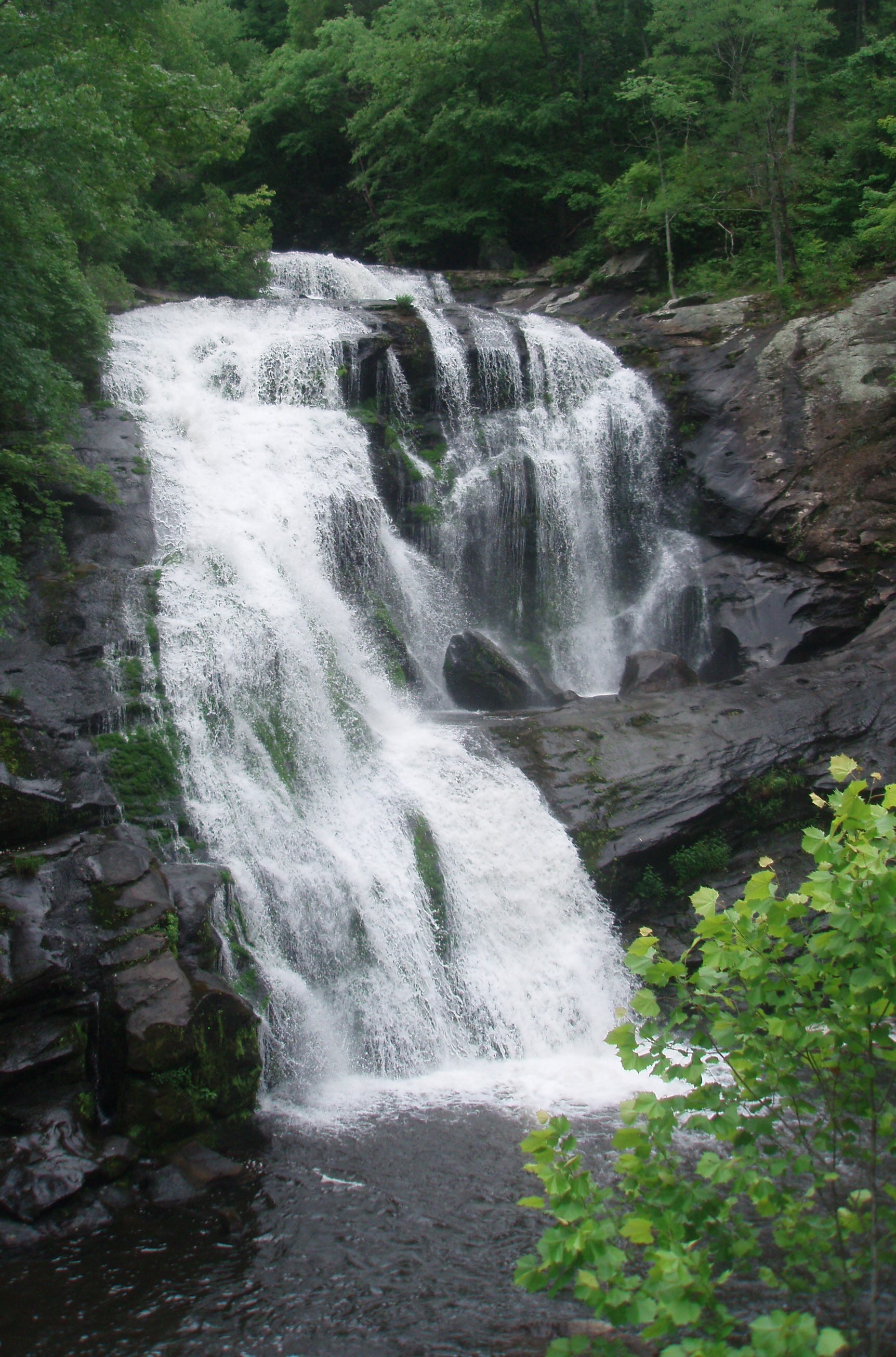
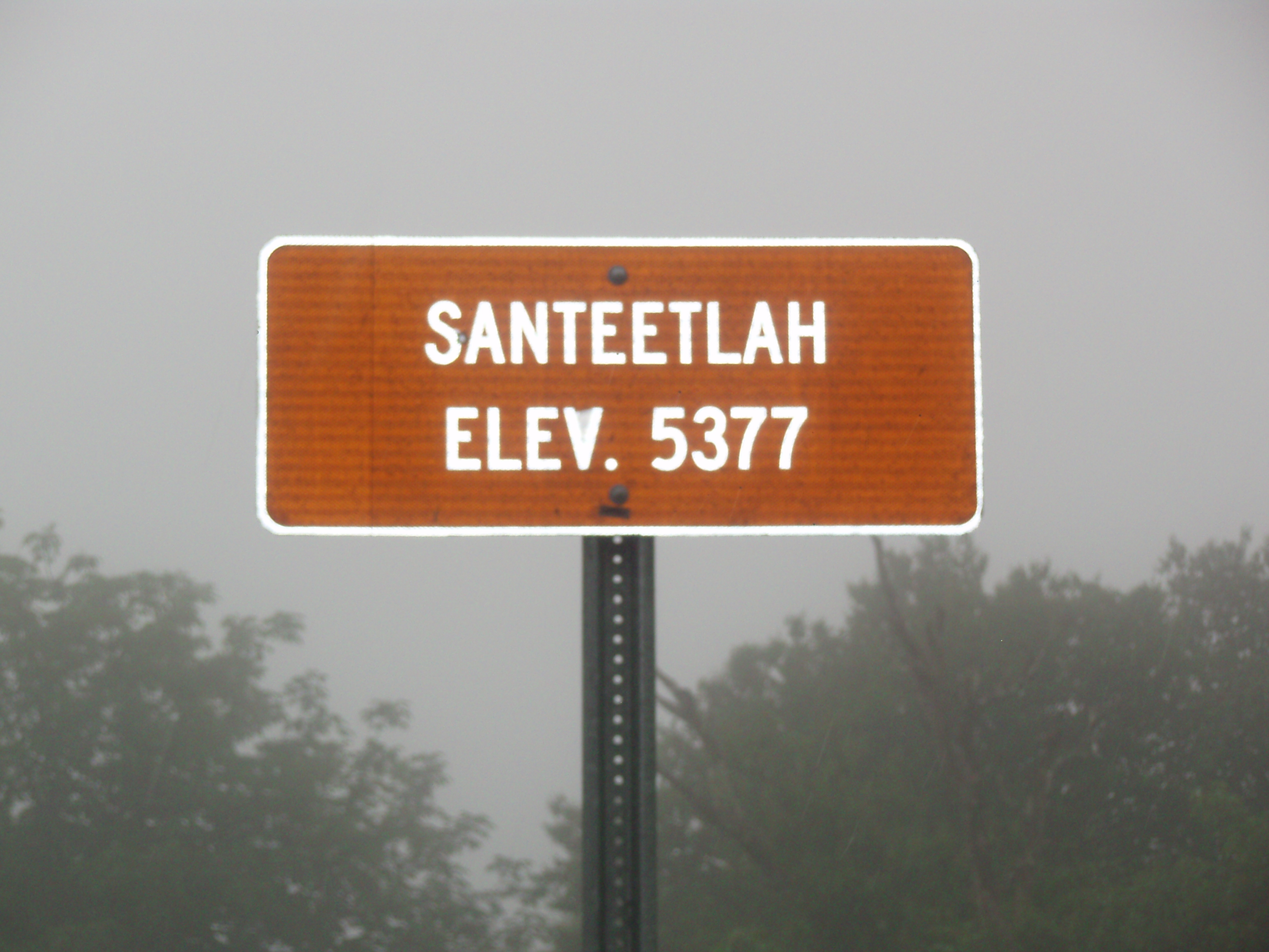
By the time we got down the road to the fish hatchery it had started to rain so we turned around and went back to the main road. We saw lots of pretty scenery along the way and went from an elevation of 950 feet to over a mile high at the Santeetlah Overlook.
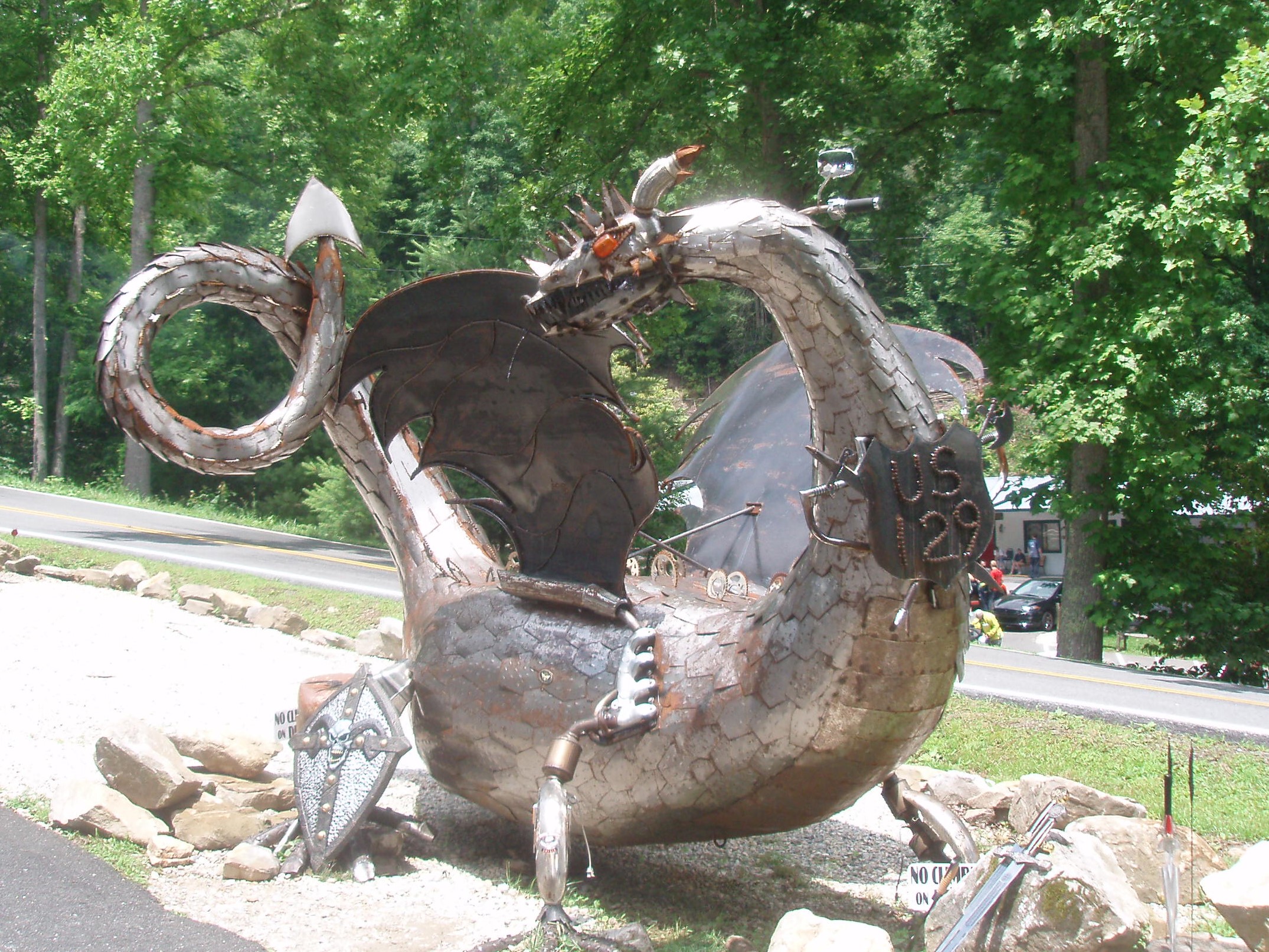
Near the end of Highway 143, we turned toward the Horse Cove Campground and onto the Joyce Kilmer Road (a shortcut to Highway 129). Soon after heading north on US 129, we came upon the Tail of the Dragon Motorcycle Resort on the border of North Carolina and Tennessee.
From this point they say there are 318 curves in the first 11 miles of the road in Tennessee. That evening, we drove into Knoxville and met our nephew, Robmat Butler and his roommate Bre for supper at the Tupelo Honey Café https://tupelohoneycafe.com/knoxville on Market Square.
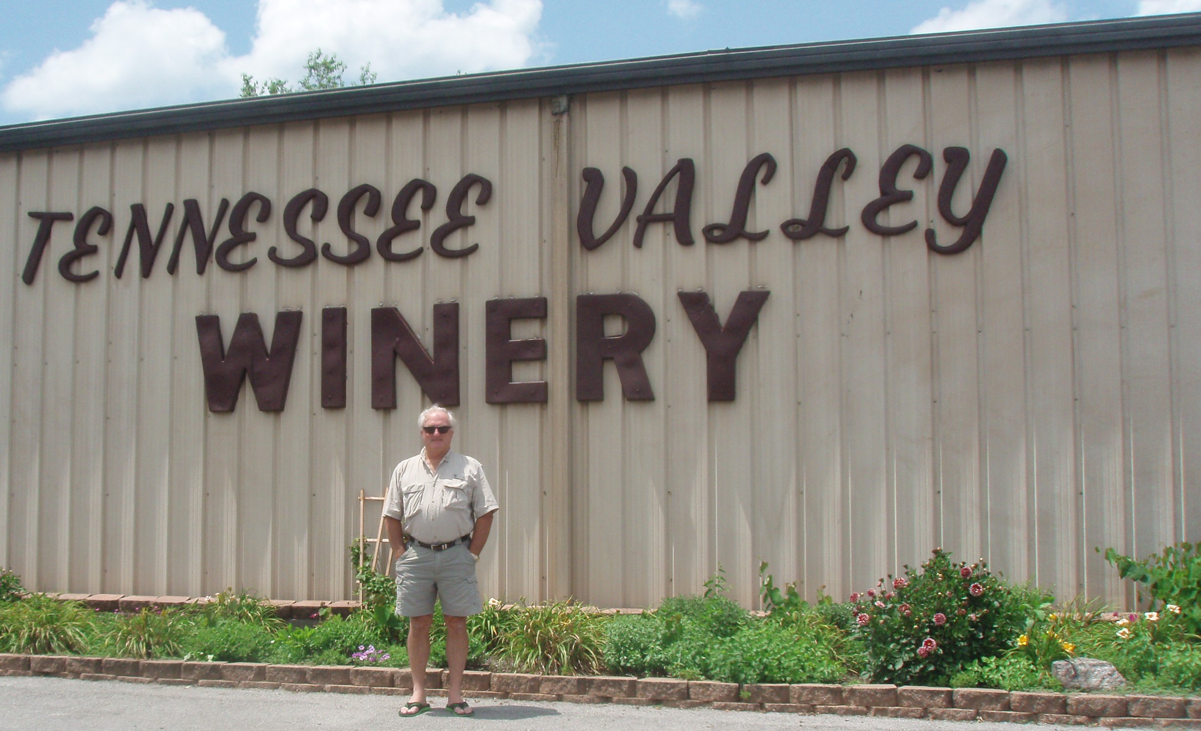
We left Marietta on Monday (LCD 004) morning starting out on I-75 North. Instead of just driving I-75 all the way, we decided to take some scenic highways in north Georgia, so we left I-75 near Calhoun at Exit 317 going onto GA 225, aka Chatsworth Highway, aka Trail of Tears Highway. We passed two historical sites relating to the Cherokee Indians and their eviction from Georgia along the Trail of Tears, but both of these sites were only open Thursday through Saturday. From GA 225 we turned west onto GA 2 which was a “scenic byway”. There were signs along the way designating that fact, but some of them were a little hard to find, so we made a few turns (and turn-arounds) that should not have been necessary. Even still, we enjoyed our “less stress” route into Tennessee. We got back on to I-75 north near Cleveland, Tennessee (Exit 25) and then got off of I-75 in Lenoir City at Exit 81. The Hampton Inn let us check in early (around 1:00) for our three-night stay. That gave us time to do some exploring in the afternoon. We picked up a brochure titled, Day Trips & Weekend Adventures from Louden County, Tennessee. In the brochure, there was a list of Top Ten Things to see or Do in Louden County (where we are staying). We managed to check off four of the ten today. Our first stop was at the Tennessee Valley Winery where we tried several of their red wines and purchased three bottles to blend into our own reserve selection.
From there, we drove to the Sweetwater Valley Farm and Cheese Factory where we purchased some cheese to go with our new wine. It was too late to take the tour of the milking barn, but we enjoyed tasting many different kinds of cheese.
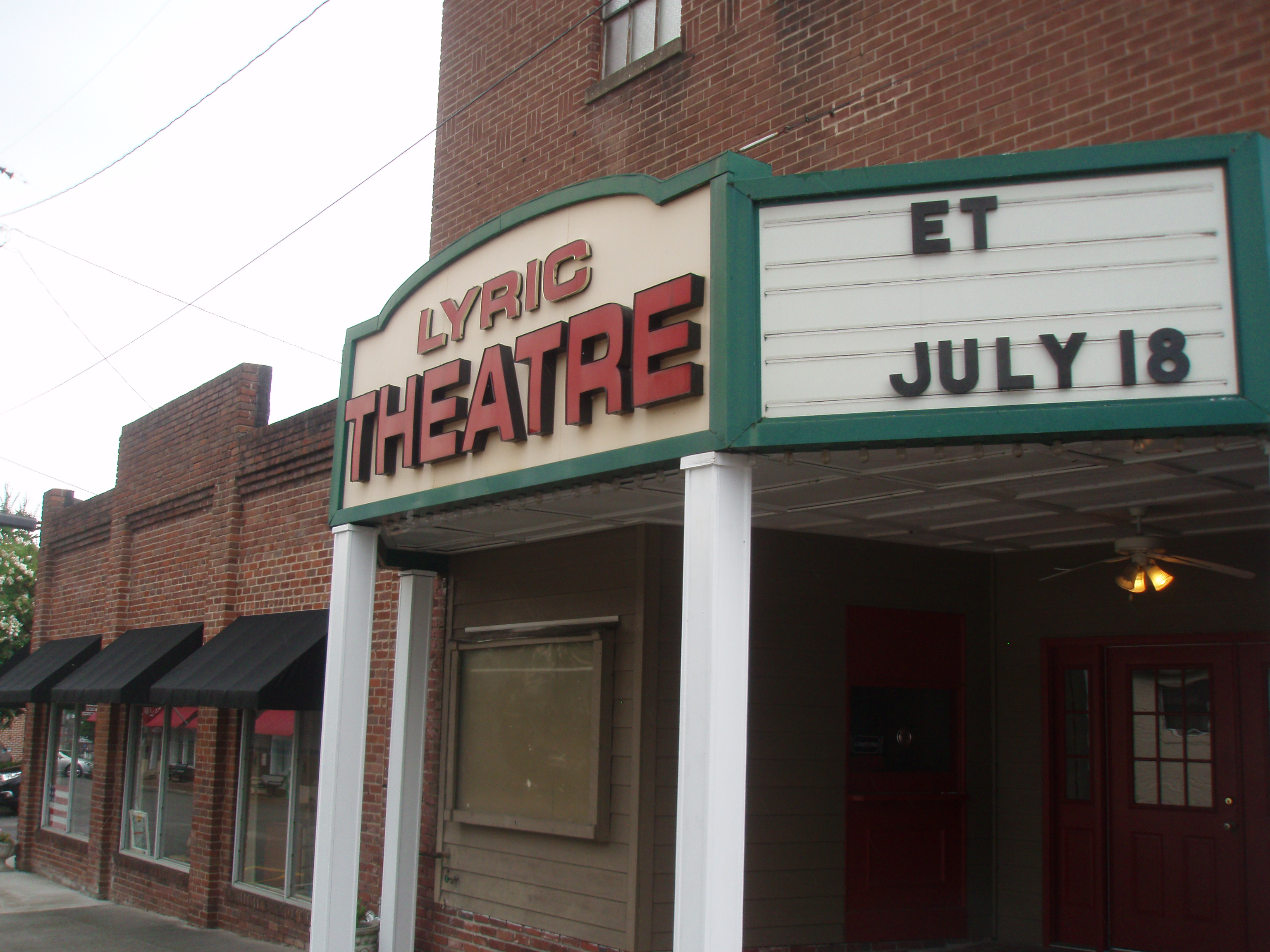
On our way back from the cheese farm, we drove through the historic town of Loudin where I took the following photo of the local movie theater advertising its upcoming show – ET!
Lastly, we passed through the historic town of Lenoir City. The official website of Lenoir City says,
“General William B. Lenoir was a native of North Carolina who had served in the Battle of Kings Mountain. His service in this battle brought him a share of 5,000 acres of land in Lenoir City. He later deeded the land to his son, Major William B. Lenoir who moved into the area in 1810. Major Lenoir had a thriving plantation by 1821 known for its cattle and hog production. A successful cotton and flour mill were also attributed to Major Lenoir’s successes. When Major Lenoir died in 1852, four of his sons formed William Lenoir & Sons and controlled 2,700 acres of his land. This land was later sold to the Lenoir City Company which developed the town. Lenoir City was incorporated in 1907.”
LCD 003 – Marietta, Georgia. We left Ormond Beach about 8:30 Sunday, June 22, 2014, eventually heading to I-75 North. We decided to take the “less travelled” route, going up US 1 to Bunnell, Florida and then taking FL 100 across the state getting to I-75 on the south side of Lake City. Although FL 100 was two lanes, the pavement was good and what traffic there was moved very well. Along this road we saw lots of farms including: corn, potatoes, horses, fruits, and vegetables. We also saw lots of planted pine trees which could be for lumber/pulp, turpentine, and/or pine needles. We filled up the gas tank at Lake Butler, Florida paying $3.71/gallon. We stayed on I-75 the rest of the way except for 16 miles on 475 which skirts Macon. After checking in to a Days Inn in Marietta, we went to Pappadeaux’s Seafood Restaurant for supper, hoping to see our nephew, Tim Cambre, working there tonight. Unfortunately, we missed Tim – he had worked earlier in the day; but we had great service at the bar from Mohamed.
LCD 002 – Saturday, June 21, 2014 Ormond Beach, Florida. We promised Rick’s mother that we would see her again before we left on the big trip. (And, I still needed to wash some of the clothes we wanted to take with us!)
LCD 001 – Friday, June 20, 2014 – Palmetto, Florida. We had to go pick up some items that had been delivered to the house which we wanted to take on the trip.