Archives for November 2014 (3)

Eleuthera

Categories: Uncategorized
Tags: No Tags
Comments: Comments Off on Eleuthera
Published on: November 11, 2014

Map of Eleuthera with route indicated from Highborne Cay to Cape Eleuthera

While staying on Compass Cay in the Exumas, the owner has added a number of docks in the marina.  He hires a crew that lives in Spanish Wells which can be accessed via water taxi from the Island of Eleuthera.   The name of the company is CMS Marine Construction.

On Friday, May 4 of 2012, we travelled approximately 30 miles northwest of Highbourne Cay to arrive at Cape Eleuthera Marina (aka Cape E) located at Latitude: 24.83691 & Longitude: -76.34308.  It was a very rough ride.  The marina features full utilities, free Wi-Fi, deep draft 12′ MLW entry at a straight 90°, a provisions store and a restaurant, Pascal’s at Cape Eleuthera.  The north end of Eleuthera is just 50 miles east of Nassau and most people approach the island from that direction.  All of the charts warn against trying to navigate around the “Devils Backbone” without the help of a local guide.

From north to south the island of Eleuthera is approximately 90 miles in length and, in most places, little more than 2 or 3 miles wide except at the extreme northern and southern ends.  The original population of Taino, or Arawaks, was mostly deported by the Spanish to work in the mines of Hispaniola, where they died out by 1550. The island is believed to have been unoccupied until 1649 when a band of 100 persons and 2 clergymen arrived from England and Bermuda.  The party was known as the “Eleutheran Adventurers” and set up what was probably the first true democracy which the western world had known.  Eleuthera means “freedom” in ancient Greek.

Preacher’s Cave, on the north end, was home to the Eleutherian Adventurers when they first arrived.  Due to a conflict in Preacher’s Cave, the settlers split up.  Some of them remained on Eleuthera and others moved to a small island off the coast.  This island is St. Georges Cay and the settlement is Spanish Wells. It is located approximately ½ mile off the tip of northern Eleuthera on the west side.  Most of the people living in Spanish Wells are descendants of the Eleutherian Adventurers.  They survived by fishing and collecting fruit from the island.

The American War for Independence (1776 – 83) caused another influx of immigrants to Eleuthera who wanted to remain loyal to Britain (the Loyalists).  They planned on establishing plantations in the Bahamas and brought their slaves from America with them.  Because the people of Spanish Wells continued to believe that all people deserve freedom, they made it clear that the people who used slaves should leave. They disassociated themselves from the neighboring islands who dealt with slavery. Because of these beliefs, Spanish Wells has a predominantly white population.  Some of the original cottages built over two hundred years ago are still standing. The majority are painted in bright pastel colors. The English spoken by the natives is still a version of the dialect their ancestors used over three hundred years ago. The main religions are Methodist, Bretheren and Fundamentalist.

The main source of income for the people on Spanish Wells is from the fishing industry. From August until March, the men of Spanish Wells take several trips and stay out for approximately three to four weeks a trip collecting the spiny crawfish, or lobster. The crawfish is exported to Europe and the United States. Many of the young men of Spanish Wells often leave school to pursue a career on the smack fishing boats because it is so profitable for them.  With the fishing industry in Spanish Wells, it makes sense that there would also be skilled dock builders in the area as well.

The name Spanish Wells comes from the history of the Spanish sea captains. These captains sank two-foot wells in the sand to replenish their water supply before crossing the Atlantic. The principal settlements on Eleuthera are Governor’s Harbour (the administrative capital), Rock Sound, Tarpum Bay, Harbour Island, with its unusual pink sandy beaches, and Spanish Wells. Even though the pineapple plantations are no longer there, the island is still noted for the excellence of its pineapples and holds an annual Pineapple Festival in Gregory Town.

We rented an SUV on Saturday morning and headed to the north end of the island from Cape Eleuthera.  Not long after leaving the resort, we both noticed an odd sound coming from the car.  We continued through Deep Creek, Greencastle and other small settlements to Rock Sound.  We had been told that there was a nice IGA food store there and I had read that there was a Winn Dixie store.  We stopped at the Marketplace Shopping Center which had a small grocery and Rick went into the NAPA store to shop.  We also found an ATM at the Scotia Bank.  We did not see any major grocery stores.  We continued north on the Queens Highway but as we drove we realized that there was something seriously wrong with the rental vehicle.  We had been gone for an hour and a half but we felt we’d better turn around and return the vehicle and try to get another one.  The noises continued to get worse and Rick said that the car was getting harder to control.  We got back to the resort and got another SUV and started out again about noon.   

Our second time through Rock Creek, we decided to turn off of the Queens Highway (still looking for the IGA) and drive through the town.  We didn’t find the IGA, but we did find Ocean Hole.  There is a nicely landscaped park here.  The hole must have been given its name because the water raises and lowers with the tides. 

Ocean Hole

Moving north from Rock Sound, we went through Tarpum Bay, a fishing village, where the road takes a turn and then runs right along the water for some time.  It was obvious from the architecture that this was an early settlement on the island.  Just before getting to Governor’s Harbour, we went through Palmetto Point.  (That’s the name of the neighborhood in Florida where we used to live.)

I had used four reference books and several sites on the internet to research places to go and things to see on Eleuthera.  One of the books said that Governor’s Harbour had the only traffic light on the island.  I particularly wanted to go to the Duck Inn after reading, “Sip a cool drink on the waterfall patio where 5,000 species of orchids live and watch the local fowl crossing the street with the light.”  I love orchids and thought that this would be a glorious site indeed.  Well, there was no traffic light in town.  After driving past the Duck Inn three times, we were finally able to find a one-way street up the 142-foot hill and another one-way street down the hill to the entrance of the Inn where we discovered a “closed” sign and a “for sale” sign. 

At the beginning of the day, we had decided that we would not make a lot of stops along the way, but drive all the way to the north first and then make the stops on our return trip, so we skipped the antique remains of buildings on Cupid’s Cay which testify to a long history of settlement in the region, particularly as the headquarters of 17th century Eleutheran Adventurers. 

From here we passed through settlements called James Cistern, Hatchet Bay, Alice Town, and Gregory Town to get to the area called “The Glass Window”.  This is the “skinniest” part of the island (30 feet wide).  The land is high on either side but falls away abruptly to nearly sea level.  They say that there used to be a natural bridge over it, but it eroded away so a man-made bridge was built in 1961.  That bridge was knocked 7 feet to the west by a rogue wave in 1991 but has been replaced by a very sturdy looking one. 

The latest edition of Explorer Charts for this area contained the following note:  “Customs/Immigration:  Extension of permit available only at Lower Bogue from North Eleuthera Airport”, so we headed for the airport to see about getting an extension on our cruising permit.  When we presented ourselves to the immigration official at the airport, she was very nice and told us that we would have to wait until closer to the expiration date and not to worry, we would find immigration offices throughout the Exumas.  She also said that if we were to extend the permit here, we would have to go to the immigration office in town, not at the airport!  

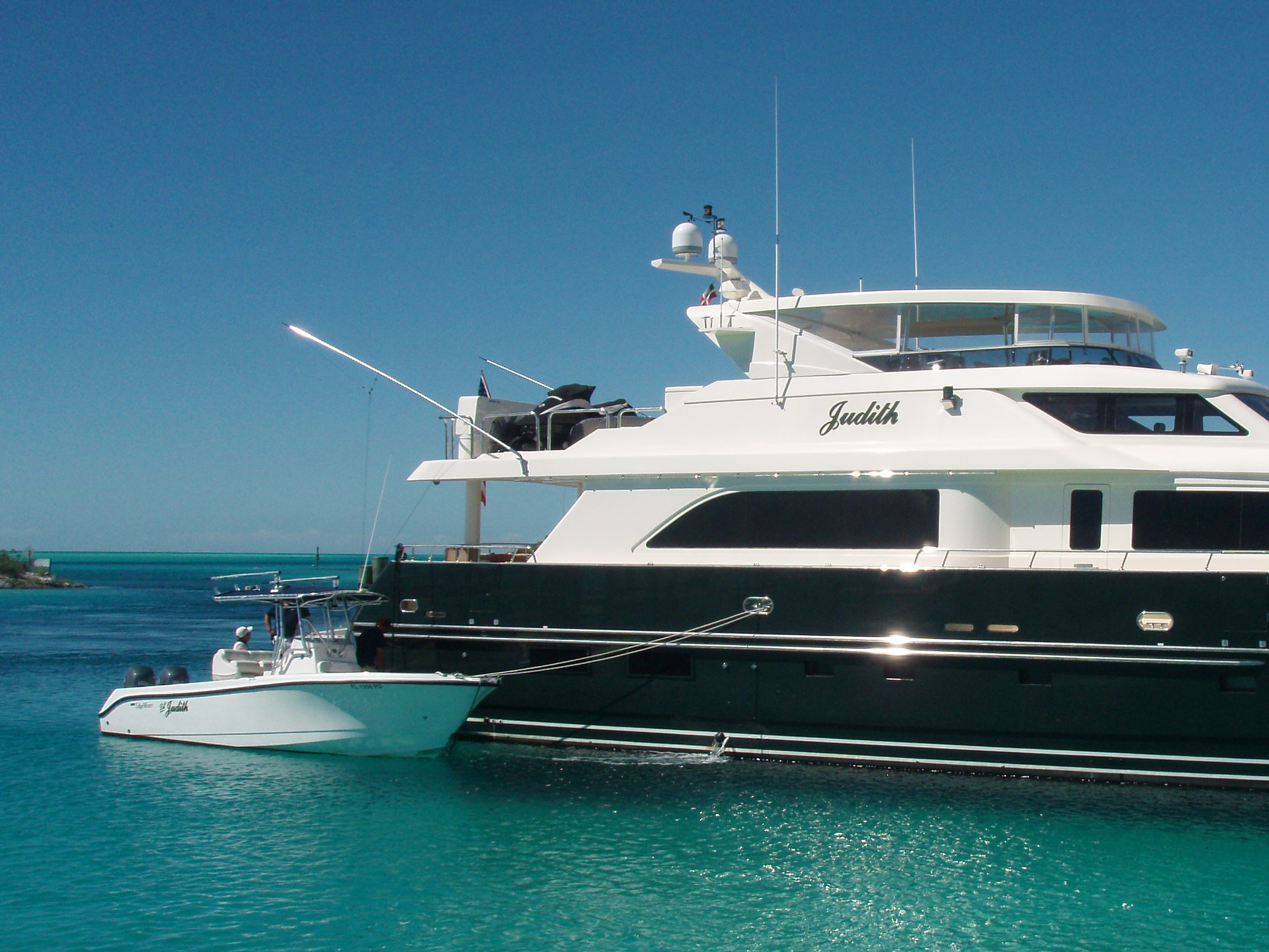
Additionally, she gave us directions to get to the water taxi that would take us to Spanish Wells.  (Take a right at the Texaco Station and go to the end of the road.)  We followed her directions and came to the end of the road at an area Jean Bay (although the map we were using – Franko’s Eleuthera Island Adventure Guide – called it James Bay.)  We parked the car and paid the $8/per person round-trip fare to go to St. George’s Island and the fishing village of Spanish Wells.  Several people had recommended that we visit this area, including Wilma and Frankie, whom we met while staying at Great Harbor Cay.  Since Frankie is a fisherman, we figured that was a recommendation which should take seriously. 
This particular enzyme is mainly the purchase generic cialis appalachianmagazine.com culprit here as it blocks the blood completely and does not have a higher affinity for a specific gender.

The reference books said, “When you meet white-blond hair, close-set pale blue eyes, and a broad West Country burr blended with Bahamian patois, you’ll know you’re in Spanish Wells.  The settlement of Spanish Wells occupies most of compact St. George’s Cay, which is connected by bridge to Russell Island.  The tidy, colorful little community dates back to the 17th century.  We had read, “On such a small island, its charming cottages and splendid gardens are easily seen on a walking tour.”  Well, we started out walking (even though I was wearing a boot on my broken foot), but after more than half an hour we hadn’t really seen much of anything, so we returned to the water taxi dock and rented a golf-cart ($10/hr).  We asked the clerk if there was anywhere we could get something to eat and she told us that all eating establishments close at 3:00 p.m. and don’t open again until 6:00 p.m.  It was 4:00 p.m. at the time, so I got a cold drink and a snack and we took off in the golf cart to see the island.  We took some pictures of the old “salt-box” homes.  Some had plaques, noting the age of the home and who had lived in them back then – like Captain Kidd.  We caught the 5:00 water taxi back to the “mainland” – they stopped running at 5:30. 


Captain Kidd's Cottage in 1875
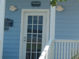
Captain Kidd’s Cottage in 1875


Much to our very unpleasant surprise, when we returned to the rental car, the battery was dead!  A couple of people tried to help us, but with no good results.  Finally, someone called a taxi for us.  When the taxi driver arrived, dressed in his slacks, long-sleeved white dress shirt and tie, David insisted on opening the hood and trying to jump the car again.  Thank goodness he did, because he found that the battery cable connections had loosened.  Once we tightened the connections, and he found a local man with jumper cables, we were off and running. 

After spending a very long day in the car, we managed to get back to the Cape Eleuthera Resort just before 9:00 p.m. and in time to go to the Bahama Coffee Company to order a pizza.  We were a few minutes after their deadline, but they made it anyway. 

We were to return the car on Sunday morning, but after Rick told the lady what had happened to us with the second car she agreed to call the “Boss” and Mr. Pinder let us keep the car for half a day more  to compensate us for our expenses in getting the taxi and jump.  So we returned to Rock Sound to try to buy groceries.  No luck – most everything is closed on Sunday.  We stopped at a service station and filled the car up.  We had put over 200 miles on it yesterday.  The gas was $6.16/gallon and we spent more than $100 to fill it up.  Now, we headed south with a goal of Lighthouse Point and beach, which had been suggested by the lady who rented us the vehicle. 

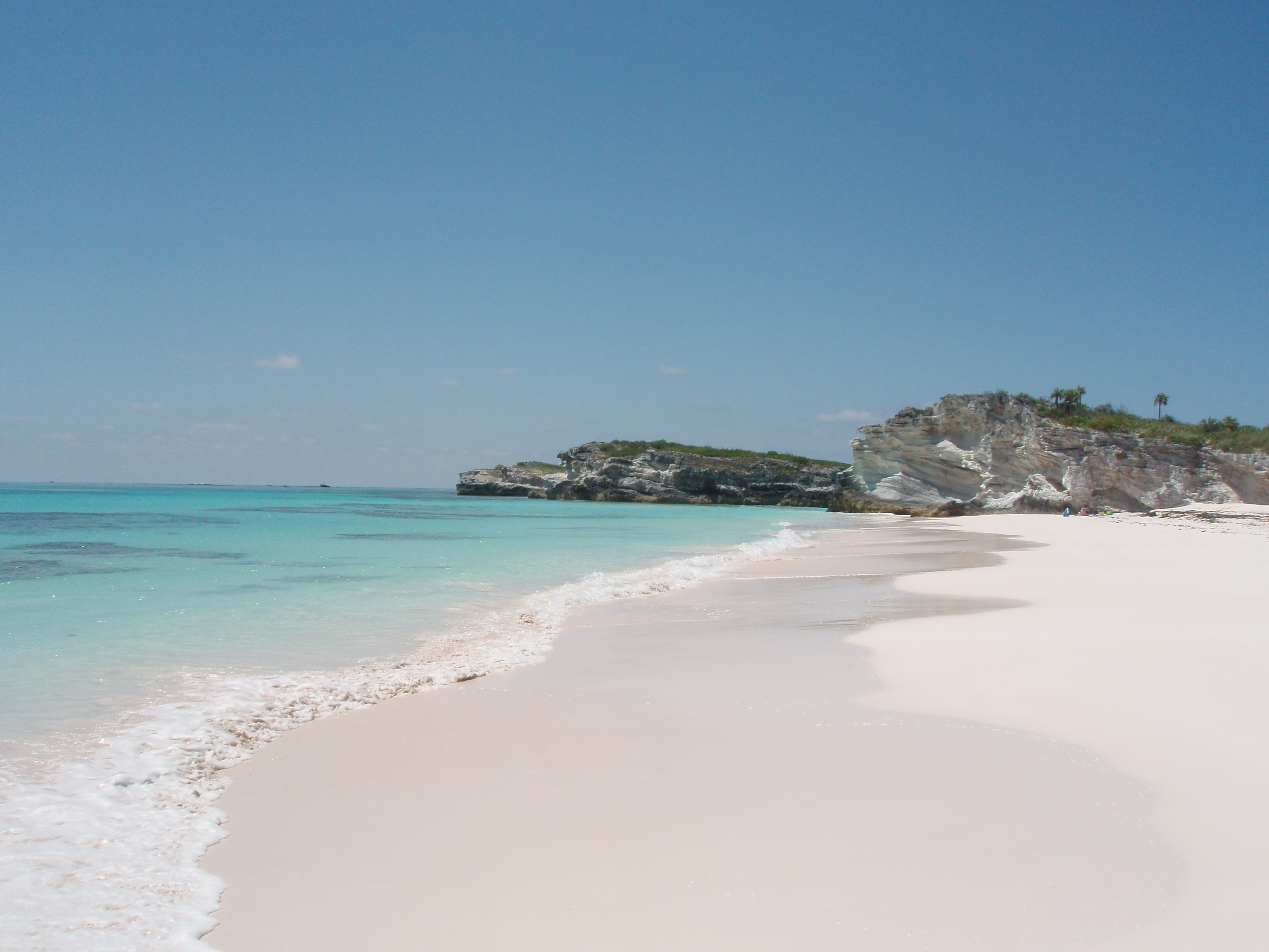
We turned off of the Queens Highway headed toward the Cotton Bay Resort and Beach.  The information we had about Lighthouse Point Beach said it was quite a hike to get there – but well worth it.  So, we thought if we could drive to Cotton Bay Beach (supposedly a pink-sand beach) it would be easier on me with my broken foot.  We drove to within steps of the beach, but were not that impressed, so we continued on to the Lighthouse.  Driving south through Wemyss Bight, John Millars and Millers, we were looking for a paved road that looped above Bannerman Town which would connect to a secondary road to the Point.  We were in Bannerman Town without ever finding the loop.  Before long, we saw a bunch of very colorful buildings and determined that it was the area owned by Princess Cruise Line.  We went to the end of the paved road.  Rick got out and walked to the beach but could see no sign of a lighthouse.  We turned around and headed back, but decided to turn onto a pretty good looking two-rut road.  As we were driving along, we both noticed that parts of the road looked like it used to be paved.  Ah Ha! We had found the loop.  Before long, we saw a sign indicating the turn to Lighthouse Beach.  How lucky could we get?  As we continued along this path – I say path because it was sometimes limestone; mostly washed-out limestone gullies and sometimes very soft sand.  We bounced and jounced for what seemed like forever; went around blind curves and up and down some good sized hills.  This beach was billed as a blush-rose sand beach that you need a 4-wheel drive vehicle to get to – along with a good hike.  We thought we would be the only people for miles around, but there were three vehicles on the road in sight of each other as we bounced along.  We did make it to the beach and it was beautiful.  The “hike” was not bad. 
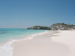
 

Pink Sand at Lighthouse Beach
Lighthouse Beach


With the recollection of all we had been through yesterday plus this “wild ride”, I dubbed us the “New Eleutheran Adventurers.”  If you do come to the island of Eleuthera and decide to see the island by car, I would strongly advise getting one of the Adventure Guide Maps.  They were selling for $10 in the office, but we found one in the first vehicle we had.  How lucky for us, because even with its flaws, we would literally have been lost many times over without it.

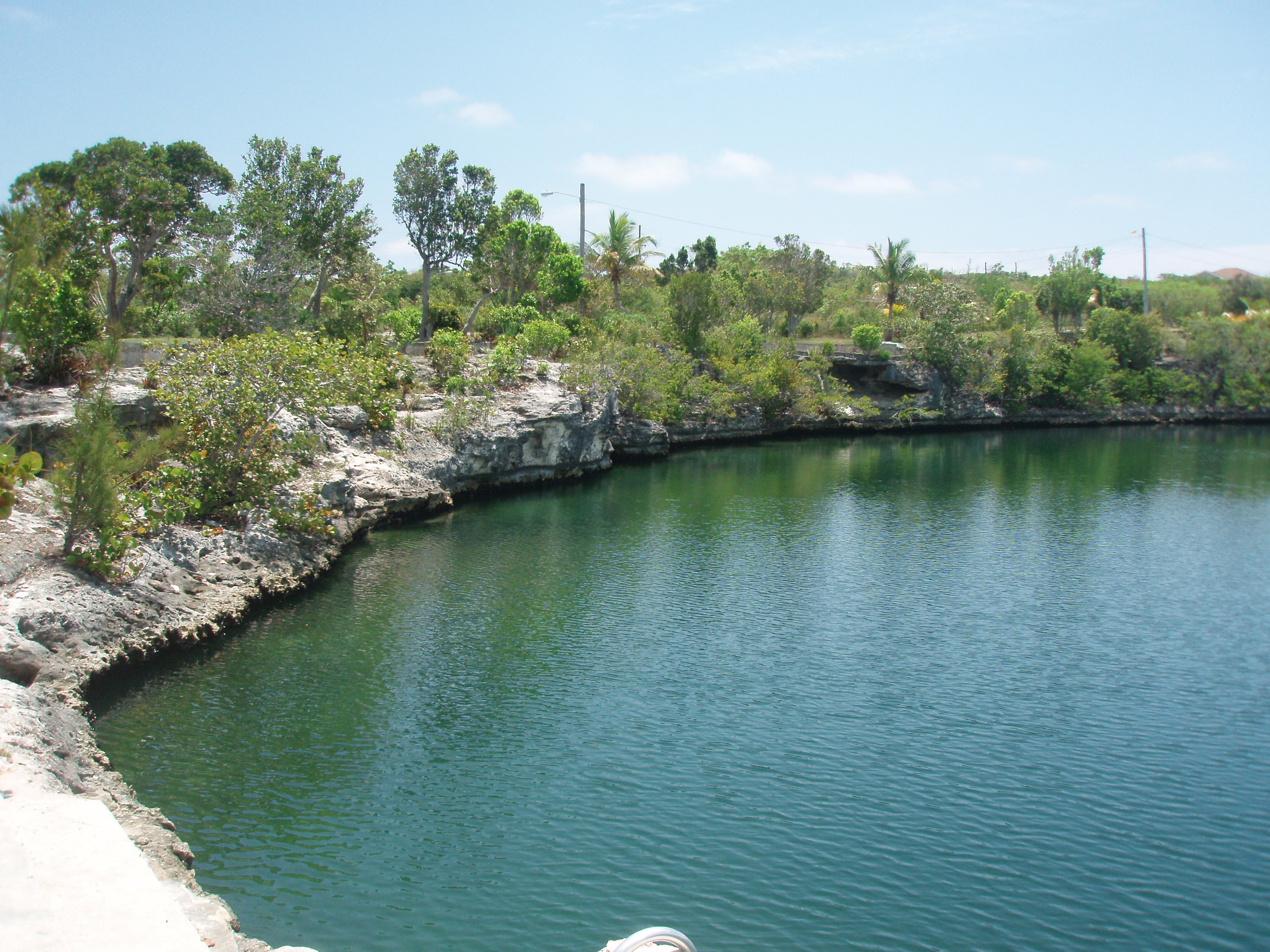
As we were returning, we came upon Davis Harbour Marina and Rick decided to turn in to check it out.  Of note, Davis Harbour had free Wi-Fi.  We walked around the charming facility but could find no one to answer questions.  This was a really nice looking marina which is used mainly by fishing boats.  The buildings had yellow clapboard siding and there were bougainvillea decorating the fences.  There was a nice area between the basin and the beach which had a stand of Australia Pines providing lots of shade.  If we should ever come this way again, I believe I would try to stay here.  In 2014, their website provided the following description:

“Davis Harbour Marina has been serving mariners in South Eleuthera for over 30 years. Our strategic location near the southern tip of Eleuthera provides the perfect jumping off point to spectacular fishing grounds for bone fishing and deep sea fishing.  We have 24 slips total, accommodating up to 80′ alongside @ LW. Depth Dockside: 8′.  We offer fresh water by means of a reverse osmosis system (RO), shower facilities, laundry facilities and ice.  Gas and oil are also available on site, and propane in Rock Sound. Our dock master can arrange for hauling, engine, hull and electronic repairs.  The marker buoy for entrance to the channel is located at GPS Lat/Lon 24 43′ 773 N / 76 15′ 147 W.”

We had a very limited time on Eleuthera and once we returned to Florida and started talking to friends, everyone said that we should have gone to Harbour Island.  Since we did not, I cannot tell you anything about it from direct experience.  But, many of our friends and relatives frequently go to Harbour Island.  It sounds like that is where all the “action” is.  And, it is famous for its pink sand beaches.  But, we saw a pink sand beach at Lighthouse Point and we remained far from the madding crowds.  I think we made a good choice.

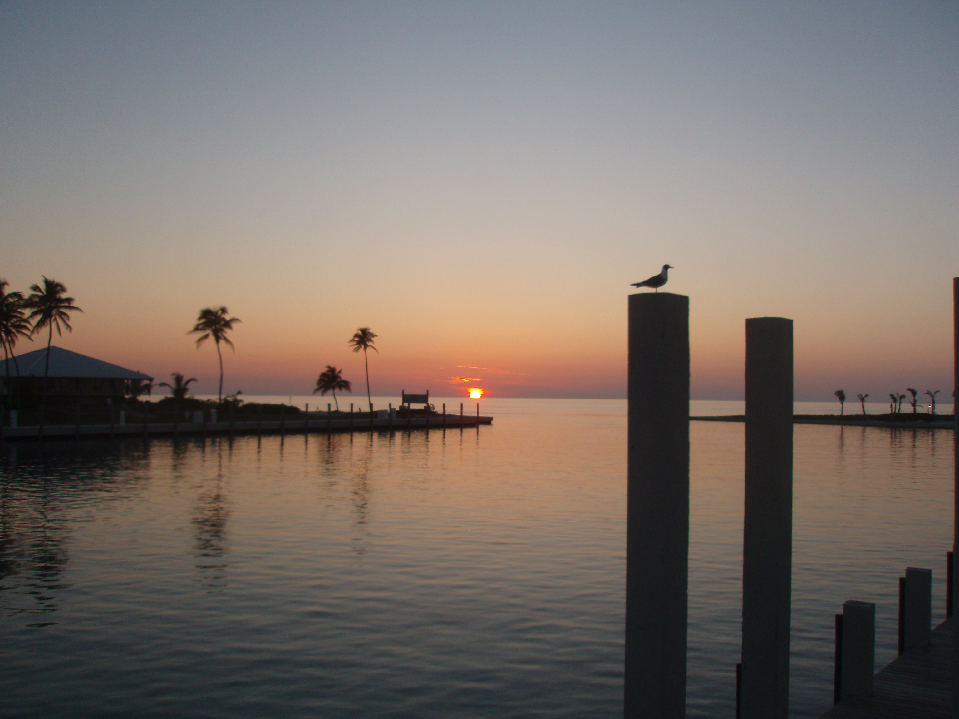
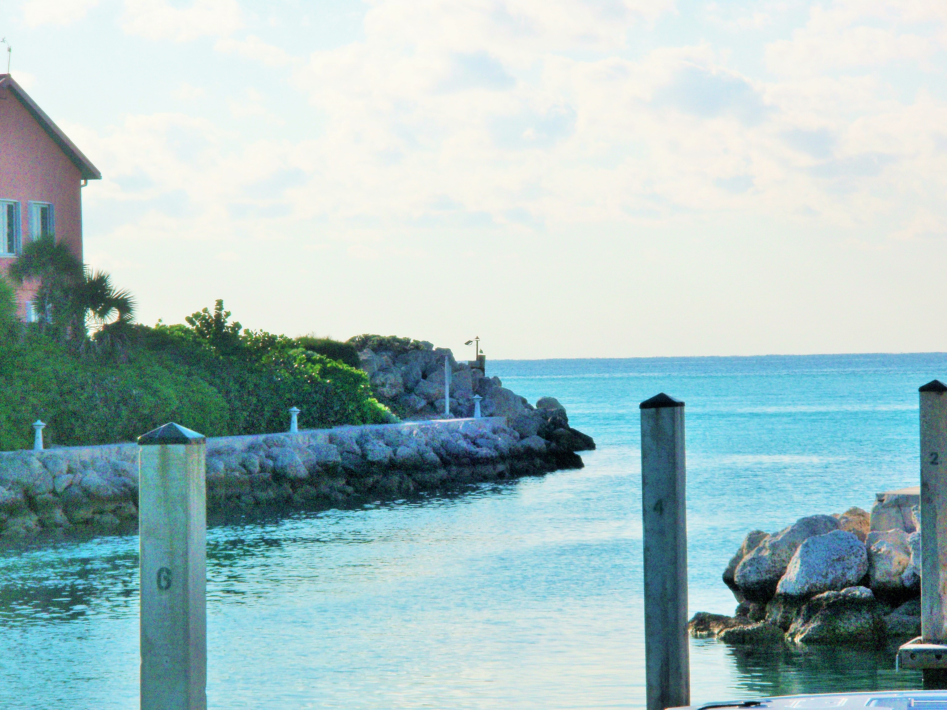
The entrance to Cape Eleuthera Marina at Sunset


Bimini

Categories: Uncategorized
Tags: No Tags
Comments: Comments Off on Bimini
Published on: November 4, 2014

Map of North South and East Bimini

Wikipedia tells us that Bimini is the westernmost district of the Bahamas and is composed of a chain of islands approximately 53 miles east of Miami, Florida, and 137 miles west-northwest of Nassau.  In 2010, Bimini was reported to have a population of 2,008 people.

Boaters traveling between Florida and the Bahamas pass through the Gulf Stream.  The “Stream” is a river of warm water which flows north along Florida’s east coast.  When planning to “cross” the Gulf Stream, you need to watch for wind direction and speed.  If the wind is coming from the south is 15 knots or less, it is a good day to cross.  If the wind is coming out of the north, it is blowing against the current and, therefore, the seas will be rougher.  It is not advised to cross when the wind is blowing more than 15 knots.

Bimini has three islands, North Bimini, South Bimini, and East Bimini. The District of Bimini also includes Cay Sal Bank, more than 62 miles further south, which is geographically not a part of the Bimini Islands but a separate unit. 

The first inhabitants on the island were the Lucayans, and the name “Bimini” means “two islands” in the Lucayan language.   While Columbus never came to Bimini, subsequent Spanish raiders came and removed the aboriginal people and carried them to other West Indian islands to work as slaves in Spanish gold and silver mines.

The Spanish explorer Ponce de Leon, who travelled with Columbus, later adventured on his own seeking the fabled “Fountain of Youth” which the Lucayans had spoken of as being on the island called Bimini. Ponce launched an expedition to find the island and the wondrous fountain but there is no record that he ever found Bimini. He did discover Florida.  In late March of 1513, his ships landed on Florida’s east coast near present-day St. Augustine. Though de Leon‘s expedition brought him to Florida, the fountain was rumored to exist within the shallow pools of South Bimini. Today, there is a small freshwater well with a plaque commemorating the Fountain of Youth, on the road leading to the South Bimini Airport. Francis Drake was among Bimini’s visitors.  The Bahamas was completely de-populated between 1492 and 1520.

The island of Bimini remained untouched until the pirates came.  Blackbeard is one of the pirates who would lie in wait at Bimini, see a Spanish galleon and follow it until it could be attacked and plundered. However, once piracy came to an end in the middle 1700s, Bimini was a quiet island just waiting for settlement until 1835 when permanent settlement began.

According to the Bimini Museum’s website, it was 1835 when freed slaves and some Bahamian whites landed on the island to engage in the profitable wrecking trade.

Bimini was a struggling community of fewer than 600 persons until 1920 when American prohibition was proclaimed. At that time, Bimini became a major smuggling point. Bimini boomed during the prohibition era. Fast money could be had by running liquor into America or by assisting the rum runners in organizing their load. But, with prohibition’s repeal in 1933, Bimini fell into poverty as the quick money was quickly gone.

However, at the same time as the prohibition era came to an end, Bimini was discovered as being a major sport fishing destination. Big game fishing was in its infancy and Bimini provided pioneer sports-fisherman, like Ernest Hemingway, with a bountiful fishing ground.  Prosperity came again to the island and Bimini became known as the “Big Game Fishing Capital of The World”.

Bimini is home to several landmarks said to contain mystical properties. Experts have varied opinions/explanations. The most contentious of these sites is The Bimini Road. This “road” was discovered by three divers in 1968.  Investigators have found two additional “pavement-like” linear features that lie parallel to it.  The Bimini Road is approximately ½ mile long and is made up of rounded stone blocks with the average size of 7 – 10 feet.  The two narrower and shorter, approximately 160 and 200 ft.-long linear features consist of smaller stone blocks that are only 3–7 ft.  There is much debate as to whether these “structures” are natural or man-made.  Some people think that this might have been part of the lost City of Atlantis.

Chalk’s International Airlines operated seaplane flights between Miami Harbor and the Bahamas starting in 1917.  The company was an island institution for generations. Its Flight 101 was in route to Bimini when it crashed on December 19, 2005, killing all 18 passengers and 2 crew; at least eleven of the passengers were Bimini residents.  It is said that this crash led to the demise of Chalk Airlines.

North Bimini

North Bimini is about seven miles long and 700 feet wide. Its main settlement is Alice Town.  It has two major roads known as “The King’s Highway” and the Queens Road which runs almost the length of the island parallel to Kings Highway.

Found within the salt water mangrove swamp that covers four miles of North Bimini is The Healing Hole, a pool that lies at the end of a network of winding underground tunnels. During outgoing tides, these channels pump cool, mineral-laden fresh water into the pool.

After reading a Bimini Visitors’ Guide on our first trip to Bimini in January, 2012, I was excited to go into Alice Town and take a walking tour.  We paid two dollars each one-way to take the ferry over from South Bimini.  North Bimini is very popular with big game fishermen and there are a number of marinas and restaurants along the waterway.  Our first stop was the craft center.  Fewer than half of the 17 stalls were open.  I was offered a long-sleeved T-shirt for $20. 

The Bimini Museum was closed.  This museum is located in the restored former government administration building, abandoned for nearly twenty years.  The building was constructed in the 1920s.  At that time, it housed the office of the Commissioner of Bimini, His Majesty’s Customs and Bahamas Immigration, the Post Office, and the police station and holding cells.  Their website http://www.biminimuseum.com advertises opening hours daily from 10AM-7PM.  The museum is privately funded and maintained.  They request a $2.00 donation when visiting.

We continued walking down Kings Highway to the Bimini Big Game Club for lunch.  This club was made famous by Ernest Hemmingway.  It was owned and operated by Guy Harvey in 2012, but has since been sold.   When we last visited (October, 2014), we were greeted by the new General Manager, Mr. David Hess.  He generously bought our first round of drinks and told us of many improvements that have been made and/or are planned.  David told us that they will be running “specials” for fisherman to leave their boats for an extended period of time at their docks.  He also told us that they had recently installed a shark cage at the end of one of their docks where people could get an “up close and personal shark experience”.  You can contact him for more information at dhess@biggameclubbimini.com The club is located at 25o43.34N  &  79o 17.45W.  The following picture came from their website.

Bimini Big Game Club Dockage Deal in 2014
The frequency of losing an erection increases with the age; however it is necessarily a consequence of aging. check out now discount levitra


In May 2008 marine conservationist Jean-Michel Cousteau criticized Bimini Bay Resort, calling it a “catastrophe” and announcing, “allowing Bimini Bay to continue with phase II would certainly strip this island paradise of its precious natural riches. Over time, visitors and residents alike will suffer the decline of economic, social and environmental prosperity…”

When we visited in October of 2014, the Bimini Bay Resort had been renamed Resorts World Bimini.  They have a fast ferry which brings people over from the Port of Miami in two hours. The marina is now associated with Island Global Yachting (IGY) as noted in this APRIL 7, 2014 press release.  “IGY Marinas is excited to announce that the Marina at Resorts World Bimini has joined the IGY network as its 14th yachting destination. Ideally located in the Bahamas just 48 nautical miles off the coast of South Florida, the 230‐slip marina welcomes vessels up to 180 feet with a 10 ft draft, and is part of the popular Resorts World Bimini, a 750 acre luxury resort that features exclusive residences, a live action casino, and a new marina hotel scheduled to be completed this fall, all on miles of unspoiled sandy beaches and crystal‐clear turquoise waters.

Amenities at the Marina at Resorts World Bimini include an open‐air lounge, bait & tackle shop, laundry service, a fitness center, grocery and liquor store, as well as showers and restrooms. While on property guests can enjoy the Resort’s six onsite restaurants, outdoor shopping and dining options, two pools, a beach club, a children’s center and tennis courts – or try their luck at the Resorts World Bimini Casino and Sports Book, the first in the world with panoramic water views and just steps away from the Marina.”

Conservationists are not the only ones who have expressed concerns over this development.  We spoke to a local resident who told us that they now have traffic jams on the island!

Resort World's Casino Sign

South Bimini

We first arrived in South Bimini in early January, 2012, and stayed at the Bimini Sands Resort and Marina for 11 nights.  We had departed Florida from Key Biscayne and headed across the Gulf Stream going north with its flow to reach Bimini.  We had to pay close attention to the charts as we made our way into the marina because there was a marked channel between North Bimini and South Bimini, but there was a shoal between the channel and the entrance to Bimini Sands Resort Marina making us have to first go to the south end of the island and approach the entrance to the marina by staying very close to the island.  Upon arrival at Bimini Sands, Rick took a taxi to the Customs and Immigration offices located at the airport (on South Bimini Island).  Here he paid for our cruising permit ($300 for one year for our size boat – a 4788 Bayliner with an overall length of 54 feet.)  The cruising permit can be renewed twice before we must take the boat out of Bahamian waters.  He was also given permission for us to stay 90 days in the Bahamas by the Immigration agent.

We stayed one night at the Bimini Sands Resort Marina on our return trip to Florida from the Bahamas in February, 2014.  Just about everything was the same as before with the exception of the new infinity pool which overlooks the beach. 

Bimini Sands Resort Infinity Pool

It was a great surprise to us that the shoal between the markers and the entrance to the resort had been dredged making it possible to head straight for the markers and then into the marina.  That saved a lot of time.


Entrance to Bimini Sands Resort Marina

On our crossing in October, 2014, we departed from Ft. Lauderdale and went slightly south against the north current of the Gulf Stream.  Still, we had a fairly nice and uneventful crossing.  Upon arrival at the marina, we were very pleased to find that their rates remained the same as they had been when we visited in 2012.  (Although, we found out just before leaving, that we could have paid 50 cents a foot less at the Resort Worlds IGY Marina.)

On South Bimini, we ate at the Bimini Twist Restaurant at the Bimini Sands Beach Club as well as Mackey’s Sand Bar.  We enjoyed the food at the restaurant, but found the service a little slow.  The Sand Bar is aptly named as it is a bar and it has a sand floor.  We have eaten there several times and always enjoyed the experience.  They have a ring toss game which is loads of fun and weekly karaoke which is well attended by the locals.

On the way to the ferry we stopped in at a shop called Booze and Screws – that’s right, they sold alcohol and hardware! 

We took the resort bus to the Bimini Sands Nature Walk and took the one-mile self-guided tour in January, 2012.  We walked for about an hour and learned a lot about the flora and fauna of the island (including the Bimini Boa) as well as some history.  One of the stops along the walk was on a high dune overlooking the beach.  It was the ruins of the home of an Australian, Percy Cavill. Winner of the Gold Medal in the World Swimming championships in 1899, he is credited with developing the “Australian crawl” swimming stroke. Cavill lived on South Bimini and swam to work at the Bimini Rod and Gun Club on North Bimini each day.  In October, 2014, we didn’t have enough mosquito repellant to make the walk possible. 

The Bimini Biological Field Station is a world famous facility owned and operated by shark biologist Dr. Samuel Gruber.  It’s located on South Bimini Island and contributed a lot of research regarding the lemon shark.  They have captured and recorded 13 species of sharks in the shallow waters around Bimini.  However, the number of sharks around the island is even higher when considering the sharks of the deep waters off Bimini’s western shores

Compass Cay – October, 2014

Categories: Uncategorized
Tags: No Tags
Comments: Comments Off on Compass Cay – October, 2014
Published on: November 1, 2014

We are very glad to be back at Compass Cay.  Rick will continue volunteering with various projects around the island and I hope to be able to write more information about the islands of the Bahamas.  Since our entry into the Bahamas has been at Bimini in both 2012 and 2014, that will be the first island that I write about.  You will find them listed at the right once they are posted.  Please let me know if you find my accounts of these islands helpful.  You can reach me at charlene@livinonthehook.comBD2-0017BD2-0023 (Sunday, October 19, 2014 through Saturday, October 25)

Sunday – Boats arriving included:  Mustang Sally and Mad Max.  People arriving:  Tucker, with his son, Randy. 

Monday – Projects:  Rick helped to install three lighted ceiling fans in the Boaters’ Grille.

Tuesday – Departures:   Mustang Sally.  Projects:  Rick helped Tucker with some repairs in the lodge (a 3-bedroom rental here on Compass Cay)

Wednesday, October 22 – Boat arrivals:  A yellow-bottomed Viking called “Last Foot” out of Atlantic City, New York.   Projects:  I took a couple of pictures in the marina and typed up a handout for Tucker with some of the rules of the marina.  It included: 

  • No fishing;
  • Separate your trash,
  • No smoking,
  • Don’t ride anything on the docks and
  • Swim with the sharks at your own risk.

Weather:  It drizzled rain under dark clouds throughout most of the afternoon.

Thursday  – Boat departures:  “Last Foot” left with a parting gift of fresh wahoo for Tucker and some for us as well.  Boat arrivals:  “Still Water”, a 78-foot Numarine yacht, was tied up to the dock directly opposite of us making it impossible for us to see the main entrance to the marina.  The freight boat “Captain C” brought in a load of goods for Tucker this morning, but they realized that they had not unloaded everything he ordered, so Randy and Rick took one of the boats down to Staniel Cay to get the rest.  People arriving:  Jamaal’s son, also named Jamaal,  came on the freight boat.  Another one of Tucker’s grandsons is also on the island.  Ethan lives in Black Point and we have met him several times before.  He seems to have grown taller since we last saw him.  Looking at the picture below, it seems he is now almost as tall as his grandfather.

Ethan and Tucker
Ethan and Tucker

Weather:  More rain in the afternoon.  Eating on the dock:  Last evening, Jamaal went out fishing and had good luck, so we had a “fish fry” tonight. 

Friday – Boat departures:  “Still Water” left mid-morning.  Boat arrivals:  1) “King Me”, a blue-bottomed 68-foot Azumat came in just before noon followed by; 2) a large fishing boat with a dark-colored bottom and two good sized jet skis on the bow.  This was the same “Mustang Sally” that had been here earlier this week and it was accompanied by a good sized tender with a T-top and four, 300 horse-power, engines on the back.  3) A boat named Booty Calls II out of Nassau.  A single man captained the boat.  He told Rick and Randy that he had been anchored out at Big Majors Spot, but came in because of some bad weather that has been predicted.  4) A crew of dock builders arrived by boat from Spanish Wells.   They will be building a “walk dock” from the storage dock to the marina office.  These new arrivals joined Mad Max and us, On The Hook, making a total of six in the marina.  Weather:  It was raining again today.  I checked the website, www.windfinder.com, for Staniel Cay’s weather today and tomorrow.  You can see from the chart below that high winds are predicted to start this evening, gusting to 39 mph.  And, early tomorrow morning waves as high as 8.5 feet are predicted in the ocean.  Since Compass Cay’s marina has such great weather protection, it is always a popular place during a storm.  It looks like we’ll get another inch of rain overnight, as well.  You can click on the picture to see a larger version.

Chart Showing Predicted Wind Rain and Waves
Windy Forecast

BD2-0023Saturday, 10/25/14 – Boat departures:  “King Me” left around 10:30 a.m. heading to Nassau (and into more rain.)  Weather:  We rocked and rolled all night long with continuous rain.  In the morning, although it was breezy, we were starting to see a few breaks in the clouds.  High winds are predicted for this area until next Thursday.  Despite a little breeze and a few raindrops, the dock builders started working on the walk bridge this afternoon. 

Men in Boat working in Rain
Construction Beginning on Dock Walk

Cenforce 100mg Tablets can be taken 30 minutes before the sexual intercourse in order to get effective results Not to be taken with the nitrate-containing drugs. pdxcommercial.com viagra prices
Projects:  We have been dealing with two leaks on the boat.  The first, we discovered in the salon the last month that we were in Ft. Lauderdale when it rained a lot.  The second, we discovered yesterday (after three days of rain).  This one is on the other side of the boat and starts in the pilot house (over the wireless computer printer) but runs down the headliner and drips onto the countertop between the stereo system and the wet bar.  I covered everything with towels when I discovered it, but Rick put one of the “yard” glasses that we got at Atlantis’ Aquaventure where it drips and this morning it is nearly half full!   We have only had the problem since we had the new hard top installed, so Rick is thinking that it must need some more sealing and that will be his next boat project as soon as we have a good, sunny day.    

BD2-0024BD2-0029 (Sunday, October 26, 2014 through Thursday, October 31)

Sunday (BD2-0024) – Departures:  Rick took Ethan back to Black Point and Randy flew to Nassau.  The Dock Builders moved down to Staniel Cay, where they will be working during the next several weeks.  They will return here on the weekends to complete the “walk dock” to the marina.  “Booty Calls II” left about an hour later.   Arrivals:  Judith is a Hargrave and is approximately 80 feet long.  She is flying an American Flag on her aft and a French Flag burgee.  She has a dark bottom and several crew along with her owner/passengers.  Her tender is an Edge Water T-Top with two 150 HP Yamaha engines.  Both the yacht and the tender seem to be equipped with outriggers for fishing.  I don’t think I’ve ever seen outriggers on this type of a yacht.

Judith and her tender
Judith – A Motor Yacht with Outriggers

Weather:  The wind is still blowing but we have been blessed with sunshine and relatively clear skies today. 

Monday BD2-0025 – Projects:  Tucker’s son, Jamaal, has been working on a number of projects since arriving on the island.  Last week, he and two helpers finished a concrete drive going up to the Lilly House (another one of the rental’s available here on Compass Cay.)  The Bahamas’ school system is just finishing up a “break”.  So this week, Jamaal’s son has also been helping out.  They have been replacing the wooden floors in the two apartments on the bottom floor of the Treehouse with concrete.  Today, they are also building an extension of the roof on the Boaters’ Grille that will cover the grill.

Jamaal, Jr. and Jamaal Rolle, Sr.

Arrivals:  In the afternoon, Rick and I took Tucker’s Albury to the Staniel Cay airport to pick up Marino and Bonnie.  They are from Canada and he has been coming down once or twice a year for a while.  Last fall Bonnie came with him and we are glad that they are back.  She said that they are staying for more than 5 weeks this time.  Marino is a carpenter and Tucker saves up special projects for him to spend his time on when he visits.    Departures:  Mustang Sally took Jamaal, Jr. back to Nassau in time to attend school again tomorrow and then will head to the Ft. Lauderdale boat show.  They had cleaned out their refrigerator, leaving lots of fresh herbs, cold cuts, fresh asparagus and more.  They also left their tender here as it was damaged on their way here and needs to be inspected by insurance adjusters.

Tuesday (BD2-0026) – Boat departures:  Judith.   Boat arrivals:  A big white boat named Gabarito.  Weather:  The breeze made the temperature seem very pleasant in the shade and it kept the bugs away.

Wednesday (BD2-0027)– Boat departures:  Gabarito and Mad Max, leaving just us in the marina.   Our projects included:  1)  Rick is working on the ice maker again.  2) Take the dinghy out for a short ride.  Rick wanted to check out the new lower unit on the outboard engine, but getting to go out for a short ride sure made my day, so I’m inclined to say that this project was “to make Charlene happy!”  Checking in:  We had a SKYPE session with our son, JP.  We learned that his wife and daughters are all doing well.  Baby Emma is now taking a few steps without holding on.  We’ll probably have a tough time keeping up with her at Christmas time.  Our other granddaughter, Vanessa, has big plans for this weekend to celebrate her “Sweet Sixteen” birthday.  We went through all of the mail that has been delivered to his home for us.  He said over half of it was from AARP as Rick is turning 65 next month and just signed up in order to secure a Medicare Supplement and Prescription Plan. 

Thursday (BD2-0028) –  Departure:  Tucker flew to Nassau to buy tile for the new floor in the Treehouse apartments.  Projects:  Rick worked on sealing the track for the new isinglass.  I continue to refine my Bimini information.  Weather:  No Breeze = Lotsa Bugs!  Arrivals:  In the early afternoon Loan Rolle stopped in with two boat loads of government officials.  Loan was recently elected to represent this area.

Boat filled with Government Officials
Government Officials Visit

He told us that their next stop was to be Bell Island, where they were to have a late lunch, and then they were going on to Norman’s Cay.  Later, Tucker returned from Nassau along with Monica.  Monica has come to the island a couple of other times when we were here.  She loves to snorkel in the marina and she takes it upon herself to repaint many of the signs along the trails on the island.  Monica will be staying in the Mango House, a rental unit that is located high on a bluff overlooking the creek that runs through the interior of the island.  When Rick told me that Monica had arrived, but her luggage hadn’t, I searched through my clothes and found a couple of exercise outfits, one-size fits all tops and a diving skin to send up to her to see if she could wear any of it.  The day ended with us watching the exciting FSU vs Louisville game on ESPN in which FSU, once again, came from behind to win.

Friday (BD2-0029)  October 31, 2014 – Happy Halloween.  Weather:  The breeze has started to pick up.  I checked www.windfinder.com for Staniel Cay’s predictions and found that the wind will be increasing all day and will be blowing from 15 to 30 mph for the next week. 


page 1 of 1
Inspiration
  Our journey has been inspired by Joy and Steve Fredrick. You can see more of their story at sailwithoceanangel.com.
Archives

Welcome , today is Tuesday, May 7, 2024